TopoQuest Logo
Do you find TopoQuest useful?
Help keep TopoQuest running and adding new maps/features by donating!
Bitcoin:  19c7KJd3qBynnjoSw5npx9KScwjBe4ifkT
Litecoin:  LXs6TkuXGGXo1vDsWCkWVdjQX94eUKd6ui
Home View Maps Find Maps Find Places Resources & Links


Nickel Mountain, Oregon Topographic Map

USGS Map Title: Nickel Mountain, OR
USGS Map MRC: 42123H4
DRG (GeoTIFF) Download: o42123h4.tif


Neighboring USGS Topographic Map Quads:


  Tenmile, OR  
43123A5
 

  Winston, OR  
43123A4
 

  Myrtle Creek, OR  
43123A3
 

  Live Oak Mountain, OR  
42123H5
 

  Nickel Mountain, OR  
42123H4
 

  Canyonville, OR  
42123H3
 

  Rabbit Mountain, OR  
42123G5
 

  McCullough Creek, OR  
42123G4
 

  Quines Creek, OR  
42123G3


Map MRC Location:

N43°
W124°
N43°
W123°
H8 H7 H6 H5 H4 H3 H2 H1
G8 G7 G6 G5 G4 G3 G2 G1
F8 F7 F6 F5 F4 F3 F2 F1
E8 E7 E6 E5 E4 E3 E2 E1
D8 D7 D6 D5 D4 D3 D2 D1
C8 C7 C6 C5 C4 C3 C2 C1
B8 B7 B6 B5 B4 B3 B2 B1
A8 A7 A6 A5 A4 A3 A2 A1
N42°
W124°
N42°
W123°

Nickel Mountain, OR USGS 1:24K Topographic Map Preview:
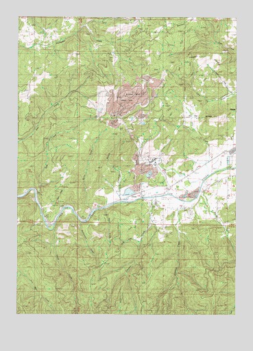
Nickel Mountain, OR USGS Topographic Map
Click on map above to begin viewing in our Map Viewer.

This topographic map contains these locations and features:
Feature Name Type Latitude Longitude GNIS ID View Map
Alder CreekStreamN42.9193°W123.4748°1132260View Map
Beatty CreekStreamN42.9179°W123.4570°1117408View Map
Boomer HillSummitN42.9993°W123.4021°1136086View Map
Catching CreekStreamN42.9223°W123.4045°1118681View Map
China CreekStreamN42.9054°W123.4290°1132262View Map
CornuttLocaleN42.9251°W123.4328°1119288View Map
Council CreekStreamN42.9235°W123.4223°1119390View Map
Crawford BranchStreamN42.9221°W123.4415°1119519View Map
GlenbrookLocaleN42.9207°W123.4220°1132261View Map
Hanna MineMineN42.9660°W123.4353°1135013View Map
Island CreekStreamN42.9107°W123.4803°1122295View Map
Jerry CreekStreamN42.9335°W123.3898°1122412View Map
Jerry FlatFlatN42.9571°W123.4003°1122413View Map
Lake Stomar ReservoirReservoirN42.9415°W123.3845°1132259View Map
Langell RidgeRidgeN42.9812°W123.3920°1122950View Map
Little Doe CreekStreamN42.9476°W123.4998°1123182View Map
Mount IsaacSummitN42.9579°W123.3898°1122290View Map
Nickel Mountain (historical)SummitN42.9670°W123.4379°1124683View Map
Rail GulchValleyN42.9296°W123.4320°1158436View Map
Rattlesnake CreekStreamN42.9137°W123.4645°1125826View Map
Riddle CemeteryCemeteryN42.9489°W123.3782°1132256View Map
Russell CreekStreamN42.9268°W123.3951°1126373View Map
Salt CreekStreamN42.9248°W123.4909°1126523View Map
Sanderson BrookStreamN42.9679°W123.3790°1132258View Map
Squaw CreekStreamN42.9190°W123.4501°1127479View Map

Note: Coordinates in the location and feature list above are referenced to NAD83 datum.


Copyright (C) 2008-2025 Ryan Niemi / Sunset Dynamics ... All Rights Reserved