TopoQuest Logo
Do you find TopoQuest useful?
Help keep TopoQuest running and adding new maps/features by donating!
Bitcoin:  19c7KJd3qBynnjoSw5npx9KScwjBe4ifkT
Litecoin:  LXs6TkuXGGXo1vDsWCkWVdjQX94eUKd6ui
Home View Maps Find Maps Find Places Resources & Links


Live Oak Mountain, Oregon Topographic Map

USGS Map Title: Live Oak Mountain, OR
USGS Map MRC: 42123H5
DRG (GeoTIFF) Download: o42123h5.tif


Neighboring USGS Topographic Map Quads:


  Camas Valley, OR  
43123A6
 

  Tenmile, OR  
43123A5
 

  Winston, OR  
43123A4
 

  Chipmunk Ridge, OR  
42123H6
 

  Live Oak Mountain, OR  
42123H5
 

  Nickel Mountain, OR  
42123H4
 

  Dutchman Butte, OR  
42123G6
 

  Rabbit Mountain, OR  
42123G5
 

  McCullough Creek, OR  
42123G4


Map MRC Location:

N43°
W124°
N43°
W123°
H8 H7 H6 H5 H4 H3 H2 H1
G8 G7 G6 G5 G4 G3 G2 G1
F8 F7 F6 F5 F4 F3 F2 F1
E8 E7 E6 E5 E4 E3 E2 E1
D8 D7 D6 D5 D4 D3 D2 D1
C8 C7 C6 C5 C4 C3 C2 C1
B8 B7 B6 B5 B4 B3 B2 B1
A8 A7 A6 A5 A4 A3 A2 A1
N42°
W124°
N42°
W123°

Live Oak Mountain, OR USGS 1:24K Topographic Map Preview:
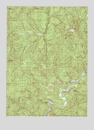
Live Oak Mountain, OR USGS Topographic Map
Click on map above to begin viewing in our Map Viewer.

This topographic map contains these locations and features:
Feature Name Type Latitude Longitude GNIS ID View Map
Azalea Post Office (historical)Post OfficeN42.9251°W123.5037°1164192View Map
Buck CreekStreamN42.9243°W123.5084°1118179View Map
Buck MountainSummitN42.9744°W123.5250°1118199View Map
Buck RockPillarN42.9640°W123.5363°1118214View Map
Byers (historical)LocaleN42.9251°W123.5037°1166625View Map
Cattle CreekStreamN42.8823°W123.5573°1118701View Map
Cookhouse CreekStreamN42.9451°W123.5034°1119225View Map
Dads CreekPopulated PlaceN42.8901°W123.5606°1136199View Map
Doe CreekStreamN42.9237°W123.5040°1120000View Map
Dribble CreekStreamN42.8904°W123.6101°1160796View Map
Horse PrairieFlatN42.9318°W123.5948°1122014View Map
Horse Prairie (historical)LocaleN42.9568°W123.5942°1161654View Map
Iron MountainSummitN42.9046°W123.5217°1122273View Map
Iron Mountain CreekStreamN42.9084°W123.5278°1122279View Map
Little Dads CreekStreamN42.8893°W123.5612°1123175View Map
Live Oak MountainSummitN42.9377°W123.6209°1123325View Map
Minnie CreekStreamN42.9151°W123.5156°1124243View Map
Nichols (historical)LocaleN42.8887°W123.5387°1166768View Map
Nichols Post Office (historical)Post OfficeN42.8887°W123.5387°1165707View Map
PeckPopulated PlaceN42.8957°W123.5384°1136617View Map
Peck Post Office (historical)Post OfficeN42.8957°W123.5384°1165773View Map
Polan CreekStreamN42.9157°W123.5240°1125516View Map
Smith CreekStreamN42.9118°W123.5281°1127106View Map
Smith Creek (historical)LocaleN42.9123°W123.5290°1638547View Map
Staircase CreekStreamN42.8854°W123.6023°1160797View Map
Table CreekStreamN42.8926°W123.5601°1127856View Map
Table MountainSummitN42.9296°W123.5642°1127860View Map
Thompson CreekStreamN42.9893°W123.5573°1128027View Map
Wildcat CreekStreamN42.9693°W123.5679°1129056View Map
Willingham CreekStreamN42.9679°W123.5734°1132269View Map

Note: Coordinates in the location and feature list above are referenced to NAD83 datum.


Copyright (C) 2008-2025 Ryan Niemi / Sunset Dynamics ... All Rights Reserved