TopoQuest Logo
Do you find TopoQuest useful?
Help keep TopoQuest running and adding new maps/features by donating!
Bitcoin:  19c7KJd3qBynnjoSw5npx9KScwjBe4ifkT
Litecoin:  LXs6TkuXGGXo1vDsWCkWVdjQX94eUKd6ui
Home View Maps Find Maps Find Places Resources & Links


Rabbit Mountain, Oregon Topographic Map

USGS Map Title: Rabbit Mountain, OR
USGS Map MRC: 42123G5
DRG (GeoTIFF) Download: o42123g5.tif


Neighboring USGS Topographic Map Quads:


  Chipmunk Ridge, OR  
42123H6
 

  Live Oak Mountain, OR  
42123H5
 

  Nickel Mountain, OR  
42123H4
 

  Dutchman Butte, OR  
42123G6
 

  Rabbit Mountain, OR  
42123G5
 

  McCullough Creek, OR  
42123G4
 

  Bunker Creek, OR  
42123F6
 

  Mount Reuben, OR  
42123F5
 

  Glendale, OR  
42123F4


Map MRC Location:

N43°
W124°
N43°
W123°
H8 H7 H6 H5 H4 H3 H2 H1
G8 G7 G6 G5 G4 G3 G2 G1
F8 F7 F6 F5 F4 F3 F2 F1
E8 E7 E6 E5 E4 E3 E2 E1
D8 D7 D6 D5 D4 D3 D2 D1
C8 C7 C6 C5 C4 C3 C2 C1
B8 B7 B6 B5 B4 B3 B2 B1
A8 A7 A6 A5 A4 A3 A2 A1
N42°
W124°
N42°
W123°

Rabbit Mountain, OR USGS 1:24K Topographic Map Preview:
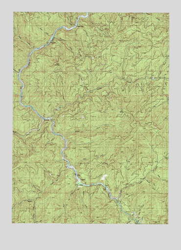
Rabbit Mountain, OR USGS Topographic Map
Click on map above to begin viewing in our Map Viewer.

This topographic map contains these locations and features:
Feature Name Type Latitude Longitude GNIS ID View Map
Argil (historical)LocaleN42.8165°W123.6095°1166444View Map
Benson GulchValleyN42.7759°W123.5190°1117536View Map
Bonnie CreekStreamN42.7637°W123.6095°1132726View Map
Boulder CreekStreamN42.8721°W123.5679°1132270View Map
Brandt (historical)LocaleN42.7712°W123.5495°1118039View Map
Buck CreekStreamN42.8357°W123.5040°1118184View Map
Calf CreekStreamN42.8721°W123.5670°1160798View Map
Cedar GulchValleyN42.8382°W123.5092°1118752View Map
Cook CreekStreamN42.7526°W123.5267°1119214View Map
Corral CreekStreamN42.8679°W123.5748°1162360View Map
Cow CreekPopulated PlaceN42.8565°W123.5976°1119420View Map
Dads CreekStreamN42.7640°W123.5423°1119656View Map
Darby CreekStreamN42.8523°W123.6092°1119685View Map
Devils Punch BowlLocaleN42.8526°W123.6067°1132241View Map
Dothan Post Office (historical)Post OfficeN42.8109°W123.5956°1165173View Map
Dutchman CreekStreamN42.8387°W123.6212°1160802View Map
Hare CreekStreamN42.8276°W123.5665°1160800View Map
Henry SpringSpringN42.7785°W123.5757°1160801View Map
Herman Post Office (historical)Post OfficeN42.8121°W123.6020°1164406View Map
Hutch CreekStreamN42.8201°W123.5831°1160799View Map
Isabell (historical)LocaleN42.7540°W123.5317°1166448View Map
Knupp CreekStreamN42.7984°W123.5845°1132244View Map
Langdon (historical)LocaleN42.7759°W123.5726°1136460View Map
Middle CreekStreamN42.8115°W123.5959°1124092View Map
Middle Creek Warden StationLocaleN42.8471°W123.5220°1124096View Map
Mud SpringSpringN42.8162°W123.5373°1124478View Map
Ping GulchValleyN42.7807°W123.5137°1125420View Map
Rabbit MountainSummitN42.8434°W123.5885°1125765View Map
Rattail CreekStreamN42.7721°W123.5692°1132249View Map
Riffle CreekStreamN42.7834°W123.5809°1126013View Map
Short CreekStreamN42.8609°W123.5956°1132240View Map
Skull CreekStreamN42.7748°W123.5751°1159158View Map
Sled CreekStreamN42.7829°W123.5770°1127067View Map
Slip CreekStreamN42.8026°W123.5929°1132247View Map
Stanchion CreekStreamN42.8609°W123.5956°1162359View Map
Sullivan CreekStreamN42.8248°W123.5456°1132535View Map
Susan CreekStreamN42.7998°W123.5859°1132246View Map
Tuller CreekStreamN42.7521°W123.5312°1128289View Map
Union CreekStreamN42.8668°W123.5765°1128412View Map
Union Creek (historical)LocaleN42.8696°W123.5756°1161566View Map
West ForkLocaleN42.8107°W123.5948°1128832View Map
West Fork Cow CreekStreamN42.8112°W123.5851°1152061View Map

Note: Coordinates in the location and feature list above are referenced to NAD83 datum.


Copyright (C) 2008-2025 Ryan Niemi / Sunset Dynamics ... All Rights Reserved