TopoQuest Logo
Do you find TopoQuest useful?
Help keep TopoQuest running and adding new maps/features by donating!
Bitcoin:  19c7KJd3qBynnjoSw5npx9KScwjBe4ifkT
Litecoin:  LXs6TkuXGGXo1vDsWCkWVdjQX94eUKd6ui
Home View Maps Find Maps Find Places Resources & Links


Bellflower North, Missouri Topographic Map

USGS Map Title: Bellflower North, MO
USGS Map MRC: 39091A3
DRG (GeoTIFF) Download: o39091a3.tif


Neighboring USGS Topographic Map Quads:


  Middletown, MO  
39091B4
 

  New Hartford, MO  
39091B3
 

  Louisville, MO  
39091B2
 

  Buell, MO  
39091A4
 

  Bellflower North, MO  
39091A3
 

  Truxton, MO  
39091A2
 

  New Florence, MO  
38091H4
 

  Bellflower South, MO  
38091H3
 

  Hawk Point, MO  
38091H2


Map MRC Location:

N40°
W92°
N40°
W91°
H8 H7 H6 H5 H4 H3 H2 H1
G8 G7 G6 G5 G4 G3 G2 G1
F8 F7 F6 F5 F4 F3 F2 F1
E8 E7 E6 E5 E4 E3 E2 E1
D8 D7 D6 D5 D4 D3 D2 D1
C8 C7 C6 C5 C4 C3 C2 C1
B8 B7 B6 B5 B4 B3 B2 B1
A8 A7 A6 A5 A4 A3 A2 A1
N39°
W92°
N39°
W91°

Bellflower North, MO USGS 1:24K Topographic Map Preview:
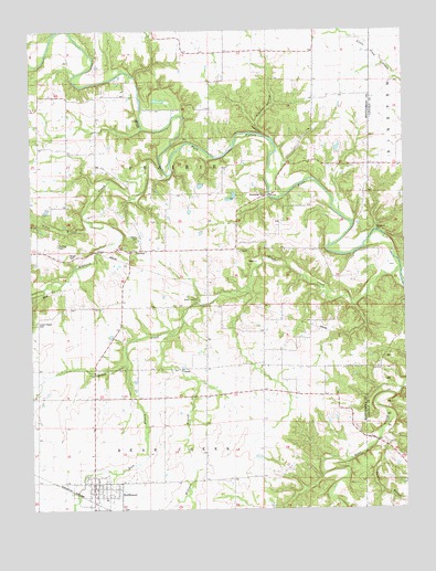
Bellflower North, MO USGS Topographic Map
Click on map above to begin viewing in our Map Viewer.

This topographic map contains these locations and features:
Feature Name Type Latitude Longitude GNIS ID View Map
BackboneRidgeN39.1000°W91.3021°713517View Map
BellflowerPopulated PlaceN39.0067°W91.3552°713929View Map
Bellflower Elementary SchoolSchoolN39.0028°W91.3507°2651350View Map
Bellflower Post OfficePost OfficeN39.0059°W91.3550°2782694View Map
Bellflower Volunteer Fire Protection DistrictBuildingN39.0053°W91.3551°2621744View Map
Berger CemeteryCemeteryN39.0656°W91.3615°713984View Map
Brush CreekStreamN39.0624°W91.2516°714848View Map
Brush Creek ChurchChurchN39.0539°W91.3199°729448View Map
City of BellflowerCivilN39.0036°W91.3521°2394121View Map
Dillon School (historical)SchoolN39.1187°W91.3154°742521View Map
East Branch Brush CreekStreamN39.0381°W91.3440°717254View Map
Elkhorn CreekStreamN39.0881°W91.3277°717467View Map
Fulcher HollowValleyN39.0962°W91.2938°718282View Map
GammaPopulated PlaceN39.0673°W91.3415°718326View Map
Hawkins DamDamN39.0817°W91.3068°761808View Map
Horeb Presbyterian Church (historical)ChurchN39.1197°W91.3102°744199View Map
Lincoln School (historical)SchoolN39.1006°W91.3632°742522View Map
Long BranchStreamN39.0742°W91.3546°755556View Map
Mabry CemeteryCemeteryN39.0711°W91.3390°721707View Map
Macedonia CemeteryCemeteryN39.0814°W91.2963°721714View Map
Macedonia Church (historical)ChurchN39.0820°W91.2960°742523View Map
Maple Grove School (historical)SchoolN39.0684°W91.2963°742525View Map
Milligan BranchStreamN39.0456°W91.3285°722403View Map
Milligan School (historical)SchoolN39.0292°W91.3224°742528View Map
Mudd School (historical)SchoolN39.0298°W91.2868°742529View Map
Picnic BranchStreamN39.0184°W91.2590°724314View Map
Pine Knot School (historical)SchoolN39.1150°W91.2793°742520View Map
Pontlow CemeteryCemeteryN39.0692°W91.3663°724737View Map
Prairie Flower SchoolSchoolN39.0673°W91.3304°742526View Map
Stillhouse FordPopulated PlaceN39.0725°W91.2599°741292View Map
Township of PrairieCivilN39.0948°W91.3650°767051View Map
Union Chapel CemeteryCemeteryN39.0489°W91.3735°727982View Map
Walnut Grove Church (historical)ChurchN39.0756°W91.3724°742524View Map
Wolf CreekStreamN39.0598°W91.3643°729050View Map

Note: Coordinates in the location and feature list above are referenced to NAD83 datum.


Copyright (C) 2008-2025 Ryan Niemi / Sunset Dynamics ... All Rights Reserved