TopoQuest Logo
Do you find TopoQuest useful?
Help keep TopoQuest running and adding new maps/features by donating!
Bitcoin:  19c7KJd3qBynnjoSw5npx9KScwjBe4ifkT
Litecoin:  LXs6TkuXGGXo1vDsWCkWVdjQX94eUKd6ui
Home View Maps Find Maps Find Places Resources & Links


Buell, Missouri Topographic Map

USGS Map Title: Buell, MO
USGS Map MRC: 39091A4
DRG (GeoTIFF) Download: o39091a4.tif


Neighboring USGS Topographic Map Quads:


  Vandalia Lake, MO  
39091B5
 

  Middletown, MO  
39091B4
 

  New Hartford, MO  
39091B3
 

  Wellsville, MO  
39091A5
 

  Buell, MO  
39091A4
 

  Bellflower North, MO  
39091A3
 

  Montgomery City, MO  
38091H5
 

  New Florence, MO  
38091H4
 

  Bellflower South, MO  
38091H3


Map MRC Location:

N40°
W92°
N40°
W91°
H8 H7 H6 H5 H4 H3 H2 H1
G8 G7 G6 G5 G4 G3 G2 G1
F8 F7 F6 F5 F4 F3 F2 F1
E8 E7 E6 E5 E4 E3 E2 E1
D8 D7 D6 D5 D4 D3 D2 D1
C8 C7 C6 C5 C4 C3 C2 C1
B8 B7 B6 B5 B4 B3 B2 B1
A8 A7 A6 A5 A4 A3 A2 A1
N39°
W92°
N39°
W91°

Buell, MO USGS 1:24K Topographic Map Preview:
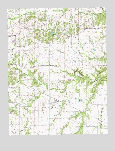
Buell, MO USGS Topographic Map
Click on map above to begin viewing in our Map Viewer.

This topographic map contains these locations and features:
Feature Name Type Latitude Longitude GNIS ID View Map
BuellPopulated PlaceN39.0342°W91.4390°714998View Map
Cahall Lake DamDamN39.0717°W91.4635°762167View Map
Coon CreekStreamN39.1198°W91.3779°716256View Map
Crooked CreekStreamN39.1200°W91.4077°716511View Map
Cross Roads School (historical)SchoolN39.0681°W91.4379°742537View Map
Elkhorn ChurchChurchN39.0337°W91.4307°729478View Map
Garrison Lake DamDamN39.0684°W91.4652°762166View Map
Hagemier Lake DamDamN39.1017°W91.4435°761611View Map
Hazel Dell School (historical)SchoolN39.0675°W91.3877°742536View Map
Hopewell CemeteryCemeteryN39.0789°W91.4765°719796View Map
Hopewell ChurchChurchN39.0700°W91.4765°729516View Map
Hopewell School (historical)SchoolN39.0697°W91.4766°744198View Map
Kleinsorge Lake DamDamN39.0534°W91.4218°762164View Map
Little Coon CreekStreamN39.1223°W91.4585°738293View Map
Little Elkhorn CreekStreamN39.0339°W91.4688°721228View Map
Little Wolf CreekStreamN39.0214°W91.4060°721360View Map
Locust Grove School (historical)SchoolN39.0331°W91.4929°742535View Map
Maupin Lake DamDamN39.0634°W91.4135°762165View Map
McQuoid CemeteryCemeteryN39.0475°W91.4640°722172View Map
Meadow Lark School (historical)SchoolN39.0334°W91.4160°742534View Map
Middletown Elementary School (historical)SchoolN39.1247°W91.4122°2651295View Map
Middletown LakeReservoirN39.0995°W91.4439°758314View Map
Number 763 DamDamN39.0734°W91.3802°761591View Map
Opossum BranchStreamN39.0584°W91.4146°729595View Map
Postoak School (historical)SchoolN39.1042°W91.4032°742540View Map
ProhibitionLocaleN39.0478°W91.3860°740309View Map
Prohibition Post Office (historical)Post OfficeN39.0478°W91.3860°759543View Map
River Acres Lake DamDamN39.0017°W91.4668°761860View Map
Rodgers School (historical)SchoolN39.0289°W91.3779°742541View Map
Slavins Lake DamDamN39.0934°W91.4902°762168View Map
Stanek Lake DamDamN39.0434°W91.3885°762161View Map
Thomas School (historical)SchoolN39.0962°W91.4338°742538View Map
Trinity ChurchChurchN39.0856°W91.4907°729675View Map
Twomile BranchStreamN39.0473°W91.4268°727938View Map
Walton Lake DamDamN39.0467°W91.4402°762163View Map
Wehrman AirportAirportN39.0120°W91.4199°742790View Map
White CemeteryCemeteryN39.0031°W91.4952°728722View Map
White Lake DamDamN39.0334°W91.4252°762162View Map
White Oak CreekStreamN39.0448°W91.4502°729692View Map
Young School (historical)SchoolN39.0992°W91.4885°742539View Map

Note: Coordinates in the location and feature list above are referenced to NAD83 datum.


Copyright (C) 2008-2025 Ryan Niemi / Sunset Dynamics ... All Rights Reserved