TopoQuest Logo
Do you find TopoQuest useful?
Help keep TopoQuest running and adding new maps/features by donating!
Bitcoin:  19c7KJd3qBynnjoSw5npx9KScwjBe4ifkT
Litecoin:  LXs6TkuXGGXo1vDsWCkWVdjQX94eUKd6ui
Home View Maps Find Maps Find Places Resources & Links


Bellville, Texas Topographic Map

USGS Map Title: Bellville, TX
USGS Map MRC: 29096H3
DRG (GeoTIFF) Download: o29096h3.tif


Neighboring USGS Topographic Map Quads:


  Welcome, TX  
30096A4
 

  Kenney, TX  
30096A3
 

  Buckhorn, TX  
30096A2
 

  New Ulm, TX  
29096H4
 

  Bellville, TX  
29096H3
 

  Burleigh, TX  
29096H2
 

  Bernardo, TX  
29096G4
 

  Cat Spring, TX  
29096G3
 

  Sealy, TX  
29096G2


Map MRC Location:

N30°
W97°
N30°
W96°
H8 H7 H6 H5 H4 H3 H2 H1
G8 G7 G6 G5 G4 G3 G2 G1
F8 F7 F6 F5 F4 F3 F2 F1
E8 E7 E6 E5 E4 E3 E2 E1
D8 D7 D6 D5 D4 D3 D2 D1
C8 C7 C6 C5 C4 C3 C2 C1
B8 B7 B6 B5 B4 B3 B2 B1
A8 A7 A6 A5 A4 A3 A2 A1
N29°
W97°
N29°
W96°

Bellville, TX USGS 1:24K Topographic Map Preview:
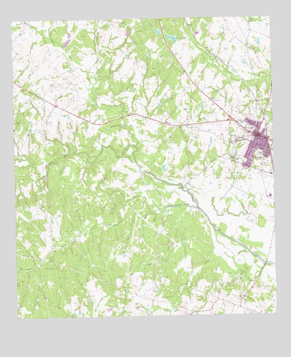
Bellville, TX USGS Topographic Map
Click on map above to begin viewing in our Map Viewer.

This topographic map contains these locations and features:
Feature Name Type Latitude Longitude GNIS ID View Map
Atkinson CemeteryCemeteryN29.9527°W96.2825°1351321View Map
Austin CountyCivilN29.8870°W96.2779°1383793View Map
Austin County Constable's Office Precinct 1BuildingN29.9579°W96.2633°2739493View Map
Austin County Courthouse (historical)BuildingN29.9508°W96.2580°2030596View Map
Austin County Emergency Medical ServicesBuildingN29.9562°W96.2674°2655864View Map
Austin County JailBuildingN29.9494°W96.2576°2738883View Map
Austin County Jail (historical)BuildingN29.9494°W96.2577°2031550View Map
Austin County Sheriff's OfficeBuildingN29.9580°W96.2632°2739190View Map
BellvillePopulated PlaceN29.9502°W96.2572°1372492View Map
Bellville City HallBuildingN29.9497°W96.2583°2753491View Map
Bellville General HospitalHospitalN29.9536°W96.2606°2015610View Map
Bellville High SchoolSchoolN29.9494°W96.2544°2003025View Map
Bellville Junior High SchoolSchoolN29.9494°W96.2544°2003028View Map
Bellville Police DepartmentBuildingN29.9510°W96.2562°2739309View Map
Bellville Post OfficePost OfficeN29.9505°W96.2551°2732310View Map
Brast CemeteryCemeteryN29.9608°W96.3011°1352837View Map
Buffalo CreekStreamN29.9783°W96.3397°1372804View Map
Burns CemeteryCemeteryN29.9584°W96.3749°1353354View Map
Campbell BranchStreamN29.9888°W96.3536°1372896View Map
Cat Spring CreekStreamN29.9013°W96.2625°1372970View Map
City of BellvilleCivilN29.9472°W96.2597°2409825View Map
DantLocaleN29.9872°W96.2822°1355639View Map
East Mill CreekStreamN29.9405°W96.3169°1372148View Map
Jeff CemeteryCemeteryN29.9636°W96.2600°1360194View Map
KACO-AM (Bellville)TowerN29.9474°W96.2652°1385501View Map
Keuffel CemeteryCemeteryN29.8922°W96.2680°1360609View Map
Kollatschny CemeteryCemeteryN29.8791°W96.3177°1360744View Map
Long BranchStreamN29.9916°W96.2886°1374693View Map
Machemehl CemeteryCemeteryN29.9838°W96.3186°1362032View Map
Mawis LakeReservoirN29.9947°W96.3048°1864908View Map
Mawis Lake DamDamN29.9936°W96.3036°1864907View Map
Mewis LakeReservoirN29.9918°W96.2978°1856998View Map
Mewis Lake DamDamN29.9919°W96.2969°1856997View Map
Meyer CemeteryCemeteryN29.9808°W96.3111°1362685View Map
Millheim Gas FieldOilfieldN29.8991°W96.2689°1362919View Map
Muery CemeteryCemeteryN29.9762°W96.3074°1363433View Map
Nelsonville Gas FieldOilfieldN29.9666°W96.3516°1363669View Map
O'Bryant Intermediate SchoolSchoolN29.9494°W96.2544°2002972View Map
O'Bryant Primary SchoolSchoolN29.9494°W96.2544°2002921View Map
Old Masonic HallBuildingN29.9511°W96.2580°2031771View Map
Palm CemeteryCemeteryN29.8847°W96.2772°1364716View Map
Pin Oak CreekStreamN29.9208°W96.2905°1375454View Map
Sandy CreekStreamN29.9194°W96.2858°1367700View Map
Sevevin CemeteryCemeteryN29.8758°W96.2616°1368002View Map
Spricer SchoolSchoolN29.9499°W96.2683°1368919View Map
Traylor Tick Farm AirportAirportN29.9719°W96.3095°1386240View Map
Ueckert CemeteryCemeteryN29.9922°W96.2771°1370425View Map
Ward BranchStreamN29.9986°W96.3680°1376635View Map
West Mill CreekStreamN29.9405°W96.3166°1350835View Map

Note: Coordinates in the location and feature list above are referenced to NAD83 datum.


Copyright (C) 2008-2025 Ryan Niemi / Sunset Dynamics ... All Rights Reserved