TopoQuest Logo
Do you find TopoQuest useful?
Help keep TopoQuest running and adding new maps/features by donating!
Bitcoin:  19c7KJd3qBynnjoSw5npx9KScwjBe4ifkT
Litecoin:  LXs6TkuXGGXo1vDsWCkWVdjQX94eUKd6ui
Home View Maps Find Maps Find Places Resources & Links


Welcome, Texas Topographic Map

USGS Map Title: Welcome, TX
USGS Map MRC: 30096A4
DRG (GeoTIFF) Download: o30096a4.tif


Neighboring USGS Topographic Map Quads:


  Burton, TX  
30096B5
 

  Brenham, TX  
30096B4
 

  Chappell Hill, TX  
30096B3
 

  Greenvine, TX  
30096A5
 

  Welcome, TX  
30096A4
 

  Kenney, TX  
30096A3
 

  Industry, TX  
29096H5
 

  New Ulm, TX  
29096H4
 

  Bellville, TX  
29096H3


Map MRC Location:

N31°
W97°
N31°
W96°
H8 H7 H6 H5 H4 H3 H2 H1
G8 G7 G6 G5 G4 G3 G2 G1
F8 F7 F6 F5 F4 F3 F2 F1
E8 E7 E6 E5 E4 E3 E2 E1
D8 D7 D6 D5 D4 D3 D2 D1
C8 C7 C6 C5 C4 C3 C2 C1
B8 B7 B6 B5 B4 B3 B2 B1
A8 A7 A6 A5 A4 A3 A2 A1
N30°
W97°
N30°
W96°

Welcome, TX USGS 1:24K Topographic Map Preview:
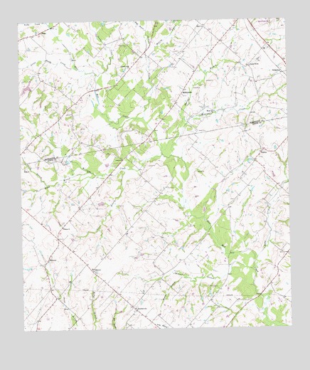
Welcome, TX USGS Topographic Map
Click on map above to begin viewing in our Map Viewer.

This topographic map contains these locations and features:
Feature Name Type Latitude Longitude GNIS ID View Map
Beaty BranchStreamN30.0205°W96.4236°1330266View Map
BleiblervillePopulated PlaceN30.0080°W96.4475°1330860View Map
Bleiblerville Post OfficePost OfficeN30.0082°W96.4481°2731370View Map
Bleiblerville Volunteer Fire DepartmentBuildingN30.0038°W96.4404°2552683View Map
Boggy BranchStreamN30.0641°W96.4686°1330995View Map
Brenham Oil FieldOilfieldN30.0699°W96.4777°1331225View Map
Germania CemeteryCemeteryN30.0299°W96.3758°1336498View Map
Goodwill ChurchChurchN30.0688°W96.4527°1336717View Map
Jackson CreekStreamN30.0858°W96.4425°1338583View Map
KlumpPopulated PlaceN30.1205°W96.4908°1378530View Map
Lime BranchStreamN30.0649°W96.4516°1339927View Map
Little Sandy CreekStreamN30.1061°W96.4741°1340181View Map
Meeting BranchStreamN30.1091°W96.4394°1341340View Map
Meir CemeteryCemeteryN30.0502°W96.4550°1341347View Map
Millseat BranchStreamN30.0238°W96.3925°1341693View Map
MuellersvillePopulated PlaceN30.0952°W96.4247°1378715View Map
Pleasant Grove CemeteryCemeteryN30.1158°W96.4491°1344186View Map
Pleasant Grove ChurchChurchN30.1061°W96.4486°1344192View Map
Pleasant Hill SchoolSchoolN30.1066°W96.3927°1344222View Map
Randle Hill CemeteryCemeteryN30.0894°W96.4139°1344784View Map
Randle Hill ChurchChurchN30.0877°W96.4097°1344785View Map
Rocky CreekStreamN30.0230°W96.3916°1345459View Map
Rocky CreekStreamN30.1244°W96.4866°1345462View Map
Salem CemeteryCemeteryN30.1249°W96.4280°1346165View Map
Salem ChurchChurchN30.1224°W96.4141°1346166View Map
Sandy CreekStreamN30.1033°W96.4644°1346593View Map
Scranton Grove CemeteryCemeteryN30.0169°W96.4097°1346831View Map
Shirttail BranchStreamN30.0722°W96.4341°1347085View Map
Spring BranchStreamN30.0591°W96.4877°1347688View Map
Tonn LakeReservoirN30.1012°W96.4952°1854360View Map
Tonn Lake DamDamN30.1019°W96.4952°1854359View Map
WehdemPopulated PlaceN30.0713°W96.3877°1379250View Map
WelcomeLocaleN30.0288°W96.4880°1349622View Map
WelcomePopulated PlaceN30.0277°W96.4891°2034852View Map
Welcome ChurchChurchN30.0413°W96.4811°1349623View Map
Welcome SchoolSchoolN30.0247°W96.4677°1349624View Map
Wesley Brethren ChurchChurchN30.0655°W96.4983°2032214View Map
Wesley ChurchChurchN30.0655°W96.4983°1349665View Map
Williams CreekStreamN30.0702°W96.4300°1350136View Map
Williams CreekStreamN30.0705°W96.4341°1350137View Map
Wood BranchStreamN30.1213°W96.4408°1350504View Map

Note: Coordinates in the location and feature list above are referenced to NAD83 datum.


Copyright (C) 2008-2025 Ryan Niemi / Sunset Dynamics ... All Rights Reserved