TopoQuest Logo
Do you find TopoQuest useful?
Help keep TopoQuest running and adding new maps/features by donating!
Bitcoin:  19c7KJd3qBynnjoSw5npx9KScwjBe4ifkT
Litecoin:  LXs6TkuXGGXo1vDsWCkWVdjQX94eUKd6ui
Home View Maps Find Maps Find Places Resources & Links


Hegg, Wisconsin Topographic Map

USGS Map Title: Hegg, WI
USGS Map MRC: 44091B2
DRG (GeoTIFF) Download: o44091b2.tif


Neighboring USGS Topographic Map Quads:


  Whitehall, WI  
44091C3
 

  Blair, WI  
44091C2
 

  Taylor, WI  
44091C1
 

  Ettrick, WI  
44091B3
 

  Hegg, WI  
44091B2
 

  North Bend NE, WI  
44091B1
 

  Galesville, WI  
44091A3
 

  Stevenstown, WI  
44091A2
 

  North Bend, WI  
44091A1


Map MRC Location:

N45°
W92°
N45°
W91°
H8 H7 H6 H5 H4 H3 H2 H1
G8 G7 G6 G5 G4 G3 G2 G1
F8 F7 F6 F5 F4 F3 F2 F1
E8 E7 E6 E5 E4 E3 E2 E1
D8 D7 D6 D5 D4 D3 D2 D1
C8 C7 C6 C5 C4 C3 C2 C1
B8 B7 B6 B5 B4 B3 B2 B1
A8 A7 A6 A5 A4 A3 A2 A1
N44°
W92°
N44°
W91°

Hegg, WI USGS 1:24K Topographic Map Preview:
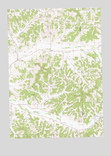
Hegg, WI USGS Topographic Map
Click on map above to begin viewing in our Map Viewer.

This topographic map contains these locations and features:
Feature Name Type Latitude Longitude GNIS ID View Map
Beach School (historical)SchoolN44.2019°W91.2365°1851061View Map
Beachs CornersPopulated PlaceN44.2013°W91.2374°1561332View Map
Bear CreekStreamN44.2027°W91.2396°1561347View Map
Borreson CouleeValleyN44.1457°W91.1823°1562081View Map
Buckholz CornersLocaleN44.1438°W91.1265°1562332View Map
Columbus CreekStreamN44.2100°W91.1385°1563283View Map
Faith Lutheran ChurchChurchN44.2080°W91.1799°1564829View Map
German CouleeValleyN44.1463°W91.1287°1565481View Map
HeggPopulated PlaceN44.2091°W91.1924°1566263View Map
Hegg School (historical)SchoolN44.2080°W91.1793°1851112View Map
Joe CouleeValleyN44.2150°W91.1859°1851621View Map
Joe Coulee CreekStreamN44.2102°W91.1888°1567189View Map
Legue CouleeValleyN44.2161°W91.1936°1567951View Map
Lone Star School (historical)SchoolN44.2466°W91.1988°1851129View Map
North Beaver Creek Lutheran ChurchChurchN44.2083°W91.1671°1570358View Map
Peacock Road CouleeValleyN44.1322°W91.1582°1571120View Map
Pioneer CemeteryCemeteryN44.2091°W91.1513°1571540View Map
Salzwedel CouleeValleyN44.1533°W91.2091°1573642View Map
Salzwedel Coulee CreekStreamN44.1505°W91.2138°1577414View Map
Simonson CouleeValleyN44.1491°W91.2269°1574182View Map
South Beaver Creek ChurchChurchN44.1327°W91.1465°1574390View Map
South Branch School (historical)SchoolN44.1391°W91.1818°1851175View Map
Stensven CouleeValleyN44.1567°W91.2449°1574859View Map
Svenson CouleeValleyN44.1370°W91.1545°1575141View Map
Thimble PeakSummitN44.1672°W91.2190°1575352View Map
Town of EttrickCivilN44.1912°W91.2473°1583175View Map
Van Riper CouleeValleyN44.1399°W91.1886°1576039View Map
Washington Coulee CreekStreamN44.2108°W91.1785°1576239View Map
Washington School (historical)SchoolN44.1875°W91.1527°1851198View Map
West Branch Beaver CreekStreamN44.2212°W91.2407°2760867View Map
Whalen School (historical)SchoolN44.1580°W91.2396°1851202View Map

Note: Coordinates in the location and feature list above are referenced to NAD83 datum.


Copyright (C) 2008-2025 Ryan Niemi / Sunset Dynamics ... All Rights Reserved