TopoQuest Logo
Do you find TopoQuest useful?
Help keep TopoQuest running and adding new maps/features by donating!
Bitcoin:  19c7KJd3qBynnjoSw5npx9KScwjBe4ifkT
Litecoin:  LXs6TkuXGGXo1vDsWCkWVdjQX94eUKd6ui
Home View Maps Find Maps Find Places Resources & Links


Belmont, New York Topographic Map

USGS Map Title: Belmont, NY
USGS Map MRC: 42078B1
DRG (GeoTIFF) Download: o42078b1.tif


Neighboring USGS Topographic Map Quads:


  Black Creek, NY  
42078C2
 

  Angelica, NY  
42078C1
 

  West Almond, NY  
42077C8
 

  Friendship, NY  
42078B2
 

  Belmont, NY  
42078B1
 

  Wellsville North, NY  
42077B8
 

  Bolivar, NY  
42078A2
 

  Allentown, NY  
42078A1
 

  Wellsville South, NY  
42077A8


Map MRC Location:

N43°
W79°
N43°
W78°
H8 H7 H6 H5 H4 H3 H2 H1
G8 G7 G6 G5 G4 G3 G2 G1
F8 F7 F6 F5 F4 F3 F2 F1
E8 E7 E6 E5 E4 E3 E2 E1
D8 D7 D6 D5 D4 D3 D2 D1
C8 C7 C6 C5 C4 C3 C2 C1
B8 B7 B6 B5 B4 B3 B2 B1
A8 A7 A6 A5 A4 A3 A2 A1
N42°
W79°
N42°
W78°

Belmont, NY USGS 1:24K Topographic Map Preview:
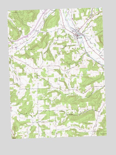
Belmont, NY USGS Topographic Map
Click on map above to begin viewing in our Map Viewer.

This topographic map contains these locations and features:
Feature Name Type Latitude Longitude GNIS ID View Map
Amity Rescue SquadBuildingN42.2323°W78.0278°2719184View Map
BelmontPopulated PlaceN42.2231°W78.0345°977517View Map
Belmont Fire DepartmentBuildingN42.2246°W78.0308°2701163View Map
Belmont Literary and Historical Society Free LibraryBuildingN42.2236°W78.0355°2617221View Map
Belmont Post OfficePost OfficeN42.2229°W78.0342°2617813View Map
Belmont United Methodist ChurchChurchN42.2235°W78.0355°2615577View Map
Carnahan School (historical)SchoolN42.1775°W78.1114°2371519View Map
Cooley School (historical)SchoolN42.1517°W78.0892°2371520View Map
Corbin Hill School (historical)SchoolN42.1950°W78.0589°2371521View Map
East NotchGapN42.1256°W78.1217°949191View Map
Feathers CreekStreamN42.2376°W78.0164°949949View Map
First Baptist ChurchChurchN42.2241°W78.0355°2615944View Map
Forest Hills CemeteryCemeteryN42.2229°W78.0434°950399View Map
Francisco FarmsLocaleN42.2044°W78.0242°2703652View Map
Friendship Rest AreaLocaleN42.2240°W78.1006°2615115View Map
Genesee Valley Elementary SchoolSchoolN42.2327°W78.0318°2668848View Map
Genesee Valley High SchoolSchoolN42.2334°W78.0320°2669213View Map
Genesee Valley Middle SchoolSchoolN42.2338°W78.0328°2669157View Map
Gospel Fellowship ChurchChurchN42.2190°W78.0215°2616100View Map
Gospel TabernacleChurchN42.2031°W78.0019°951409View Map
HigginsPopulated PlaceN42.2301°W78.0878°952716View Map
Holy Family ChurchChurchN42.2281°W78.0320°2616472View Map
InavalePopulated PlaceN42.1406°W78.0889°972646View Map
Knight CreekPopulated PlaceN42.1292°W78.0175°954776View Map
Knights Creek CemeteryCemeteryN42.1291°W78.0189°2544285View Map
Long Gore CreekStreamN42.2067°W78.0228°955856View Map
Maple Grove CemeteryCemeteryN42.2176°W78.1183°956401View Map
Maple Grove Mobile Home EstatesPopulated PlaceN42.2145°W78.1217°2618256View Map
Middaugh School (historical)SchoolN42.1703°W78.0486°2371525View Map
Moss BrookStreamN42.2053°W78.1245°969291View Map
Mount Hope CemeteryCemeteryN42.2045°W78.1211°957840View Map
New York State Police Troop A Zone 4 Amity StationBuildingN42.2423°W78.0539°2780753View Map
Norton CemeteryCemeteryN42.2108°W78.0162°959009View Map
Phillips CreekStreamN42.2259°W78.0331°960303View Map
Plum Bottom CreekStreamN42.2234°W78.0267°960755View Map
Saint Marys CemeteryCemeteryN42.2313°W78.0357°963887View Map
School Number 4 (historical)SchoolN42.1517°W78.0522°2371536View Map
School Number 9 (historical)SchoolN42.2419°W78.0161°2371540View Map
Scott School (historical)SchoolN42.1928°W78.0925°2371543View Map
Snowball Hollow CreekStreamN42.1484°W78.0058°965583View Map
Sortore CemeteryCemeteryN42.1840°W78.0873°965645View Map
Town of AmityCivilN42.2183°W78.0170°978676View Map
Town of ScioCivilN42.1449°W78.0057°979475View Map
Utopia CemeteryCemeteryN42.1526°W78.1249°968330View Map
Valley View EstatesPopulated PlaceN42.2173°W78.1071°2618299View Map
Village of BelmontCivilN42.2226°W78.0328°2391547View Map

Note: Coordinates in the location and feature list above are referenced to NAD83 datum.


Copyright (C) 2008-2025 Ryan Niemi / Sunset Dynamics ... All Rights Reserved