TopoQuest Logo
Do you find TopoQuest useful?
Help keep TopoQuest running and adding new maps/features by donating!
Bitcoin:  19c7KJd3qBynnjoSw5npx9KScwjBe4ifkT
Litecoin:  LXs6TkuXGGXo1vDsWCkWVdjQX94eUKd6ui
Home View Maps Find Maps Find Places Resources & Links


Bolivar, New York Topographic Map

USGS Map Title: Bolivar, NY
USGS Map MRC: 42078A2
DRG (GeoTIFF) Download: o42078a2.tif


Neighboring USGS Topographic Map Quads:


  Cuba, NY  
42078B3
 

  Friendship, NY  
42078B2
 

  Belmont, NY  
42078B1
 

  Portville, NY  
42078A3
 

  Bolivar, NY  
42078A2
 

  Allentown, NY  
42078A1
 

  Bullis Mills, PA  
41078H3
 

  Shinglehouse, PA  
41078H2
 

  Oswayo, PA  
41078H1


Map MRC Location:

N43°
W79°
N43°
W78°
H8 H7 H6 H5 H4 H3 H2 H1
G8 G7 G6 G5 G4 G3 G2 G1
F8 F7 F6 F5 F4 F3 F2 F1
E8 E7 E6 E5 E4 E3 E2 E1
D8 D7 D6 D5 D4 D3 D2 D1
C8 C7 C6 C5 C4 C3 C2 C1
B8 B7 B6 B5 B4 B3 B2 B1
A8 A7 A6 A5 A4 A3 A2 A1
N42°
W79°
N42°
W78°

Bolivar, NY USGS 1:24K Topographic Map Preview:
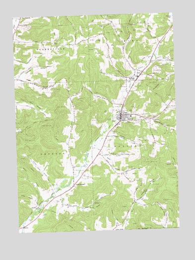
Bolivar, NY USGS Topographic Map
Click on map above to begin viewing in our Map Viewer.

This topographic map contains these locations and features:
Feature Name Type Latitude Longitude GNIS ID View Map
Anderson HollowValleyN42.0167°W78.1579°942459View Map
Belleigh Acres Hunt ClubLocaleN42.0162°W78.1911°974315View Map
BolivarPopulated PlaceN42.0667°W78.1678°944401View Map
Bolivar - Richburg Elementary SchoolSchoolN42.0888°W78.1538°2668814View Map
Bolivar - Richburg Junior - Senior High SchoolSchoolN42.0661°W78.1600°2668983View Map
Bolivar Fire DepartmentBuildingN42.0639°W78.1679°2701234View Map
Bolivar Free LibraryBuildingN42.0653°W78.1676°2617228View Map
Bolivar Post OfficePost OfficeN42.0672°W78.1678°2617824View Map
Bolivar United Methodist ChurchChurchN42.0657°W78.1662°2615625View Map
BowlerPopulated PlaceN42.0031°W78.2461°972252View Map
Colonial LibraryBuildingN42.0878°W78.1536°2617251View Map
Cordory HollowValleyN42.0012°W78.1728°947439View Map
Cottrell School (historical)SchoolN42.1086°W78.1353°2371522View Map
Courtney HollowValleyN42.0898°W78.2475°947563View Map
Dodge HollowValleyN42.0187°W78.2358°948524View Map
Eastman School (historical)SchoolN42.0869°W78.2392°2371524View Map
Evergreen Golf CourseLocaleN42.0370°W78.2025°2615393View Map
Foreman HollowValleyN42.0550°W78.1758°950383View Map
Foster BrookStreamN42.0253°W78.2197°950513View Map
Genesee Public LibraryBuildingN42.0238°W78.2102°2617283View Map
Johnson HillSummitN42.1101°W78.1814°954120View Map
Jordan HillSummitN42.1187°W78.1792°954197View Map
KossuthPopulated PlaceN42.0642°W78.1422°954810View Map
Kossuth Community ChapelChurchN42.0647°W78.1426°2616622View Map
Little GeneseePopulated PlaceN42.0270°W78.2061°955539View Map
Little Genesee CemeteryCemeteryN42.0377°W78.2062°955540View Map
Little Genesee Post OfficePost OfficeN42.0268°W78.2063°2618003View Map
Maple Lawn CemeteryCemeteryN42.0565°W78.1762°956434View Map
Mead HollowValleyN42.0433°W78.1814°956862View Map
Miller HollowValleyN42.0445°W78.1800°957314View Map
Paradise LakeLakeN42.1233°W78.1258°959843View Map
Pine Grove School (historical)SchoolN42.1136°W78.1800°2371529View Map
Pleasant ValleyValleyN42.0985°W78.1385°960726View Map
RichburgPopulated PlaceN42.0884°W78.1533°962466View Map
Richburg CemeteryCemeteryN42.0868°W78.1559°2544256View Map
Richburg HillSummitN42.0898°W78.1292°962467View Map
Richburg Post OfficePost OfficeN42.0885°W78.1528°2618087View Map
Richburg Volunteer Fire CompanyBuildingN42.0914°W78.1504°2700787View Map
Saint Marys CemeteryCemeteryN42.0571°W78.1758°963880View Map
SanfordPopulated PlaceN42.0153°W78.2356°973041View Map
School Number 13 (historical)SchoolN42.1081°W78.2069°2371541View Map
School Number 2 (historical)SchoolN42.0497°W78.1822°2371532View Map
School Number 3 (historical)SchoolN42.0131°W78.1628°2371533View Map
Scott Hollow School (historical)SchoolN42.0047°W78.1347°2371542View Map
Seventh Day Baptist ChurchChurchN42.0864°W78.1549°2616249View Map
Skunk HollowValleyN42.0140°W78.1953°965367View Map
Southside Union ChapelChurchN42.0669°W78.1684°2616281View Map
Town of BolivarCivilN42.0433°W78.1327°978740View Map
Town of GeneseeCivilN42.0430°W78.2498°978989View Map
Village of BolivarCivilN42.0684°W78.1662°2391555View Map
Village of RichburgCivilN42.0888°W78.1565°2391093View Map
WCID-FM (Friendship)TowerN42.1178°W78.1797°977726View Map
Wells CemeteryCemeteryN42.0323°W78.1992°969031View Map
West NotchGapN42.1192°W78.1595°970829View Map
Willow BrookStreamN42.0209°W78.2231°971339View Map
Wilson HollowValleyN42.0217°W78.2320°971418View Map
Windfall CreekStreamN42.0315°W78.2047°971454View Map

Note: Coordinates in the location and feature list above are referenced to NAD83 datum.


Copyright (C) 2008-2024 Ryan Niemi / Sunset Dynamics ... All Rights Reserved