TopoQuest Logo
Do you find TopoQuest useful?
Help keep TopoQuest running and adding new maps/features by donating!
Bitcoin:  19c7KJd3qBynnjoSw5npx9KScwjBe4ifkT
Litecoin:  LXs6TkuXGGXo1vDsWCkWVdjQX94eUKd6ui
Home View Maps Find Maps Find Places Resources & Links


Black Creek, New York Topographic Map

USGS Map Title: Black Creek, NY
USGS Map MRC: 42078C2
DRG (GeoTIFF) Download: o42078c2.tif


Neighboring USGS Topographic Map Quads:


  Freedom, NY  
42078D3
 

  Houghton, NY  
42078D2
 

  Fillmore, NY  
42078D1
 

  Rawson, NY  
42078C3
 

  Black Creek, NY  
42078C2
 

  Angelica, NY  
42078C1
 

  Cuba, NY  
42078B3
 

  Friendship, NY  
42078B2
 

  Belmont, NY  
42078B1


Map MRC Location:

N43°
W79°
N43°
W78°
H8 H7 H6 H5 H4 H3 H2 H1
G8 G7 G6 G5 G4 G3 G2 G1
F8 F7 F6 F5 F4 F3 F2 F1
E8 E7 E6 E5 E4 E3 E2 E1
D8 D7 D6 D5 D4 D3 D2 D1
C8 C7 C6 C5 C4 C3 C2 C1
B8 B7 B6 B5 B4 B3 B2 B1
A8 A7 A6 A5 A4 A3 A2 A1
N42°
W79°
N42°
W78°

Black Creek, NY USGS 1:24K Topographic Map Preview:
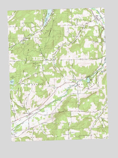
Black Creek, NY USGS Topographic Map
Click on map above to begin viewing in our Map Viewer.

This topographic map contains these locations and features:
Feature Name Type Latitude Longitude GNIS ID View Map
Bellville CemeteryCemeteryN42.3367°W78.2469°943633View Map
Bellville Wesleyan ChurchChurchN42.3552°W78.2075°2615576View Map
Black CreekPopulated PlaceN42.2756°W78.2264°944096View Map
Black Creek CemeteryCemeteryN42.2683°W78.2473°944125View Map
Black Creek Post OfficePost OfficeN42.2755°W78.2266°2617817View Map
Camp RushfordLocaleN42.3440°W78.2289°945651View Map
Crawford CreekStreamN42.3748°W78.1408°947720View Map
Friendship Amish SchoolSchoolN42.2558°W78.1467°2669023View Map
Genesee Valley CanalCanalN42.2726°W78.2333°950995View Map
Hanging BogLakeN42.3071°W78.2470°952160View Map
Hanging Bog Game Management AreaParkN42.3176°W78.2336°952161View Map
MarshallPopulated PlaceN42.3262°W78.2020°972767View Map
Marshall CemeteryCemeteryN42.3268°W78.1925°956568View Map
McGrawvillePopulated PlaceN42.3492°W78.2275°972780View Map
New Hudson Volunteer Fire CompanyBuildingN42.2756°W78.2257°2734975View Map
OramelPopulated PlaceN42.3662°W78.1356°959426View Map
Oramel Fire DepartmentBuildingN42.3653°W78.1359°2700803View Map
RockvillePopulated PlaceN42.3067°W78.1645°962763View Map
Rockville LakeLakeN42.3064°W78.1491°962766View Map
Rush CreekStreamN42.3595°W78.2033°963097View Map
Rushford LakeReservoirN42.3608°W78.2028°963105View Map
Sayers CemeteryCemeteryN42.3012°W78.1934°2544239View Map
Town of BelfastCivilN42.3043°W78.1332°978720View Map
Valleyview Amish SchoolSchoolN42.2939°W78.1537°2669125View Map

Note: Coordinates in the location and feature list above are referenced to NAD83 datum.


Copyright (C) 2008-2025 Ryan Niemi / Sunset Dynamics ... All Rights Reserved