TopoQuest Logo
Do you find TopoQuest useful?
Help keep TopoQuest running and adding new maps/features by donating!
Bitcoin:  19c7KJd3qBynnjoSw5npx9KScwjBe4ifkT
Litecoin:  LXs6TkuXGGXo1vDsWCkWVdjQX94eUKd6ui
Home View Maps Find Maps Find Places Resources & Links


West Almond, New York Topographic Map

USGS Map Title: West Almond, NY
USGS Map MRC: 42077C8
DRG (GeoTIFF) Download: o42077c8.tif


Neighboring USGS Topographic Map Quads:


  Fillmore, NY  
42078D1
 

  Birdsall, NY  
42077D8
 

  Canaseraga, NY  
42077D7
 

  Angelica, NY  
42078C1
 

  West Almond, NY  
42077C8
 

  Alfred, NY  
42077C7
 

  Belmont, NY  
42078B1
 

  Wellsville North, NY  
42077B8
 

  Andover, NY  
42077B7


Map MRC Location:

N43°
W78°
N43°
W77°
H8 H7 H6 H5 H4 H3 H2 H1
G8 G7 G6 G5 G4 G3 G2 G1
F8 F7 F6 F5 F4 F3 F2 F1
E8 E7 E6 E5 E4 E3 E2 E1
D8 D7 D6 D5 D4 D3 D2 D1
C8 C7 C6 C5 C4 C3 C2 C1
B8 B7 B6 B5 B4 B3 B2 B1
A8 A7 A6 A5 A4 A3 A2 A1
N42°
W78°
N42°
W77°

West Almond, NY USGS 1:24K Topographic Map Preview:
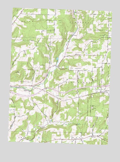
West Almond, NY USGS Topographic Map
Click on map above to begin viewing in our Map Viewer.

This topographic map contains these locations and features:
Feature Name Type Latitude Longitude GNIS ID View Map
Bainbridge Family FarmLocaleN42.3322°W77.9053°2703660View Map
Bald MountainSummitN42.3162°W77.9878°942864View Map
BennettsPopulated PlaceN42.3212°W77.9417°972222View Map
Black CreekStreamN42.3051°W77.9589°944106View Map
Black Creek School (historical)SchoolN42.3669°W77.9181°2379130View Map
California CreekStreamN42.3217°W77.9425°945460View Map
Jersey Hill School (historical)SchoolN42.3500°W77.8783°2379131View Map
Palmers PondLakeN42.2844°W77.8964°959800View Map
Peacock HillSummitN42.2845°W77.9972°960032View Map
Phillips CreekPopulated PlaceN42.2581°W77.8936°960301View Map
Phillips Creek CemeteryCemeteryN42.2607°W77.8954°2544241View Map
Potters Field County Home CemeteryCemeteryN42.2975°W77.9760°2544282View Map
ScholesPopulated PlaceN42.3520°W77.9206°973046View Map
School Number 1 (historical)SchoolN42.3300°W77.9328°2379149View Map
School Number 2 (historical)SchoolN42.2914°W77.9269°2379151View Map
School Number 3 (historical)SchoolN42.2536°W77.9281°2379152View Map
School Number 4 (historical)SchoolN42.2758°W77.8756°2379153View Map
School Number 6 (historical)SchoolN42.3111°W77.9189°2379159View Map
School Number 6 (historical)SchoolN42.3358°W77.9806°2379160View Map
School Number 6 (historical)SchoolN42.3581°W77.9464°2379161View Map
School Number 7 (historical)SchoolN42.3236°W77.8856°2379163View Map
School Number 8 (historical)SchoolN42.2700°W77.9339°2379165View Map
Shadows PondReservoirN42.3678°W77.9197°2784946View Map
Town of West AlmondCivilN42.3043°W77.8979°979617View Map
West AlmondPopulated PlaceN42.2995°W77.8831°969078View Map
West Almond CemeteryCemeteryN42.3029°W77.8858°2057548View Map

Note: Coordinates in the location and feature list above are referenced to NAD83 datum.


Copyright (C) 2008-2024 Ryan Niemi / Sunset Dynamics ... All Rights Reserved