TopoQuest Logo
Do you find TopoQuest useful?
Help keep TopoQuest running and adding new maps/features by donating!
Bitcoin:  19c7KJd3qBynnjoSw5npx9KScwjBe4ifkT
Litecoin:  LXs6TkuXGGXo1vDsWCkWVdjQX94eUKd6ui
Home View Maps Find Maps Find Places Resources & Links


Norvell, Michigan Topographic Map

USGS Map Title: Norvell, MI
USGS Map MRC: 42084B2
DRG (GeoTIFF) Download: o42084b2.tif


Neighboring USGS Topographic Map Quads:


  Gilletts Lake, MI  
42084C3
 

  Grass Lake, MI  
42084C2
 

  Chelsea, MI  
42084C1
 

  Michigan Center, MI  
42084B3
 

  Norvell, MI  
42084B2
 

  Manchester, MI  
42084B1
 

  Cement City, MI  
42084A3
 

  Onsted, MI  
42084A2
 

  Tipton, MI  
42084A1


Map MRC Location:

N43°
W85°
N43°
W84°
H8 H7 H6 H5 H4 H3 H2 H1
G8 G7 G6 G5 G4 G3 G2 G1
F8 F7 F6 F5 F4 F3 F2 F1
E8 E7 E6 E5 E4 E3 E2 E1
D8 D7 D6 D5 D4 D3 D2 D1
C8 C7 C6 C5 C4 C3 C2 C1
B8 B7 B6 B5 B4 B3 B2 B1
A8 A7 A6 A5 A4 A3 A2 A1
N42°
W85°
N42°
W84°

Norvell, MI USGS 1:24K Topographic Map Preview:
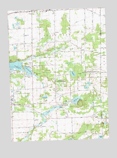
Norvell, MI USGS Topographic Map
Click on map above to begin viewing in our Map Viewer.

This topographic map contains these locations and features:
Feature Name Type Latitude Longitude GNIS ID View Map
Apple Creek Resort and RV ParkLocaleN42.1922°W84.2022°2633025View Map
Bessey LakeLakeN42.1879°W84.1686°621190View Map
Charter Township of Grass LakeCivilN42.2499°W84.1900°1626388View Map
Close SchoolSchoolN42.2186°W84.2286°623491View Map
Cobb LakeLakeN42.1667°W84.2050°2109925View Map
Coppernoll SchoolSchoolN42.2231°W84.1902°623813View Map
Dorr SchoolSchoolN42.2486°W84.1472°624801View Map
Eby Elementary SchoolSchoolN42.1661°W84.2489°2632964View Map
First Baptist ChurchChurchN42.1608°W84.2447°2632961View Map
FishvillePopulated PlaceN42.2100°W84.1567°2112696View Map
Fishville CemeteryCemeteryN42.2091°W84.1572°2633100View Map
Fishville SchoolSchoolN42.2103°W84.1574°626083View Map
Grass Lake High SchoolSchoolN42.2426°W84.2006°2633002View Map
Grey TowerLocaleN42.2259°W84.2294°627423View Map
Jackson County ParkParkN42.1903°W84.2194°2112695View Map
Jackson County Waterfowl Production AreaParkN42.2360°W84.2386°2765344View Map
Jude Stone QuarryMineN42.1608°W84.2397°2725144View Map
Little Wolf LakeLakeN42.1923°W84.2258°630824View Map
Long SchoolSchoolN42.2486°W84.2000°2112698View Map
Maple Grove CemeteryCemeteryN42.2459°W84.2185°627217View Map
Mellen Camp LakeLakeN42.1876°W84.2170°2109926View Map
Mud LakeLakeN42.1608°W84.1786°633055View Map
NapoleonPopulated PlaceN42.1606°W84.2461°633212View Map
Napoleon Census Designated PlaceCensusN42.1658°W84.2416°2393143View Map
Napoleon High SchoolSchoolN42.1656°W84.2478°2632966View Map
Napoleon Middle SchoolSchoolN42.1656°W84.2489°2632965View Map
Napoleon Post OfficePost OfficeN42.1616°W84.2481°2632963View Map
Napoleon Station (historical)LocaleN42.1692°W84.2475°2632959View Map
Napoleon United Methodist ChurchChurchN42.1597°W84.2450°2632960View Map
NorvellPopulated PlaceN42.1575°W84.1841°633747View Map
Norvell CemeteryCemeteryN42.1472°W84.1769°2633095View Map
Norvell Community Baptist ChurchChurchN42.1583°W84.1819°2632957View Map
Norvell LakeLakeN42.1542°W84.1916°633748View Map
Norvell Manchester DrainCanalN42.1428°W84.1361°2109923View Map
Norvell Plains SchoolSchoolN42.1462°W84.1766°633749View Map
Norvell Post OfficePost OfficeN42.1581°W84.1833°2632956View Map
Norvell Station (historical)LocaleN42.1586°W84.1836°2632958View Map
Oak Grove CemeteryCemeteryN42.1561°W84.2494°2633098View Map
Prospect Hill SchoolSchoolN42.1786°W84.1349°635486View Map
Ray CemeteryCemeteryN42.1972°W84.2056°2633091View Map
Roman Orthodox CemeteryCemeteryN42.2269°W84.2306°2633092View Map
Romanian Orthodox EpiscopateChurchN42.2256°W84.2297°2112697View Map
Sharonville State Wildlife Management AreaParkN42.1889°W84.1472°2109924View Map
Sweezey lakeLakeN42.1632°W84.1657°1614500View Map
Tamarack LakeLakeN42.1877°W84.1566°1614572View Map
Thorn LakeLakeN42.1398°W84.1295°1614790View Map
Township of NorvellCivilN42.1317°W84.1716°1626820View Map
Tucker LakeLakeN42.1781°W84.1493°1615155View Map
Twin Knolls Golf CourseLocaleN42.2000°W84.2222°2633024View Map
Willow CreekStreamN42.2009°W84.2344°1616531View Map
Wolf LakeLakeN42.1958°W84.2413°1616705View Map
Wolf Lake AirportAirportN42.2091°W84.2324°2650889View Map

Note: Coordinates in the location and feature list above are referenced to NAD83 datum.


Copyright (C) 2008-2025 Ryan Niemi / Sunset Dynamics ... All Rights Reserved