TopoQuest Logo
Do you find TopoQuest useful?
Help keep TopoQuest running and adding new maps/features by donating!
Bitcoin:  19c7KJd3qBynnjoSw5npx9KScwjBe4ifkT
Litecoin:  LXs6TkuXGGXo1vDsWCkWVdjQX94eUKd6ui
Home View Maps Find Maps Find Places Resources & Links


Owl Creek, Mississippi Topographic Map

USGS Map Title: Owl Creek, MS
USGS Map MRC: 32088G8
DRG (GeoTIFF) Download: o32088g8.tif


Neighboring USGS Topographic Map Quads:


  Noxapater, MS  
32089H1
 

  Vernon, MS  
32088H8
 

  Preston, MS  
32088H7
 

  Philadelphia, MS  
32089G1
 

  Owl Creek, MS  
32088G8
 

  Lynville, MS  
32088G7
 

  Deemer, MS  
32089F1
 

  House, MS  
32088F8
 

  Moscow, MS  
32088F7


Map MRC Location:

N33°
W89°
N33°
W88°
H8 H7 H6 H5 H4 H3 H2 H1
G8 G7 G6 G5 G4 G3 G2 G1
F8 F7 F6 F5 F4 F3 F2 F1
E8 E7 E6 E5 E4 E3 E2 E1
D8 D7 D6 D5 D4 D3 D2 D1
C8 C7 C6 C5 C4 C3 C2 C1
B8 B7 B6 B5 B4 B3 B2 B1
A8 A7 A6 A5 A4 A3 A2 A1
N32°
W89°
N32°
W88°

Owl Creek, MS USGS 1:24K Topographic Map Preview:
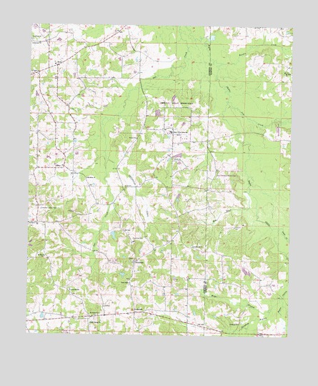
Owl Creek, MS USGS Topographic Map
Click on map above to begin viewing in our Map Viewer.

This topographic map contains these locations and features:
Feature Name Type Latitude Longitude GNIS ID View Map
Bendix CreekStreamN32.8601°W88.9087°666817View Map
Bogue ChittoPopulated PlaceN32.8307°W88.9320°685013View Map
Bogue Chitto Census Designated PlaceCensusN32.8338°W88.9189°2402699View Map
Bogue Chitto Indian SchoolSchoolN32.8321°W88.9317°667384View Map
BondPopulated PlaceN32.8587°W88.9873°667417View Map
Bond ChurchChurchN32.8551°W88.9989°667420View Map
Brandon Hill ChurchChurchN32.7862°W88.9209°667525View Map
CenterLocaleN32.8179°W88.9834°668227View Map
Choctaw ChurchChurchN32.8296°W88.9489°668411View Map
Choctaw Fire Department Station 3BuildingN32.8173°W88.9113°2665811View Map
Coffadeliah (historical)LocaleN32.7585°W88.9598°707192View Map
Coffadeliah CreekStreamN32.8226°W88.9634°668642View Map
Cooks ChapelChurchN32.7712°W88.9512°668787View Map
Cooks Store (historical)LocaleN32.7585°W88.9570°685016View Map
Cow CreekStreamN32.8449°W88.9053°668894View Map
CrossroadsPopulated PlaceN32.7590°W88.9484°691792View Map
East Neshoba Volunteer Fire Department Station 1 HeadquartersBuildingN32.7558°W88.9865°2665797View Map
East Neshoba Volunteer Fire Department Station 4BuildingN32.8025°W88.9313°2665796View Map
ForestdalePopulated PlaceN32.7790°W88.9489°691866View Map
Guy Gray Lake DamDamN32.8235°W88.9301°681678View Map
Hensons CemeteryCemeteryN32.7937°W88.9012°671121View Map
Indian Reservation Lake DamDamN32.8468°W88.9334°681697View Map
Land CreekStreamN32.7932°W88.8803°672293View Map
Long CemeteryCemeteryN32.8098°W88.9534°672814View Map
Long Dale SchoolSchoolN32.7679°W88.9795°672826View Map
Macedonia ChurchChurchN32.8132°W88.9723°673006View Map
Mayo BranchStreamN32.7657°W88.8778°673272View Map
Mount Nelson CemeteryCemeteryN32.7579°W88.9664°707213View Map
Mount Nelson ChurchChurchN32.7587°W88.9653°674100View Map
Mount Salem ChurchChurchN32.8565°W88.8784°674261View Map
Mount Zion ChurchChurchN32.7815°W88.9917°674367View Map
New Hope (historical)LocaleN32.8724°W88.9962°685043View Map
North BendPopulated PlaceN32.8682°W88.9931°707218View Map
North Bend CemeteryCemeteryN32.8693°W88.9989°707219View Map
North Bend ChurchChurchN32.8676°W88.9959°674939View Map
North Bend Volunteer Fire Department Station 1 HeadquartersBuildingN32.8589°W88.9884°2665829View Map
Pat McDonald Lake DamDamN32.7885°W88.9617°681650View Map
Poplar Springs ChurchChurchN32.7546°W88.9698°676242View Map
Rea DitchStreamN32.8107°W88.8948°676508View Map
Red Bud (historical)Populated PlaceN32.7579°W88.8973°686703View Map
Roundtree CemeteryCemeteryN32.7890°W88.9498°676924View Map
Sandtown Lookout TowerTowerN32.8007°W88.9942°711308View Map
Sardis ChurchChurchN32.8212°W88.9303°677415View Map
Sorghum BranchStreamN32.7612°W88.8831°677980View Map
Vardaman ChurchChurchN32.7549°W88.8987°679190View Map
W W FarmsLocaleN32.8225°W88.9772°2664458View Map

Note: Coordinates in the location and feature list above are referenced to NAD83 datum.


Copyright (C) 2008-2025 Ryan Niemi / Sunset Dynamics ... All Rights Reserved