TopoQuest Logo
Do you find TopoQuest useful?
Help keep TopoQuest running and adding new maps/features by donating!
Bitcoin:  19c7KJd3qBynnjoSw5npx9KScwjBe4ifkT
Litecoin:  LXs6TkuXGGXo1vDsWCkWVdjQX94eUKd6ui
Home View Maps Find Maps Find Places Resources & Links


Oak Grove, Mississippi Topographic Map

USGS Map Title: Oak Grove, MS
USGS Map MRC: 32088F5
DRG (GeoTIFF) Download: o32088f5.tif


Neighboring USGS Topographic Map Quads:


  De Kalb, MS  
32088G6
 

  Townsend, MS  
32088G5
 

  Scooba, MS  
32088G4
 

  Lauderdale NW, MS  
32088F6
 

  Oak Grove, MS  
32088F5
 

  Porterville, MS  
32088F4
 

  Daleville, MS  
32088E6
 

  Lauderdale, MS  
32088E5
 

  Tamola, MS  
32088E4


Map MRC Location:

N33°
W89°
N33°
W88°
H8 H7 H6 H5 H4 H3 H2 H1
G8 G7 G6 G5 G4 G3 G2 G1
F8 F7 F6 F5 F4 F3 F2 F1
E8 E7 E6 E5 E4 E3 E2 E1
D8 D7 D6 D5 D4 D3 D2 D1
C8 C7 C6 C5 C4 C3 C2 C1
B8 B7 B6 B5 B4 B3 B2 B1
A8 A7 A6 A5 A4 A3 A2 A1
N32°
W89°
N32°
W88°

Oak Grove, MS USGS 1:24K Topographic Map Preview:
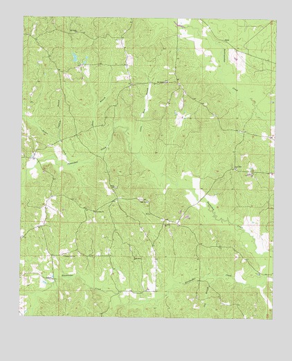
Oak Grove, MS USGS Topographic Map
Click on map above to begin viewing in our Map Viewer.

This topographic map contains these locations and features:
Feature Name Type Latitude Longitude GNIS ID View Map
AkronPopulated PlaceN32.7410°W88.5248°691661View Map
Bay Springs Baptist ChurchChurchN32.7235°W88.5534°666591View Map
Bay Springs School (historical)SchoolN32.7235°W88.5542°707934View Map
Bethany Springs CemeteryCemeteryN32.7237°W88.5536°707935View Map
Cap BranchStreamN32.6421°W88.5275°668052View Map
Center Ridge (historical)Populated PlaceN32.6701°W88.5925°686696View Map
Center Ridge Baptist ChurchChurchN32.6690°W88.5887°668254View Map
Center Ridge CemeteryCemeteryN32.6682°W88.5884°707943View Map
Center Ridge School (historical)SchoolN32.6687°W88.5889°707944View Map
Centerville School (historical)SchoolN32.7235°W88.5620°707945View Map
Chapel Hill CemeteryCemeteryN32.6874°W88.5186°707946View Map
Chapel Hill ChurchChurchN32.6876°W88.5189°668326View Map
Chapel Hill Grammar School (historical)SchoolN32.6868°W88.5195°707947View Map
Cook Lake DamDamN32.7485°W88.5700°681624View Map
CullumPopulated PlaceN32.6407°W88.6081°691794View Map
Cullum BranchStreamN32.6987°W88.6073°669011View Map
Cuthi Uckehaca (historical)Populated PlaceN32.6918°W88.6048°707949View Map
Dorothy Stennis Pond DamDamN32.7335°W88.6000°681610View Map
Grange School (historical)SchoolN32.6746°W88.6098°707963View Map
Kemper Normal College (historical)SchoolN32.6857°W88.5098°707969View Map
Little Ross BranchStreamN32.6918°W88.5667°672679View Map
Macedonia CemeteryCemeteryN32.7432°W88.5986°707975View Map
Macedonia ChurchChurchN32.7440°W88.5984°673005View Map
Oak GrovePopulated PlaceN32.6743°W88.5645°692118View Map
Oak Grove School (historical)SchoolN32.6604°W88.5628°707981View Map
Parker CreekStreamN32.6882°W88.5987°694314View Map
Pleasant Grove ChurchChurchN32.6504°W88.6034°676016View Map
Poole BranchStreamN32.6982°W88.5823°676204View Map
Porterville Lookout TowerTowerN32.6857°W88.5100°711296View Map
Rocky Mount (historical)Populated PlaceN32.7029°W88.5795°686704View Map
Rocky Point School (historical)SchoolN32.7207°W88.5448°707992View Map
Saint Johns ChurchChurchN32.6640°W88.5542°677080View Map
Shady Grove ChurchChurchN32.6504°W88.5687°677570View Map
Shady Grove School (historical)SchoolN32.6501°W88.5689°707994View Map
Supervisor District 2CivilN32.6720°W88.5166°711924View Map
Union CemeteryCemeteryN32.6793°W88.5781°708004View Map
Union ChurchChurchN32.6796°W88.5787°679059View Map

Note: Coordinates in the location and feature list above are referenced to NAD83 datum.


Copyright (C) 2008-2025 Ryan Niemi / Sunset Dynamics ... All Rights Reserved