TopoQuest Logo
Do you find TopoQuest useful?
Help keep TopoQuest running and adding new maps/features by donating!
Bitcoin:  19c7KJd3qBynnjoSw5npx9KScwjBe4ifkT
Litecoin:  LXs6TkuXGGXo1vDsWCkWVdjQX94eUKd6ui
Home View Maps Find Maps Find Places Resources & Links


Townsend, Mississippi Topographic Map

USGS Map Title: Townsend, MS
USGS Map MRC: 32088G5
DRG (GeoTIFF) Download: o32088g5.tif


Neighboring USGS Topographic Map Quads:


  Gholson, MS  
32088H6
 

  Shuqualak, MS  
32088H5
 

  Paulette, MS  
32088H4
 

  De Kalb, MS  
32088G6
 

  Townsend, MS  
32088G5
 

  Scooba, MS  
32088G4
 

  Lauderdale NW, MS  
32088F6
 

  Oak Grove, MS  
32088F5
 

  Porterville, MS  
32088F4


Map MRC Location:

N33°
W89°
N33°
W88°
H8 H7 H6 H5 H4 H3 H2 H1
G8 G7 G6 G5 G4 G3 G2 G1
F8 F7 F6 F5 F4 F3 F2 F1
E8 E7 E6 E5 E4 E3 E2 E1
D8 D7 D6 D5 D4 D3 D2 D1
C8 C7 C6 C5 C4 C3 C2 C1
B8 B7 B6 B5 B4 B3 B2 B1
A8 A7 A6 A5 A4 A3 A2 A1
N32°
W89°
N32°
W88°

Townsend, MS USGS 1:24K Topographic Map Preview:
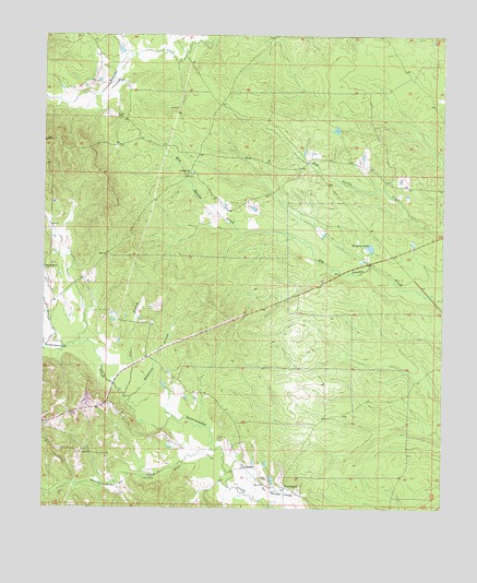
Townsend, MS USGS Topographic Map
Click on map above to begin viewing in our Map Viewer.

This topographic map contains these locations and features:
Feature Name Type Latitude Longitude GNIS ID View Map
Antioch (historical)Populated PlaceN32.8382°W88.5800°707929View Map
Antioch Baptist ChurchChurchN32.8387°W88.5803°666314View Map
Antioch CemeteryCemeteryN32.8387°W88.5784°707930View Map
Antioch School (historical)SchoolN32.8390°W88.5789°707931View Map
CartersPopulated PlaceN32.7610°W88.5620°691753View Map
Cherry CemeteryCemeteryN32.7579°W88.5545°668364View Map
East Abeika (historical)Populated PlaceN32.7960°W88.6223°707956View Map
Felton CemeteryCemeteryN32.8535°W88.6031°669944View Map
Hamilton BranchStreamN32.7793°W88.5978°670858View Map
Hoppers LakeReservoirN32.8191°W88.5227°671453View Map
Hoppers Lake DamDamN32.8168°W88.5217°681671View Map
Pole BranchStreamN32.7799°W88.5995°676174View Map
Snoody CreekStreamN32.7654°W88.5725°691615View Map
Spinks Pond DamDamN32.8235°W88.5384°681677View Map
Stonewall ChurchChurchN32.8137°W88.6248°678316View Map
Straight CreekStreamN32.7957°W88.6212°678330View Map
TownsendPopulated PlaceN32.7554°W88.5489°692274View Map

Note: Coordinates in the location and feature list above are referenced to NAD83 datum.


Copyright (C) 2008-2024 Ryan Niemi / Sunset Dynamics ... All Rights Reserved