TopoQuest Logo
Do you find TopoQuest useful?
Help keep TopoQuest running and adding new maps/features by donating!
Bitcoin:  19c7KJd3qBynnjoSw5npx9KScwjBe4ifkT
Litecoin:  LXs6TkuXGGXo1vDsWCkWVdjQX94eUKd6ui
Home View Maps Find Maps Find Places Resources & Links


Oakman, Alabama Topographic Map

USGS Map Title: Oakman, AL
USGS Map MRC: 33087F4
DRG (GeoTIFF) Download: o33087f4.tif


Neighboring USGS Topographic Map Quads:


  Howard, AL  
33087G5
 

  Townley, AL  
33087G4
 

  Jasper, AL  
33087G3
 

  Berry, AL  
33087F5
 

  Oakman, AL  
33087F4
 

  Parrish, AL  
33087F3
 

  Berry SE, AL  
33087E5
 

  Wiley, AL  
33087E4
 

  Tutwiler School, AL  
33087E3


Map MRC Location:

N34°
W88°
N34°
W87°
H8 H7 H6 H5 H4 H3 H2 H1
G8 G7 G6 G5 G4 G3 G2 G1
F8 F7 F6 F5 F4 F3 F2 F1
E8 E7 E6 E5 E4 E3 E2 E1
D8 D7 D6 D5 D4 D3 D2 D1
C8 C7 C6 C5 C4 C3 C2 C1
B8 B7 B6 B5 B4 B3 B2 B1
A8 A7 A6 A5 A4 A3 A2 A1
N33°
W88°
N33°
W87°

Oakman, AL USGS 1:24K Topographic Map Preview:
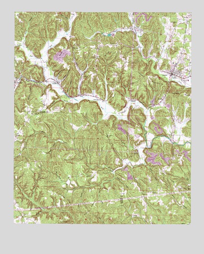
Oakman, AL USGS Topographic Map
Click on map above to begin viewing in our Map Viewer.

This topographic map contains these locations and features:
Feature Name Type Latitude Longitude GNIS ID View Map
Bee Spring BranchStreamN33.6454°W87.4614°113804View Map
BethelPopulated PlaceN33.6432°W87.4000°142275View Map
Bethel ChurchChurchN33.6434°W87.4092°114065View Map
Big Jim HollowValleyN33.6479°W87.4381°114293View Map
Birmingham HollowValleyN33.7112°W87.4703°114373View Map
Biscuit MountainSummitN33.6679°W87.4136°114377View Map
Black BranchStreamN33.7376°W87.4150°114406View Map
Blue Water CreekStreamN33.6712°W87.4064°114597View Map
Brown HollowValleyN33.7448°W87.4617°114994View Map
Cave Number 7 Drift MineMineN33.7279°W87.4028°135906View Map
Central Baptist ChurchChurchN33.7143°W87.3894°141095View Map
Church HollowValleyN33.7171°W87.4600°116152View Map
Church of God of ProphecyChurchN33.7201°W87.3844°142303View Map
Clayton ChurchChurchN33.6443°W87.4042°142304View Map
Clemments MountainSummitN33.7021°W87.3800°116249View Map
Coal ValleyPopulated PlaceN33.7401°W87.4181°116306View Map
Coal Valley Drift MineMineN33.7418°W87.4264°135914View Map
Coal Valley Number 1 MineMineN33.7348°W87.4056°135911View Map
Coal Valley Number 10 MineMineN33.7307°W87.4222°135913View Map
Coal Valley Number 11 MineMineN33.7432°W87.4403°135915View Map
Coalbed HollowValleyN33.6523°W87.4289°116309View Map
Coalbed HollowValleyN33.6734°W87.4703°116310View Map
CoronaPopulated PlaceN33.7084°W87.4695°116660View Map
Corona ChurchChurchN33.7104°W87.4703°163886View Map
Corona MineMineN33.7112°W87.4861°135920View Map
Corona Number 12 MineMineN33.7057°W87.4764°135921View Map
Corona Number 13 MineMineN33.7334°W87.4417°135916View Map
Corona Number 15 MineMineN33.7057°W87.4514°135918View Map
Cowcumber HillSummitN33.7426°W87.3872°116758View Map
Davis CemeteryCemeteryN33.7348°W87.4106°117114View Map
Day CemeteryCemeteryN33.7151°W87.3783°117149View Map
Days Gap Drift MineMineN33.7043°W87.3944°135900View Map
Deer Creek MineMineN33.7071°W87.4570°135919View Map
Dickey BranchStreamN33.6329°W87.4783°117271View Map
Dipping Vat HollowValleyN33.6593°W87.4158°117296View Map
Dividing RidgeRidgeN33.6379°W87.4631°117307View Map
EnoePopulated PlaceN33.6779°W87.3886°156317View Map
Enon ChurchChurchN33.6787°W87.3878°163892View Map
Enslen Drift MineMineN33.7432°W87.3861°135907View Map
Frost CemeteryCemeteryN33.7098°W87.4989°118731View Map
Frost CreekStreamN33.7079°W87.4775°118732View Map
Frost Drift MineMineN33.7196°W87.4042°135904View Map
Gaines HillSummitN33.7259°W87.4650°118780View Map
Gaslight MineMineN33.7265°W87.3889°135901View Map
Gibson HillSummitN33.6943°W87.4847°118928View Map
Gibson Hill CemeteryCemeteryN33.6898°W87.4861°143013View Map
Gibson Hill ChurchChurchN33.6893°W87.4864°118929View Map
Gibson Hill ChurchChurchN33.6848°W87.4839°158311View Map
Gibson Hill MineMineN33.6918°W87.4500°135923View Map
H D Collins FieldParkN33.7200°W87.3864°2357430View Map
Hamner HollowValleyN33.6615°W87.4083°119661View Map
Hayes CrossingPopulated PlaceN33.6984°W87.4386°156461View Map
Hayes HillSummitN33.7021°W87.4281°119890View Map
Infant Hill CemeteryCemeteryN33.7118°W87.4517°120679View Map
Jenkins BranchStreamN33.7298°W87.4945°120840View Map
Key CemeteryCemeteryN33.7204°W87.4222°121171View Map
Key HillPopulated PlaceN33.7189°W87.4228°142382View Map
Key Hill ChurchChurchN33.7198°W87.4217°163900View Map
Lick BranchStreamN33.6465°W87.4506°121583View Map
Little Blue Water CreekStreamN33.6559°W87.4297°121708View Map
Lockhart (historical)Populated PlaceN33.7090°W87.4806°157378View Map
Low GapGapN33.7279°W87.4592°122069View Map
MariettaPopulated PlaceN33.7007°W87.3939°122283View Map
Marietta MineMineN33.6973°W87.3889°135924View Map
Mary Emma MineMineN33.7334°W87.4069°135912View Map
Mount Olive ChurchChurchN33.7048°W87.4553°123317View Map
Mountain Valley (historical)Populated PlaceN33.7418°W87.3931°157379View Map
Mountain Valley MineMineN33.7473°W87.3958°135908View Map
New England HollowValleyN33.7134°W87.4528°123746View Map
New Hope CemeteryCemeteryN33.7473°W87.3753°142400View Map
New Hope Church of ChristChurchN33.7471°W87.3756°152642View Map
New Salem CemeteryCemeteryN33.6801°W87.4950°158498View Map
OakmanPopulated PlaceN33.7134°W87.3886°152754View Map
Oakman CemeteryCemeteryN33.7215°W87.3767°124158View Map
Oakman Church of ChristChurchN33.7162°W87.3878°142404View Map
Oakman Church of GodChurchN33.7123°W87.3856°141096View Map
Oakman Elementary SchoolSchoolN33.7204°W87.3875°157382View Map
Oakman First Baptist ChurchChurchN33.7143°W87.3872°141097View Map
Oakman High SchoolSchoolN33.7198°W87.3856°142405View Map
Oakman Methodist ChurchChurchN33.7154°W87.3881°157383View Map
Oakman MineMineN33.7182°W87.3917°135902View Map
Oakman Number 2 MineMineN33.7446°W87.3972°135909View Map
Oakman Police DepartmentBuildingN33.7136°W87.3879°2751875View Map
Oakman Post OfficePost OfficeN33.7138°W87.3900°166897View Map
Oakman Volunteer Fire DepartmentBuildingN33.7130°W87.3890°2683375View Map
Old Lebanon ChurchChurchN33.6768°W87.4350°124217View Map
PattonPopulated PlaceN33.7007°W87.4547°152855View Map
Patton Baptist ChurchChurchN33.7221°W87.4422°152532View Map
Patton HillSummitN33.7351°W87.4211°124498View Map
Patton Hill CemeteryCemeteryN33.7229°W87.4431°124499View Map
Patton Hill Fire TowerTowerN33.7304°W87.4317°164396View Map
Patton HollowValleyN33.7015°W87.4547°124500View Map
Patton Number 3 Slope MineMineN33.7182°W87.4417°135917View Map
Pendley CreekStreamN33.7173°W87.4795°124580View Map
Porter HollowValleyN33.7046°W87.4211°125182View Map
Propst MountainSummitN33.7132°W87.4114°125302View Map
Propst Mountain MineMineN33.7126°W87.4111°135903View Map
Red HillSummitN33.6451°W87.3767°125482View Map
Rocky BranchStreamN33.6973°W87.4550°125803View Map
SalemPopulated PlaceN33.6782°W87.4981°157008View Map
Salem ChurchChurchN33.6801°W87.4947°137771View Map
Shelton BranchStreamN33.7434°W87.4164°126683View Map
Stanford HollowValleyN33.7073°W87.4872°127306View Map
Stephenson CrossingPopulated PlaceN33.6987°W87.4161°157112View Map
Swindle CemeteryCemeteryN33.7284°W87.3967°127600View Map
Swindle HollowValleyN33.6696°W87.4131°127602View Map
Tank HollowValleyN33.7015°W87.4628°127661View Map
The BackboneRidgeN33.6259°W87.4642°127791View Map
Theron Wood MineMineN33.7196°W87.4069°135905View Map
Town of OakmanCivilN33.7141°W87.3890°2407028View Map
West CoronaPopulated PlaceN33.7087°W87.4983°157237View Map
West Corona MineMineN33.7084°W87.4958°135922View Map
Willie Mae MineMineN33.7334°W87.4056°135910View Map
Wolf Den HollowValleyN33.6387°W87.4864°129168View Map
Woods CemeteryCemeteryN33.6654°W87.3839°129205View Map

Note: Coordinates in the location and feature list above are referenced to NAD83 datum.


Copyright (C) 2008-2024 Ryan Niemi / Sunset Dynamics ... All Rights Reserved