TopoQuest Logo
Do you find TopoQuest useful?
Help keep TopoQuest running and adding new maps/features by donating!
Bitcoin:  19c7KJd3qBynnjoSw5npx9KScwjBe4ifkT
Litecoin:  LXs6TkuXGGXo1vDsWCkWVdjQX94eUKd6ui
Home View Maps Find Maps Find Places Resources & Links


Berry, Alabama Topographic Map

USGS Map Title: Berry, AL
USGS Map MRC: 33087F5
DRG (GeoTIFF) Download: o33087f5.tif


Neighboring USGS Topographic Map Quads:


  Hubbertville, AL  
33087G6
 

  Howard, AL  
33087G5
 

  Townley, AL  
33087G4
 

  Bankston, AL  
33087F6
 

  Berry, AL  
33087F5
 

  Oakman, AL  
33087F4
 

  New Lexington, AL  
33087E6
 

  Berry SE, AL  
33087E5
 

  Wiley, AL  
33087E4


Map MRC Location:

N34°
W88°
N34°
W87°
H8 H7 H6 H5 H4 H3 H2 H1
G8 G7 G6 G5 G4 G3 G2 G1
F8 F7 F6 F5 F4 F3 F2 F1
E8 E7 E6 E5 E4 E3 E2 E1
D8 D7 D6 D5 D4 D3 D2 D1
C8 C7 C6 C5 C4 C3 C2 C1
B8 B7 B6 B5 B4 B3 B2 B1
A8 A7 A6 A5 A4 A3 A2 A1
N33°
W88°
N33°
W87°

Berry, AL USGS 1:24K Topographic Map Preview:
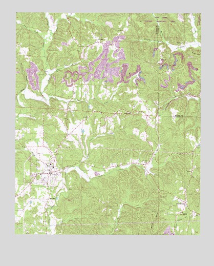
Berry, AL USGS Topographic Map
Click on map above to begin viewing in our Map Viewer.

This topographic map contains these locations and features:
Feature Name Type Latitude Longitude GNIS ID View Map
Alabama Christian College (historical)SchoolN33.6626°W87.5992°137683View Map
AltaPopulated PlaceN33.6709°W87.5317°155993View Map
Alta CemeteryCemeteryN33.6868°W87.5339°158499View Map
Alta ChurchChurchN33.6868°W87.5336°137684View Map
Arbor Springs Church (historical)ChurchN33.6307°W87.5983°147819View Map
Beaven CemeteryCemeteryN33.6937°W87.5581°158500View Map
Beaver CreekStreamN33.7354°W87.6058°113731View Map
BerryPopulated PlaceN33.6598°W87.6000°113954View Map
Berry Baptist ChurchChurchN33.6612°W87.6000°137691View Map
Berry Church of ChristChurchN33.6623°W87.5995°137692View Map
Berry City CemeteryCemeteryN33.6637°W87.5953°158502View Map
Berry DivisionCivilN33.6474°W87.6071°165775View Map
Berry Elementary SchoolSchoolN33.6646°W87.6011°137693View Map
Berry High SchoolSchoolN33.6632°W87.5992°137694View Map
Berry Methodist ChurchChurchN33.6623°W87.6008°137695View Map
Berry Police DepartmentBuildingN33.6601°W87.6003°2751746View Map
Berry Post OfficePost OfficeN33.6579°W87.6045°168898View Map
Berry Volunteer Fire DepartmentBuildingN33.6591°W87.6041°2682742View Map
Bethabara CemeteryCemeteryN33.6915°W87.5758°159016View Map
Bethabara ChurchChurchN33.6912°W87.5764°113984View Map
Bevans ChapelChurchN33.6932°W87.5583°158782View Map
Boley ChurchChurchN33.6543°W87.5072°158306View Map
Boley Spring School (historical)SchoolN33.6371°W87.5142°137703View Map
Boley SpringsPopulated PlaceN33.6432°W87.5100°114689View Map
Boley Springs CemeteryCemeteryN33.6373°W87.5128°143012View Map
Boley Springs ChurchChurchN33.6373°W87.5133°114690View Map
Boley Volunteer Fire DepartmentBuildingN33.6515°W87.5087°2683470View Map
Calvary ChurchChurchN33.6934°W87.6053°137705View Map
Cane CreekStreamN33.7026°W87.6061°115536View Map
Cedar Creek CemeteryCemeteryN33.6662°W87.5350°158807View Map
Corona Number 20 MineMineN33.7084°W87.5042°135925View Map
Erie CreekStreamN33.7332°W87.5028°118020View Map
Flat CreekStreamN33.6298°W87.6014°118376View Map
Fred Webster StadiumParkN33.6628°W87.5983°2352004View Map
Frost HillSummitN33.7259°W87.5014°118734View Map
George CreekStreamN33.7387°W87.6017°118902View Map
Jenkins CemeteryCemeteryN33.7151°W87.6056°120843View Map
Laney BranchStreamN33.7143°W87.6017°121378View Map
Little Cedar CreekStreamN33.6629°W87.5825°121732View Map
Madison CemeteryCemeteryN33.6407°W87.5639°158864View Map
Mount Joy ChurchChurchN33.6657°W87.5361°123232View Map
Nazarene Church of BerryChurchN33.6604°W87.5992°137750View Map
New Hope CemeteryCemeteryN33.7334°W87.5714°158501View Map
New Hope ChurchChurchN33.7337°W87.5708°137753View Map
Oak Grove School (historical)SchoolN33.6429°W87.5614°137757View Map
Old Salem ChurchChurchN33.6748°W87.5017°124246View Map
Panter CemeteryCemeteryN33.7318°W87.5825°124403View Map
Panter CemeteryCemeteryN33.7401°W87.5525°124404View Map
Pea RidgePopulated PlaceN33.7334°W87.5700°124523View Map
Pea Ridge Church of ChristChurchN33.7326°W87.5667°137760View Map
Pea Ridge Number 1 MineMineN33.7168°W87.5583°137761View Map
PendleyPopulated PlaceN33.7332°W87.5120°156869View Map
Pendley CemeteryCemeteryN33.7243°W87.5272°124579View Map
Pendley CemeteryCemeteryN33.6937°W87.5472°158317View Map
Pendley CemeteryCemeteryN33.7362°W87.5156°142414View Map
Pendley ChapelChurchN33.6937°W87.5475°158897View Map
Pilgrim ChapelChurchN33.6451°W87.6020°124726View Map
Pine BranchStreamN33.6640°W87.5322°124762View Map
Salem CemeteryCemeteryN33.6748°W87.5008°159017View Map
Star BranchStreamN33.7068°W87.6189°127314View Map
Tabernacle CemeteryCemeteryN33.6779°W87.5908°127621View Map
Tabernacle Church (historical)ChurchN33.6782°W87.5903°137778View Map
Thornton BranchStreamN33.7329°W87.5214°127927View Map
Town of BerryCivilN33.6623°W87.6079°2405250View Map

Note: Coordinates in the location and feature list above are referenced to NAD83 datum.


Copyright (C) 2008-2024 Ryan Niemi / Sunset Dynamics ... All Rights Reserved