TopoQuest Logo
Do you find TopoQuest useful?
Help keep TopoQuest running and adding new maps/features by donating!
Bitcoin:  19c7KJd3qBynnjoSw5npx9KScwjBe4ifkT
Litecoin:  LXs6TkuXGGXo1vDsWCkWVdjQX94eUKd6ui
Home View Maps Find Maps Find Places Resources & Links


Oconomowoc West, Wisconsin Topographic Map

USGS Map Title: Oconomowoc West, WI
USGS Map MRC: 43088A5
DRG (GeoTIFF) Download: o43088a5.tif


Neighboring USGS Topographic Map Quads:


  Watertown, WI  
43088B6
 

  Ixonia, WI  
43088B5
 

  Stonebank, WI  
43088B4
 

  Helenville, WI  
43088A6
 

  Oconomowoc West, WI  
43088A5
 

  Oconomowoc East, WI  
43088A4
 

  Rome, WI  
42088H6
 

  Palmyra, WI  
42088H5
 

  Eagle, WI  
42088H4


Map MRC Location:

N44°
W89°
N44°
W88°
H8 H7 H6 H5 H4 H3 H2 H1
G8 G7 G6 G5 G4 G3 G2 G1
F8 F7 F6 F5 F4 F3 F2 F1
E8 E7 E6 E5 E4 E3 E2 E1
D8 D7 D6 D5 D4 D3 D2 D1
C8 C7 C6 C5 C4 C3 C2 C1
B8 B7 B6 B5 B4 B3 B2 B1
A8 A7 A6 A5 A4 A3 A2 A1
N43°
W89°
N43°
W88°

Oconomowoc West, WI USGS 1:24K Topographic Map Preview:
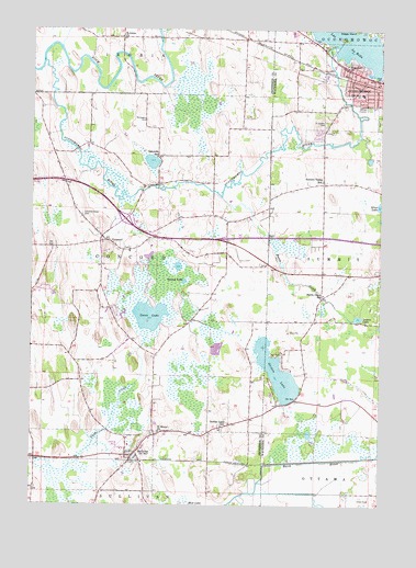
Oconomowoc West, WI USGS Topographic Map
Click on map above to begin viewing in our Map Viewer.

This topographic map contains these locations and features:
Feature Name Type Latitude Longitude GNIS ID View Map
Battle CreekStreamN43.0811°W88.5570°1561304View Map
Battle Creek AirportAirportN43.0677°W88.5089°1582117View Map
Battle Creek School (historical)SchoolN43.0553°W88.5201°1561306View Map
Blain Street ParkParkN43.1145°W88.5148°1850217View Map
Chaffee Road ParkParkN43.1153°W88.5165°1850239View Map
Champion FieldParkN43.1036°W88.5073°1850240View Map
ConcordPopulated PlaceN43.0694°W88.5987°1563308View Map
Concord Center CemeteryCemeteryN43.0759°W88.6068°1563310View Map
Concord Elementary SchoolSchoolN43.0667°W88.5898°1840353View Map
Concord Methodist Church CemeteryCemeteryN43.0676°W88.5898°2781319View Map
Concord United Methodist ChurchChurchN43.0672°W88.5901°1840354View Map
First Baptist ChurchChurchN43.1120°W88.5034°1850257View Map
First Congregational United Church of ChristChurchN43.1106°W88.5018°1850260View Map
First Methodist ChurchChurchN43.1117°W88.5018°1850261View Map
Golden LakePopulated PlaceN43.0338°W88.5366°2760398View Map
Golden LakeLakeN43.0350°W88.5367°1565608View Map
Golden Lake School (historical)SchoolN43.0208°W88.5562°1565610View Map
Goose LakeLakeN43.0497°W88.5825°1565649View Map
IslandaleIslandN43.1228°W88.5143°1850285View Map
Lakeside School (historical)SchoolN43.0914°W88.5804°1567786View Map
Laura LakeLakeN43.0493°W88.5082°1567878View Map
Lincoln Public School (historical)SchoolN43.1108°W88.5012°1850382View Map
McDermott Air ParkAirportN43.0064°W88.6022°1582229View Map
Mud LakeLakeN43.0627°W88.5726°2760356View Map
Mud LakeSwampN43.0008°W88.5693°1569989View Map
Newton CemeteryCemeteryN43.0029°W88.5843°2781328View Map
Norwegian CemeteryCemeteryN43.1013°W88.5845°1570552View Map
Oconomowoc Fire DepartmentBuildingN43.1096°W88.5086°2697480View Map
Oconomowoc Public LibraryBuildingN43.1106°W88.5032°1850308View Map
Oconomowoc RiverStreamN43.1161°W88.6209°1570740View Map
Oconomowoc Wastewater Treatment FacilityLocaleN43.1044°W88.5053°2354869View Map
Park Lawn Elementary SchoolSchoolN43.1081°W88.5067°1571043View Map
Roosevelt FieldParkN43.1039°W88.5009°1850323View Map
Round LakeLakeN43.0588°W88.5703°1572638View Map
Saint Jerome CemeteryCemeteryN43.1006°W88.5198°1572989View Map
Saint Johns ChurchChurchN43.1228°W88.5932°1573077View Map
Saint Marys ChurchChurchN43.0195°W88.5790°1573312View Map
Saint Matthew Lutheran SchoolSchoolN43.1159°W88.5125°1573356View Map
Saint Matthews Evangelical Lutheran ChurchChurchN43.1150°W88.5126°1850340View Map
Spacious AcresPopulated PlaceN43.0406°W88.5922°2508948View Map
SullivanPopulated PlaceN43.0128°W88.5882°1575043View Map
Sullivan Elementary SchoolSchoolN43.0160°W88.5900°2716589View Map
Sullivan Emergency Medical ServicesBuildingN43.0119°W88.5877°2698441View Map
Sullivan Volunteer Fire DepartmentBuildingN43.0119°W88.5885°2697767View Map
Sullivan Wastewater Treatment FacilityLocaleN43.0184°W88.5911°2729070View Map
Summit Valley School (historical)SchoolN43.0853°W88.5209°1575065View Map
Sybil LakeLakeN43.0469°W88.5001°2764660View Map
Town of ConcordCivilN43.0636°W88.5992°1583009View Map
Village of SullivanCivilN43.0119°W88.5903°1584245View Map
Webster - Holcomb CemeteryCemeteryN43.0661°W88.6247°2781333View Map

Note: Coordinates in the location and feature list above are referenced to NAD83 datum.


Copyright (C) 2008-2024 Ryan Niemi / Sunset Dynamics ... All Rights Reserved