TopoQuest Logo
Do you find TopoQuest useful?
Help keep TopoQuest running and adding new maps/features by donating!
Bitcoin:  19c7KJd3qBynnjoSw5npx9KScwjBe4ifkT
Litecoin:  LXs6TkuXGGXo1vDsWCkWVdjQX94eUKd6ui
Home View Maps Find Maps Find Places Resources & Links


Palmyra, Wisconsin Topographic Map

USGS Map Title: Palmyra, WI
USGS Map MRC: 42088H5
DRG (GeoTIFF) Download: o42088h5.tif


Neighboring USGS Topographic Map Quads:


  Helenville, WI  
43088A6
 

  Oconomowoc West, WI  
43088A5
 

  Oconomowoc East, WI  
43088A4
 

  Rome, WI  
42088H6
 

  Palmyra, WI  
42088H5
 

  Eagle, WI  
42088H4
 

  Whitewater, WI  
42088G6
 

  Little Prairie, WI  
42088G5
 

  East Troy, WI  
42088G4


Map MRC Location:

N43°
W89°
N43°
W88°
H8 H7 H6 H5 H4 H3 H2 H1
G8 G7 G6 G5 G4 G3 G2 G1
F8 F7 F6 F5 F4 F3 F2 F1
E8 E7 E6 E5 E4 E3 E2 E1
D8 D7 D6 D5 D4 D3 D2 D1
C8 C7 C6 C5 C4 C3 C2 C1
B8 B7 B6 B5 B4 B3 B2 B1
A8 A7 A6 A5 A4 A3 A2 A1
N42°
W89°
N42°
W88°

Palmyra, WI USGS 1:24K Topographic Map Preview:
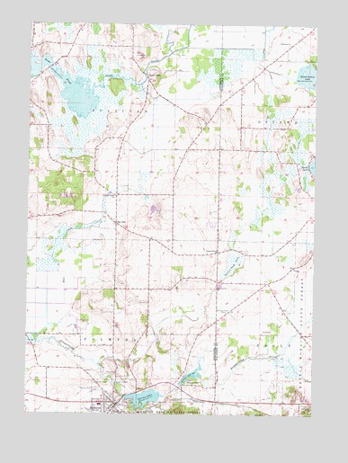
Palmyra, WI USGS Topographic Map
Click on map above to begin viewing in our Map Viewer.

This topographic map contains these locations and features:
Feature Name Type Latitude Longitude GNIS ID View Map
Beaver Dam LakeLakeN42.9239°W88.5345°1561459View Map
Carlin DamDamN42.8867°W88.5584°1792162View Map
Hardscrabble CemeteryCemeteryN42.9530°W88.5610°2781331View Map
Heath MillsPopulated PlaceN42.9839°W88.5743°1577634View Map
Melendys Prairie CemeteryCemeteryN42.9078°W88.5381°1569324View Map
Oak HillPopulated PlaceN42.9358°W88.5868°1570634View Map
PalmyraPopulated PlaceN42.8778°W88.5862°1571003View Map
Palmyra Elementary SchoolSchoolN42.8781°W88.5926°2716802View Map
Palmyra Fire and Rescue DepartmentBuildingN42.8794°W88.5855°2698017View Map
Palmyra Municipal AirportAirportN42.8829°W88.5976°1582139View Map
Palmyra Police DepartmentBuildingN42.8787°W88.5865°2759593View Map
Palmyra Wastewater Treatment PlantLocaleN42.8863°W88.5816°2729068View Map
Pleasant Valley ChurchChurchN42.9450°W88.5868°1571649View Map
Rome PondReservoirN42.9799°W88.6100°1572558View Map
Saint Brunos Catholic CemeteryCemeteryN42.9936°W88.5119°2096616View Map
Saint Brunos ChurchChurchN42.9936°W88.5112°1572877View Map
Saint Marys CemeteryCemeteryN42.8847°W88.5946°1573274View Map
Saint Theresa CemeteryCemeteryN42.8778°W88.5023°1573583View Map
School Section LakeReservoirN42.9839°W88.5036°1793606View Map
School Section Lake 2WP284 DamDamN42.9831°W88.5090°1793605View Map
Scuppernong Prairie State Natural AreaParkN42.9014°W88.5129°2054644View Map
Siloam ChapelChurchN42.9272°W88.5423°1574095View Map
Spring LakeReservoirN42.8806°W88.5820°1574684View Map
Spring Lake 38ReservoirN42.8802°W88.5731°1791941View Map
Spring Lake E18.2 DamDamN42.8806°W88.5820°1791940View Map
Town of PalmyraCivilN42.8871°W88.6014°1583891View Map
Town of SullivanCivilN42.9740°W88.6013°1584246View Map
Upper Spring LakeReservoirN42.8875°W88.5532°1575993View Map
Village of PalmyraCivilN42.8783°W88.5897°1583890View Map
Zion CemeteryCemeteryN42.9108°W88.5723°1577130View Map

Note: Coordinates in the location and feature list above are referenced to NAD83 datum.


Copyright (C) 2008-2025 Ryan Niemi / Sunset Dynamics ... All Rights Reserved