TopoQuest Logo
Do you find TopoQuest useful?
Help keep TopoQuest running and adding new maps/features by donating!
Bitcoin:  19c7KJd3qBynnjoSw5npx9KScwjBe4ifkT
Litecoin:  LXs6TkuXGGXo1vDsWCkWVdjQX94eUKd6ui
Home View Maps Find Maps Find Places Resources & Links


Old Glory Mountain, Oklahoma Topographic Map

USGS Map Title: Old Glory Mountain, OK
USGS Map MRC: 34094B7
DRG (GeoTIFF) Download: o34094b7.tif


Neighboring USGS Topographic Map Quads:


  Rocky Creek, OK  
34094C8
 

  Bethel, OK  
34094C7
 

  Hee Creek, OK  
34094C6
 

  Bear Mountain, OK  
34094B8
 

  Old Glory Mountain, OK  
34094B7
 

  Stephens Gap, OK  
34094B6
 

  Golden, OK  
34094A8
 

  Steel Junction, OK  
34094A7
 

  Broken Bow, OK  
34094A6


Map MRC Location:

N35°
W95°
N35°
W94°
H8 H7 H6 H5 H4 H3 H2 H1
G8 G7 G6 G5 G4 G3 G2 G1
F8 F7 F6 F5 F4 F3 F2 F1
E8 E7 E6 E5 E4 E3 E2 E1
D8 D7 D6 D5 D4 D3 D2 D1
C8 C7 C6 C5 C4 C3 C2 C1
B8 B7 B6 B5 B4 B3 B2 B1
A8 A7 A6 A5 A4 A3 A2 A1
N34°
W95°
N34°
W94°

Old Glory Mountain, OK USGS 1:24K Topographic Map Preview:
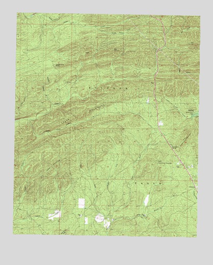
Old Glory Mountain, OK USGS Topographic Map
Click on map above to begin viewing in our Map Viewer.

This topographic map contains these locations and features:
Feature Name Type Latitude Longitude GNIS ID View Map
Briar BranchStreamN34.1326°W94.8088°1090477View Map
Brigham Young BranchStreamN34.1990°W94.8499°1090498View Map
Brigham Young SpringsSpringN34.2207°W94.8488°1090499View Map
Cedar MountainsRangeN34.1901°W94.8419°1091129View Map
East Fork Lukfata CreekStreamN34.1362°W94.8099°1092394View Map
East Government MountainSummitN34.1784°W94.7613°1092401View Map
East High PeakSummitN34.2345°W94.7541°1092406View Map
Government SpringSpringN34.1757°W94.7677°1777925View Map
Government SpringsSpringN34.1762°W94.7677°1093277View Map
HochatownPopulated PlaceN34.1523°W94.7527°1093810View Map
Hochatown CemeteryCemeteryN34.1542°W94.7511°2712255View Map
Hochatown Volunteer Fire DepartmentBuildingN34.1552°W94.7524°2657086View Map
KKBI-FM (Broken Bow)TowerN34.2459°W94.7830°1102238View Map
Middle Carter CreekStreamN34.2482°W94.8594°1095668View Map
Middle Fork Lukfata CreekStreamN34.1396°W94.8080°1095356View Map
Okmoname 089009 ReservoirReservoirN34.1318°W94.7502°1756115View Map
Oknoname 089009 DamDamN34.1318°W94.7502°1756114View Map
Old Glory MountainSummitN34.1609°W94.8530°1096238View Map
South Carter CreekStreamN34.2432°W94.8216°1098221View Map
South Cedar CreekStreamN34.1901°W94.8658°1098223View Map
West Fork Lukfata CreekStreamN34.1362°W94.8099°1099557View Map
West Government MountainSummitN34.1640°W94.7819°1099565View Map
West High PeakSummitN34.2298°W94.8105°1099568View Map

Note: Coordinates in the location and feature list above are referenced to NAD83 datum.


Copyright (C) 2008-2025 Ryan Niemi / Sunset Dynamics ... All Rights Reserved