TopoQuest Logo
Do you find TopoQuest useful?
Help keep TopoQuest running and adding new maps/features by donating!
Bitcoin:  19c7KJd3qBynnjoSw5npx9KScwjBe4ifkT
Litecoin:  LXs6TkuXGGXo1vDsWCkWVdjQX94eUKd6ui
Home View Maps Find Maps Find Places Resources & Links


Steel Junction, Oklahoma Topographic Map

USGS Map Title: Steel Junction, OK
USGS Map MRC: 34094A7
DRG (GeoTIFF) Download: o34094a7.tif


Neighboring USGS Topographic Map Quads:


  Bear Mountain, OK  
34094B8
 

  Old Glory Mountain, OK  
34094B7
 

  Stephens Gap, OK  
34094B6
 

  Golden, OK  
34094A8
 

  Steel Junction, OK  
34094A7
 

  Broken Bow, OK  
34094A6
 

  Garvin, OK  
33094H8
 

  Idabel, OK  
33094H7
 

  Shults, OK  
33094H6


Map MRC Location:

N35°
W95°
N35°
W94°
H8 H7 H6 H5 H4 H3 H2 H1
G8 G7 G6 G5 G4 G3 G2 G1
F8 F7 F6 F5 F4 F3 F2 F1
E8 E7 E6 E5 E4 E3 E2 E1
D8 D7 D6 D5 D4 D3 D2 D1
C8 C7 C6 C5 C4 C3 C2 C1
B8 B7 B6 B5 B4 B3 B2 B1
A8 A7 A6 A5 A4 A3 A2 A1
N34°
W95°
N34°
W94°

Steel Junction, OK USGS 1:24K Topographic Map Preview:
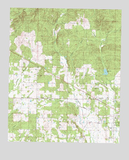
Steel Junction, OK USGS Topographic Map
Click on map above to begin viewing in our Map Viewer.

This topographic map contains these locations and features:
Feature Name Type Latitude Longitude GNIS ID View Map
Broken Bow AirportAirportN34.0139°W94.7573°1102384View Map
Broken Bow City DamDamN34.0784°W94.7536°1751947View Map
Broken Bow City LakeReservoirN34.0784°W94.7536°1751948View Map
Broken Bow City LakeReservoirN34.0634°W94.7636°1757704View Map
Broken Bow City Lake DamDamN34.0634°W94.7636°1757703View Map
Broken Bow LakeLakeN34.0664°W94.7670°1777854View Map
Colbert ChapelChurchN34.0412°W94.7841°1777853View Map
Cumberland ChurchChurchN34.0407°W94.8316°1777855View Map
Hi-Way Assembly ChurchChurchN34.0226°W94.7508°1777851View Map
Long BranchStreamN34.0940°W94.7730°1094944View Map
Lukfata CemeteryCemeteryN34.0318°W94.7847°1095050View Map
Lukfata ChurchChurchN34.0187°W94.7741°1095051View Map
Lukfata Elementary SchoolSchoolN34.0194°W94.7838°1095052View Map
McCurtain CountyCivilN34.1153°W94.7713°1101835View Map
McCurtain County Fire Training CenterBuildingN34.0138°W94.7566°2657525View Map
McGee ChapelChurchN34.0046°W94.7599°1095233View Map
Oak HillPopulated PlaceN34.0409°W94.8358°1100684View Map
Steel JunctionPopulated PlaceN34.0407°W94.7755°1100854View Map
Stephens BranchStreamN34.0565°W94.8033°1098519View Map
Sweet Home CemeteryCemeteryN34.0528°W94.7785°1098686View Map
Tohwali CemeteryCemeteryN34.0416°W94.8533°2712260View Map
Tohwali United Methodist ChurchChurchN34.0412°W94.8533°1098951View Map
Watsons Memorial CemeteryCemeteryN34.0404°W94.8410°1777856View Map
Yasho CemeteryCemeteryN34.0409°W94.7655°2712264View Map
Yasho United Methodist ChurchChurchN34.0426°W94.7652°1777852View Map

Note: Coordinates in the location and feature list above are referenced to NAD83 datum.


Copyright (C) 2008-2025 Ryan Niemi / Sunset Dynamics ... All Rights Reserved