TopoQuest Logo
Do you find TopoQuest useful?
Help keep TopoQuest running and adding new maps/features by donating!
Bitcoin:  19c7KJd3qBynnjoSw5npx9KScwjBe4ifkT
Litecoin:  LXs6TkuXGGXo1vDsWCkWVdjQX94eUKd6ui
Home View Maps Find Maps Find Places Resources & Links


Old Kingston, Alabama Topographic Map

USGS Map Title: Old Kingston, AL
USGS Map MRC: 32086E5
DRG (GeoTIFF) Download: o32086e5.tif


Neighboring USGS Topographic Map Quads:


  Billingsley, AL  
32086F6
 

  White City, AL  
32086F5
 

  Marbury, AL  
32086F4
 

  Vida, AL  
32086E6
 

  Old Kingston, AL  
32086E5
 

  Deatsville, AL  
32086E4
 

  Autaugaville, AL  
32086D6
 

  Forester, AL  
32086D5
 

  Prattville, AL  
32086D4


Map MRC Location:

N33°
W87°
N33°
W86°
H8 H7 H6 H5 H4 H3 H2 H1
G8 G7 G6 G5 G4 G3 G2 G1
F8 F7 F6 F5 F4 F3 F2 F1
E8 E7 E6 E5 E4 E3 E2 E1
D8 D7 D6 D5 D4 D3 D2 D1
C8 C7 C6 C5 C4 C3 C2 C1
B8 B7 B6 B5 B4 B3 B2 B1
A8 A7 A6 A5 A4 A3 A2 A1
N32°
W87°
N32°
W86°

Old Kingston, AL USGS 1:24K Topographic Map Preview:
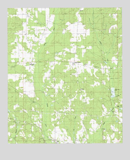
Old Kingston, AL USGS Topographic Map
Click on map above to begin viewing in our Map Viewer.

This topographic map contains these locations and features:
Feature Name Type Latitude Longitude GNIS ID View Map
Beaver CreekStreamN32.5704°W86.5119°147524View Map
BoothPopulated PlaceN32.5004°W86.5719°114739View Map
Booth Volunteer Fire DepartmentBuildingN32.5034°W86.5711°2691555View Map
Bridge Creek Fishing Club DamDamN32.5435°W86.5100°130677View Map
Bridge Creek LakeReservoirN32.5468°W86.5104°114902View Map
Brown Town ChurchChurchN32.6082°W86.5814°115001View Map
BrowntownPopulated PlaceN32.6112°W86.5911°147535View Map
Camp Tukabatchee LakeReservoirN32.5744°W86.5180°130710View Map
Camp Tukabatchee Lake DamDamN32.5735°W86.5166°130709View Map
Fox CreekStreamN32.6221°W86.5700°118581View Map
Friendship ChurchChurchN32.5312°W86.5416°147563View Map
Gibbons (historical)Populated PlaceN32.5390°W86.5972°167094View Map
Kingston ChurchChurchN32.6110°W86.5480°121239View Map
Little Bridge RunStreamN32.5324°W86.5097°121718View Map
Locust Bluff SchoolSchoolN32.5149°W86.5897°121953View Map
Locust Bluff United Methodist ChurchChurchN32.5107°W86.5853°154278View Map
Lucas CemeteryCemeteryN32.5024°W86.5500°147586View Map
Mount SinaiPopulated PlaceN32.5493°W86.5450°158029View Map
Mount Sinai Baptist ChurchChurchN32.5501°W86.5444°154281View Map
Mount Zion United Methodist ChurchChurchN32.5168°W86.6133°152525View Map
New Mount Zion ChurchChurchN32.5151°W86.6086°123873View Map
O'Dell Lake DamDamN32.5335°W86.5033°130666View Map
Oak GrovePopulated PlaceN32.6224°W86.5455°156814View Map
Old KingstonPopulated PlaceN32.5737°W86.6008°152781View Map
Old Kingston CemeteryCemeteryN32.5687°W86.6000°147605View Map
Old Kingston ChurchChurchN32.5737°W86.5966°147606View Map
Old Kingston ChurchChurchN32.5976°W86.6047°124216View Map
Old Kingston Volunteer Fire DepartmentBuildingN32.5730°W86.6091°2691095View Map
Pleasant Hill Baptist ChurchChurchN32.5176°W86.5003°152993View Map
Pleasant Hill ChurchChurchN32.5999°W86.6016°137286View Map
Poseys CrossroadsPopulated PlaceN32.5735°W86.5519°153052View Map
R M Pendergrass DamDamN32.5285°W86.6216°130659View Map
Stewart CemeteryCemeteryN32.5898°W86.5983°147653View Map
Tukabatchee CampLocaleN32.5768°W86.5203°153734View Map
Turnback CreekStreamN32.5432°W86.5078°128184View Map
Whirleys PondReservoirN32.5535°W86.5852°147671View Map
Whitewater CampLocaleN32.5218°W86.6133°147673View Map
Whitewater ChurchChurchN32.5221°W86.6136°128920View Map
Wilsons CemeteryCemeteryN32.6115°W86.5561°147676View Map

Note: Coordinates in the location and feature list above are referenced to NAD83 datum.


Copyright (C) 2008-2024 Ryan Niemi / Sunset Dynamics ... All Rights Reserved