TopoQuest Logo
Do you find TopoQuest useful?
Help keep TopoQuest running and adding new maps/features by donating!
Bitcoin:  19c7KJd3qBynnjoSw5npx9KScwjBe4ifkT
Litecoin:  LXs6TkuXGGXo1vDsWCkWVdjQX94eUKd6ui
Home View Maps Find Maps Find Places Resources & Links


Deatsville, Alabama Topographic Map

USGS Map Title: Deatsville, AL
USGS Map MRC: 32086E4
DRG (GeoTIFF) Download: o32086e4.tif


Neighboring USGS Topographic Map Quads:


  White City, AL  
32086F5
 

  Marbury, AL  
32086F4
 

  Holtville, AL  
32086F3
 

  Old Kingston, AL  
32086E5
 

  Deatsville, AL  
32086E4
 

  Elmore, AL  
32086E3
 

  Forester, AL  
32086D5
 

  Prattville, AL  
32086D4
 

  Montgomery North, AL  
32086D3


Map MRC Location:

N33°
W87°
N33°
W86°
H8 H7 H6 H5 H4 H3 H2 H1
G8 G7 G6 G5 G4 G3 G2 G1
F8 F7 F6 F5 F4 F3 F2 F1
E8 E7 E6 E5 E4 E3 E2 E1
D8 D7 D6 D5 D4 D3 D2 D1
C8 C7 C6 C5 C4 C3 C2 C1
B8 B7 B6 B5 B4 B3 B2 B1
A8 A7 A6 A5 A4 A3 A2 A1
N32°
W87°
N32°
W86°

Deatsville, AL USGS 1:24K Topographic Map Preview:
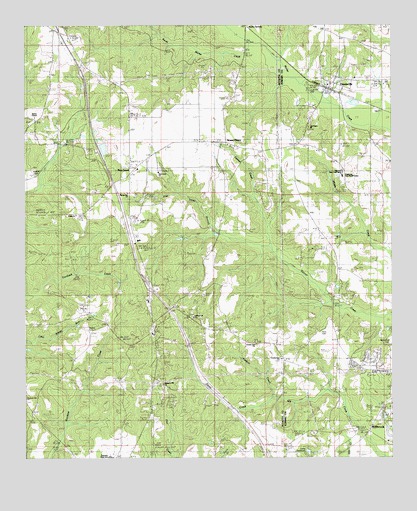
Deatsville, AL USGS Topographic Map
Click on map above to begin viewing in our Map Viewer.

This topographic map contains these locations and features:
Feature Name Type Latitude Longitude GNIS ID View Map
Alpha SpringsLocaleN32.6249°W86.4239°155992View Map
Andrew (historical)Populated PlaceN32.5685°W86.4641°147513View Map
Boones Chapel Baptist ChurchChurchN32.5982°W86.4975°151694View Map
Camp MontaugaLocaleN32.5218°W86.4980°147539View Map
Circle A Ranch DamDamN32.5885°W86.4716°130739View Map
Circle A Ranch LakeReservoirN32.5895°W86.4731°130740View Map
County Line CemeteryCemeteryN32.5285°W86.4127°1805676View Map
County Line ChurchChurchN32.5326°W86.4216°116728View Map
County Line ChurchChurchN32.5404°W86.4441°116729View Map
County Line ChurchChurchN32.5282°W86.4136°116734View Map
DeatsvillePopulated PlaceN32.6082°W86.3958°155049View Map
Deatsville ChurchChurchN32.6090°W86.3989°137179View Map
Deatsville Elementary School (historical)SchoolN32.6099°W86.3875°149288View Map
Deatsville Fire DepartmentBuildingN32.6095°W86.3864°2691273View Map
Deatsville Post OfficePost OfficeN32.6084°W86.3963°168501View Map
Faith ChurchChurchN32.5704°W86.4825°147555View Map
Franklee Correctional Youth CenterBuildingN32.5807°W86.3916°137204View Map
Grandview PinesPopulated PlaceN32.5329°W86.3850°137211View Map
Holland CemeteryCemeteryN32.5818°W86.4964°1730553View Map
Hudson CreekStreamN32.5168°W86.4158°120511View Map
Ingram State Technical InstituteSchoolN32.5835°W86.3922°137229View Map
Interchange 186CrossingN32.5496°W86.4578°155588View Map
Kenner CreekStreamN32.5399°W86.3775°151950View Map
KnollwoodPopulated PlaceN32.5118°W86.3755°137242View Map
Liberty Baptist ChurchChurchN32.6132°W86.4805°152052View Map
Lily Green ChurchChurchN32.5954°W86.4033°137247View Map
Maranatha ChurchChurchN32.5765°W86.4650°154280View Map
McKeithen CemeteryCemeteryN32.5321°W86.3758°1730575View Map
Millbrook Fire Department Station 3BuildingN32.5527°W86.3932°2691367View Map
New Nazareth ChurchChurchN32.6087°W86.3903°137274View Map
Owens CemeteryCemeteryN32.5365°W86.4797°124343View Map
Pierce CreekStreamN32.5171°W86.4158°124708View Map
Pine Haven SchoolSchoolN32.5190°W86.3761°137288View Map
Pine LevelPopulated PlaceN32.5837°W86.4655°124826View Map
Pine Level BranchStreamN32.5646°W86.4344°124827View Map
Pine Level CemeteryCemeteryN32.5829°W86.4539°1730554View Map
Pine Level Census Designated PlaceCensusN32.5797°W86.4529°2582694View Map
Pine Level Methodist ChurchChurchN32.5826°W86.4541°154282View Map
Pine Level Volunteer Fire DepartmentBuildingN32.5836°W86.4631°2691207View Map
Pink Lily Baptist ChurchChurchN32.5437°W86.4814°124899View Map
Pleasant Hill African Methodist Episcopal ChurchChurchN32.5210°W86.4539°152994View Map
Pleasant Hill CemeteryCemeteryN32.5224°W86.4558°147616View Map
Prattville Country ClubLocaleN32.6176°W86.4936°147627View Map
Prattville High SchoolSchoolN32.5010°W86.4705°147630View Map
Robinson SpringsPopulated PlaceN32.5118°W86.3766°125737View Map
Robinson Springs United Methodist ChurchChurchN32.5140°W86.3761°1959589View Map
Ross CemeteryCemeteryN32.5360°W86.3997°1730576View Map
Shady AcresPopulated PlaceN32.5065°W86.3753°137318View Map
South Mortar CreekStreamN32.6168°W86.4197°127130View Map
Stoney PointPopulated PlaceN32.5910°W86.4322°153582View Map
Stoney Point CemeteryCemeteryN32.5904°W86.4300°1805685View Map
Tatum CemeteryCemeteryN32.6048°W86.4672°147661View Map
Town of DeatsvilleCivilN32.5865°W86.3916°2406364View Map
Tuskpoka (historical)LocaleN32.6012°W86.3994°137342View Map
White School (historical)SchoolN32.5701°W86.4847°147670View Map

Note: Coordinates in the location and feature list above are referenced to NAD83 datum.


Copyright (C) 2008-2024 Ryan Niemi / Sunset Dynamics ... All Rights Reserved