TopoQuest Logo
Do you find TopoQuest useful?
Help keep TopoQuest running and adding new maps/features by donating!
Bitcoin:  19c7KJd3qBynnjoSw5npx9KScwjBe4ifkT
Litecoin:  LXs6TkuXGGXo1vDsWCkWVdjQX94eUKd6ui
Home View Maps Find Maps Find Places Resources & Links


Omega, Indiana Topographic Map

USGS Map Title: Omega, IN
USGS Map MRC: 40085B8
DRG (GeoTIFF) Download: o40085b8.tif


Neighboring USGS Topographic Map Quads:


  Tipton, IN  
40086C1
 

  Windfall, IN  
40085C8
 

  Elwood, IN  
40085C7
 

  Arcadia, IN  
40086B1
 

  Omega, IN  
40085B8
 

  Frankton, IN  
40085B7
 

  Noblesville, IN  
40086A1
 

  Riverwood, IN  
40085A8
 

  Lapel, IN  
40085A7


Map MRC Location:

N41°
W86°
N41°
W85°
H8 H7 H6 H5 H4 H3 H2 H1
G8 G7 G6 G5 G4 G3 G2 G1
F8 F7 F6 F5 F4 F3 F2 F1
E8 E7 E6 E5 E4 E3 E2 E1
D8 D7 D6 D5 D4 D3 D2 D1
C8 C7 C6 C5 C4 C3 C2 C1
B8 B7 B6 B5 B4 B3 B2 B1
A8 A7 A6 A5 A4 A3 A2 A1
N40°
W86°
N40°
W85°

Omega, IN USGS 1:24K Topographic Map Preview:
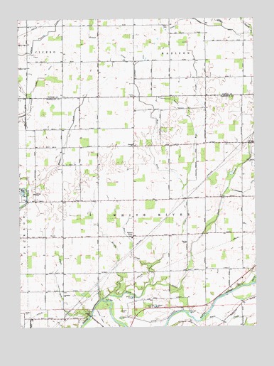
Omega, IN USGS Topographic Map
Click on map above to begin viewing in our Map Viewer.

This topographic map contains these locations and features:
Feature Name Type Latitude Longitude GNIS ID View Map
Bear CreekStreamN40.1498°W85.9316°430619View Map
Bethlehem ChurchChurchN40.1378°W85.9769°430983View Map
Buscher CemeteryCemeteryN40.1618°W85.9805°431886View Map
Carey CemeteryCemeteryN40.1332°W85.9298°432129View Map
Cruzan FieldAirportN40.1725°W85.9455°2677004View Map
Deer CreekStreamN40.1498°W85.9316°433423View Map
Duck CreekStreamN40.1364°W85.9566°433745View Map
Dyers CreekStreamN40.1273°W85.9039°433827View Map
Forkner DitchCanalN40.2120°W85.9964°434676View Map
Grubbs CemeteryCemeteryN40.1314°W85.9464°435538View Map
Harveys ChapelChurchN40.1592°W85.9114°435854View Map
Hobbs CemeteryCemeteryN40.2473°W85.9200°436260View Map
Hobbs CemeteryCemeteryN40.2188°W85.9387°436261View Map
Irion AirportAirportN40.1306°W85.9196°2677079View Map
Kaufman DitchCanalN40.2314°W85.9383°437177View Map
Long BranchStreamN40.1381°W85.9503°438248View Map
Morley CemeteryCemeteryN40.1312°W85.9976°439440View Map
Myerly Hobbs DitchCanalN40.2470°W85.8975°439912View Map
Newland CemeteryCemeteryN40.1417°W85.8854°440142View Map
OmegaPopulated PlaceN40.1984°W85.9391°440661View Map
Pipe CreekStreamN40.1425°W85.8764°441182View Map
Rogers DitchCanalN40.2117°W85.9119°442252View Map
Sloan DitchCanalN40.2267°W85.9853°443615View Map
Sugar RunStreamN40.1295°W85.9630°444359View Map
Township of White RiverCivilN40.1608°W85.9294°454054View Map
Walnut GrovePopulated PlaceN40.1620°W85.9397°445421View Map
Ward AirportAirportN40.1653°W85.9403°2677005View Map
Weasel CreekStreamN40.1811°W85.9961°445591View Map
West Fork Bear CreekStreamN40.1820°W85.9125°445740View Map

Note: Coordinates in the location and feature list above are referenced to NAD83 datum.


Copyright (C) 2008-2024 Ryan Niemi / Sunset Dynamics ... All Rights Reserved