TopoQuest Logo
Do you find TopoQuest useful?
Help keep TopoQuest running and adding new maps/features by donating!
Bitcoin:  19c7KJd3qBynnjoSw5npx9KScwjBe4ifkT
Litecoin:  LXs6TkuXGGXo1vDsWCkWVdjQX94eUKd6ui
Home View Maps Find Maps Find Places Resources & Links


Lapel, Indiana Topographic Map

USGS Map Title: Lapel, IN
USGS Map MRC: 40085A7
DRG (GeoTIFF) Download: o40085a7.tif


Neighboring USGS Topographic Map Quads:


  Omega, IN  
40085B8
 

  Frankton, IN  
40085B7
 

  Anderson North, IN  
40085B6
 

  Riverwood, IN  
40085A8
 

  Lapel, IN  
40085A7
 

  Anderson South, IN  
40085A6
 

  McCordsville, IN  
39085H8
 

  Ingalls, IN  
39085H7
 

  Pendleton, IN  
39085H6


Map MRC Location:

N41°
W86°
N41°
W85°
H8 H7 H6 H5 H4 H3 H2 H1
G8 G7 G6 G5 G4 G3 G2 G1
F8 F7 F6 F5 F4 F3 F2 F1
E8 E7 E6 E5 E4 E3 E2 E1
D8 D7 D6 D5 D4 D3 D2 D1
C8 C7 C6 C5 C4 C3 C2 C1
B8 B7 B6 B5 B4 B3 B2 B1
A8 A7 A6 A5 A4 A3 A2 A1
N40°
W86°
N40°
W85°

Lapel, IN USGS 1:24K Topographic Map Preview:
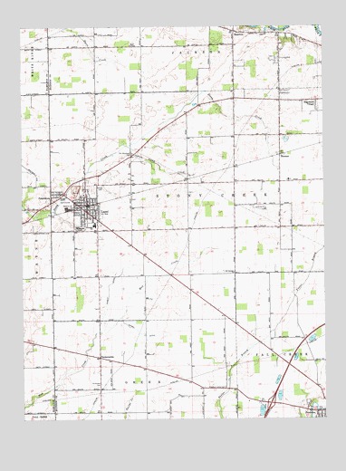
Lapel, IN USGS Topographic Map
Click on map above to begin viewing in our Map Viewer.

This topographic map contains these locations and features:
Feature Name Type Latitude Longitude GNIS ID View Map
Beall ChapelChurchN40.1189°W85.8297°430603View Map
BloomerPopulated PlaceN40.0839°W85.7680°431197View Map
Brookside CemeteryCemeteryN40.0608°W85.8509°431578View Map
Edgewood VillagePopulated PlaceN40.1014°W85.7530°434018View Map
FishersburgPopulated PlaceN40.0720°W85.8594°449656View Map
Foghorn Farms AirportAirportN40.0281°W85.7849°2676971View Map
HamiltonPopulated PlaceN40.1231°W85.7850°435636View Map
HardscrabblePopulated PlaceN40.0198°W85.8433°435733View Map
Henry DitchCanalN40.0273°W85.8266°436034View Map
Indian Camp CreekStreamN40.0875°W85.8300°436731View Map
Kynett DitchCanalN40.0417°W85.8397°437486View Map
LapelPopulated PlaceN40.0684°W85.8483°437628View Map
Lapel Elementary and High SchoolSchoolN40.0612°W85.8450°447384View Map
Lapel Police DepartmentBuildingN40.0675°W85.8490°2758190View Map
Lapel Stony Creek Township Fire Station 70BuildingN40.0745°W85.8397°2625624View Map
Nicholson CemeteryCemeteryN40.0112°W85.8429°440161View Map
North Lakeland AirportAirportN40.0189°W85.7538°449300View Map
Old German ChurchChurchN40.0467°W85.7875°440563View Map
Old Woodward CemeteryCemeteryN40.0844°W85.8294°440623View Map
Pat Robinson Airport (historical)AirportN40.0415°W85.8638°2676958View Map
Pleasant Valley CemeteryCemeteryN40.0098°W85.7914°441322View Map
Town of LapelCivilN40.0335°W85.8407°2396708View Map
Town of PendletonCivilN40.0051°W85.7692°2396852View Map
Township of Stony CreekCivilN40.0702°W85.8086°453879View Map

Note: Coordinates in the location and feature list above are referenced to NAD83 datum.


Copyright (C) 2008-2025 Ryan Niemi / Sunset Dynamics ... All Rights Reserved