TopoQuest Logo
Do you find TopoQuest useful?
Help keep TopoQuest running and adding new maps/features by donating!
Bitcoin:  19c7KJd3qBynnjoSw5npx9KScwjBe4ifkT
Litecoin:  LXs6TkuXGGXo1vDsWCkWVdjQX94eUKd6ui
Home View Maps Find Maps Find Places Resources & Links


Benn Knob, North Carolina Topographic Map

USGS Map Title: Benn Knob, NC
USGS Map MRC: 35081E6
DRG (GeoTIFF) Download: o35081e6.tif


Neighboring USGS Topographic Map Quads:


  Glen Alpine, NC  
35081F7
 

  Morganton South, NC  
35081F6
 

  Valdese, NC  
35081F5
 

  Dysartsville, NC  
35081E7
 

  Benn Knob, NC  
35081E6
 

  Casar, NC  
35081E5
 

  Sunshine, NC  
35081D7
 

  Polkville, NC  
35081D6
 

  Lawndale, NC  
35081D5


Map MRC Location:

N36°
W82°
N36°
W81°
H8 H7 H6 H5 H4 H3 H2 H1
G8 G7 G6 G5 G4 G3 G2 G1
F8 F7 F6 F5 F4 F3 F2 F1
E8 E7 E6 E5 E4 E3 E2 E1
D8 D7 D6 D5 D4 D3 D2 D1
C8 C7 C6 C5 C4 C3 C2 C1
B8 B7 B6 B5 B4 B3 B2 B1
A8 A7 A6 A5 A4 A3 A2 A1
N35°
W82°
N35°
W81°

Benn Knob, NC USGS 1:24K Topographic Map Preview:
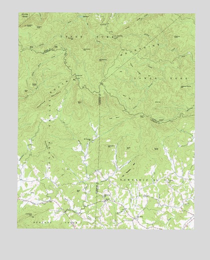
Benn Knob, NC USGS Topographic Map
Click on map above to begin viewing in our Map Viewer.

This topographic map contains these locations and features:
Feature Name Type Latitude Longitude GNIS ID View Map
Ball AlleyRidgeN35.5868°W81.7118°980490View Map
Beaverdam CreekStreamN35.5243°W81.7473°1019033View Map
Benn KnobSummitN35.5654°W81.6604°1019089View Map
Black MountainSummitN35.5735°W81.7082°1019198View Map
Brier CreekStreamN35.5104°W81.7090°981884View Map
Bumgarther MountainSummitN35.5976°W81.6934°982247View Map
Buzzard RoostSummitN35.6171°W81.7440°982357View Map
Camp KnobSummitN35.5468°W81.6537°1019494View Map
Casar Township 11 (historical)CivilN35.5271°W81.6251°1026570View Map
Chestnut KnobSummitN35.6118°W81.6398°983113View Map
Corinth ChurchChurchN35.5279°W81.6432°983558View Map
Cove MountainSummitN35.5796°W81.7454°1019812View Map
Covington MountainSummitN35.5479°W81.6868°1019814View Map
Cox CreekStreamN35.5121°W81.6401°983672View Map
Dogwood Stamp MountainSummitN35.5829°W81.6354°1020000View Map
Gibbs GapGapN35.5737°W81.6532°985658View Map
Grass RidgeRidgeN35.5926°W81.6682°985942View Map
He CreekStreamN35.6215°W81.7034°986559View Map
Hickory KnobSummitN35.6168°W81.7379°1020709View Map
Hickorynut MountainSummitN35.6040°W81.7051°1020720View Map
High PeakSummitN35.6051°W81.7245°1020749View Map
Horse RidgeRidgeN35.6185°W81.6693°987118View Map
Horse Ridge Lookout TowerTowerN35.6118°W81.6809°1023646View Map
Huckleberry MountainSummitN35.5493°W81.7307°1020857View Map
Lisenberry MountainSummitN35.5071°W81.7395°988523View Map
Morganton Watershed DamDamN35.6235°W81.7048°999174View Map
Morganton Watershed LakeReservoirN35.6235°W81.7048°999175View Map
Moriah SchoolSchoolN35.5165°W81.6879°990247View Map
Mount Moriah CemeteryCemeteryN35.5192°W81.6891°2779063View Map
Mount Moriah ChurchChurchN35.5193°W81.6887°990439View Map
Mount Pleasant ChurchChurchN35.5512°W81.6982°990535View Map
Mount Pleasant Church CemeteryCemeteryN35.5504°W81.6982°2779062View Map
Nettle BranchStreamN35.5926°W81.6487°990913View Map
New HomePopulated PlaceN35.5057°W81.6670°1001482View Map
New Home ChurchChurchN35.5065°W81.6657°990979View Map
No Business MountainSummitN35.5351°W81.6682°1021652View Map
Paine MountainSummitN35.5468°W81.6732°1021777View Map
Painter KnobSummitN35.5629°W81.6507°1021783View Map
Pheasant CreekStreamN35.5201°W81.7009°992113View Map
Pot BranchStreamN35.5426°W81.7020°992738View Map
Printers KnobSummitN35.5562°W81.6582°1001485View Map
Rainbow MountainSummitN35.6101°W81.7109°992996View Map
Red SpurRidgeN35.5646°W81.6818°993134View Map
Rich MountainSummitN35.5768°W81.6726°1022268View Map
Richland Mountain RidgeRidgeN35.5757°W81.7287°993322View Map
Shinny CreekStreamN35.6004°W81.6357°994735View Map
Skull KnobSummitN35.6051°W81.7423°1022652View Map
South MountainsRangeN35.5957°W81.6957°995180View Map
South Mountains State ParkParkN35.6000°W81.6583°2374749View Map
Squire KnobSummitN35.5832°W81.7401°1022761View Map
Walnut GapGapN35.6185°W81.6879°996739View Map
West MountainSummitN35.5221°W81.7082°1023172View Map
Whiteside Mines (historical)LocaleN35.5293°W81.6265°1001498View Map
Woods GapGapN35.5893°W81.7098°997610View Map

Note: Coordinates in the location and feature list above are referenced to NAD83 datum.


Copyright (C) 2008-2024 Ryan Niemi / Sunset Dynamics ... All Rights Reserved