TopoQuest Logo
Do you find TopoQuest useful?
Help keep TopoQuest running and adding new maps/features by donating!
Bitcoin:  19c7KJd3qBynnjoSw5npx9KScwjBe4ifkT
Litecoin:  LXs6TkuXGGXo1vDsWCkWVdjQX94eUKd6ui
Home View Maps Find Maps Find Places Resources & Links


Lawndale, North Carolina Topographic Map

USGS Map Title: Lawndale, NC
USGS Map MRC: 35081D5
DRG (GeoTIFF) Download: o35081d5.tif


Neighboring USGS Topographic Map Quads:


  Benn Knob, NC  
35081E6
 

  Casar, NC  
35081E5
 

  Banoak, NC  
35081E4
 

  Polkville, NC  
35081D6
 

  Lawndale, NC  
35081D5
 

  Cherryville, NC  
35081D4
 

  Boiling Springs North, NC  
35081C6
 

  Shelby, NC  
35081C5
 

  Waco, NC  
35081C4


Map MRC Location:

N36°
W82°
N36°
W81°
H8 H7 H6 H5 H4 H3 H2 H1
G8 G7 G6 G5 G4 G3 G2 G1
F8 F7 F6 F5 F4 F3 F2 F1
E8 E7 E6 E5 E4 E3 E2 E1
D8 D7 D6 D5 D4 D3 D2 D1
C8 C7 C6 C5 C4 C3 C2 C1
B8 B7 B6 B5 B4 B3 B2 B1
A8 A7 A6 A5 A4 A3 A2 A1
N35°
W82°
N35°
W81°

Lawndale, NC USGS 1:24K Topographic Map Preview:
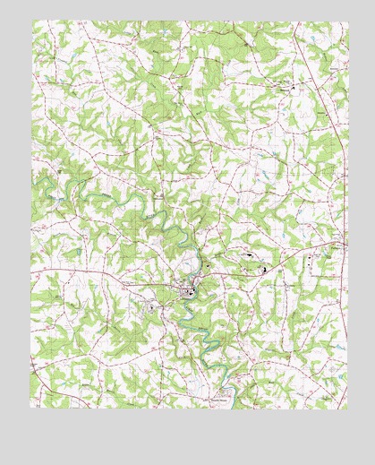
Lawndale, NC USGS Topographic Map
Click on map above to begin viewing in our Map Viewer.

This topographic map contains these locations and features:
Feature Name Type Latitude Longitude GNIS ID View Map
Adams BranchStreamN35.4932°W81.5398°980036View Map
BelwoodPopulated PlaceN35.4771°W81.5234°1023821View Map
Belwood High SchoolSchoolN35.4790°W81.5212°980976View Map
Burns High SchoolSchoolN35.4201°W81.5329°1001014View Map
Burns Junior High SchoolSchoolN35.4251°W81.5390°1001015View Map
CampcallPopulated PlaceN35.3824°W81.6184°1001530View Map
Central Cleveland SchoolSchoolN35.4076°W81.5770°1001083View Map
Cleveland County Emergency Medical Services Station 12BuildingN35.4794°W81.5200°2720493View Map
Crooked Run CreekStreamN35.4382°W81.5751°1023934View Map
Double ShoalsPopulated PlaceN35.3810°W81.5481°1020011View Map
Double Shoals Township 9 (historical)CivilN35.4276°W81.5415°1026568View Map
Douglas SchoolSchoolN35.4093°W81.5795°984308View Map
Eaker CemeteryCemeteryN35.4518°W81.6143°984474View Map
Elliotts Memorial ChurchChurchN35.4110°W81.6123°1001008View Map
FallstonPopulated PlaceN35.4290°W81.5015°1020213View Map
Fallston Community Volunteer Fire DepartmentBuildingN35.4250°W81.5007°2638972View Map
Fallston Post OfficePost OfficeN35.4290°W81.5022°2774266View Map
Flat Rock SchoolSchoolN35.4518°W81.5131°985187View Map
Friendship ChurchChurchN35.4307°W81.5034°1001012View Map
Gardners Ford (historical)LocaleN35.4157°W81.5606°1001551View Map
Grassy BranchStreamN35.4390°W81.5809°985946View Map
Kistlers ChurchChurchN35.4626°W81.5762°1024075View Map
Knob CreekStreamN35.4271°W81.5606°979993View Map
Knob Creek ChurchChurchN35.4799°W81.5265°1001017View Map
Knob Creek SchoolSchoolN35.4915°W81.5412°988046View Map
LawndalePopulated PlaceN35.4140°W81.5631°988220View Map
Lawndale Post OfficePost OfficeN35.4181°W81.5590°2774042View Map
Lawndale Volunteer Fire DepartmentBuildingN35.4130°W81.5644°2638286View Map
Ledford Grove ChurchChurchN35.3793°W81.5081°1001010View Map
Little Knob CreekStreamN35.4687°W81.5634°979996View Map
Magness CreekStreamN35.3893°W81.5473°1024127View Map
Maple CreekStreamN35.4240°W81.5584°1024129View Map
Mooney CemeteryCemeteryN35.4437°W81.5737°990169View Map
New Bethel ChurchChurchN35.4212°W81.5398°990929View Map
Normans Grove ChurchChurchN35.4804°W81.5229°1001016View Map
Oak Grove ChurchChurchN35.4329°W81.6212°991373View Map
Palm Tree ChurchChurchN35.4160°W81.5859°1024204View Map
Peelers SchoolSchoolN35.3857°W81.5412°992008View Map
Philadelphia ChurchChurchN35.4143°W81.5245°1001011View Map
Philadelphia SchoolSchoolN35.4151°W81.5237°992133View Map
Piedmont High SchoolSchoolN35.4218°W81.5545°992164View Map
Pine Grove ChurchChurchN35.4729°W81.5656°1001018View Map
Pleasant Hill ChurchChurchN35.4907°W81.5656°1024225View Map
RockdalePopulated PlaceN35.4826°W81.5079°993532View Map
Rose Hill CemeteryCemeteryN35.4257°W81.5123°1001013View Map
Ross PondLakeN35.4255°W81.5091°993724View Map
Saint Pauls ChurchChurchN35.4099°W81.5790°1001009View Map
Salem CemeteryCemeteryN35.4201°W81.5273°994157View Map
Shoal Rock CreekStreamN35.3776°W81.5443°1024299View Map
Shufords Fishing LakeReservoirN35.4285°W81.6231°998960View Map
Shufords Lake DamDamN35.4285°W81.6231°998961View Map
Stice Shoal DamDamN35.3951°W81.5531°998923View Map
Stice Shoal LakeReservoirN35.3951°W81.5531°998922View Map
Stoney Run CreekStreamN35.4487°W81.6062°995548View Map
Town of BelwoodCivilN35.4794°W81.5228°2405239View Map
Town of FallstonCivilN35.4289°W81.5023°2406489View Map
Town of LawndaleCivilN35.4143°W81.5628°2405993View Map
Union ChurchChurchN35.3882°W81.6218°996456View Map
Upper Cleveland Lifesaving and RescueBuildingN35.4159°W81.5753°2720367View Map
Vance Grove SchoolSchoolN35.4735°W81.5648°996580View Map
Warlick CemeteryCemeteryN35.4785°W81.5637°996792View Map

Note: Coordinates in the location and feature list above are referenced to NAD83 datum.


Copyright (C) 2008-2024 Ryan Niemi / Sunset Dynamics ... All Rights Reserved