TopoQuest Logo
Do you find TopoQuest useful?
Help keep TopoQuest running and adding new maps/features by donating!
Bitcoin:  19c7KJd3qBynnjoSw5npx9KScwjBe4ifkT
Litecoin:  LXs6TkuXGGXo1vDsWCkWVdjQX94eUKd6ui
Home View Maps Find Maps Find Places Resources & Links


Mount Hermon, Louisiana Topographic Map

USGS Map Title: Mount Hermon, LA
USGS Map MRC: 30090H3
DRG (GeoTIFF) Download: o30090h3.tif


Neighboring USGS Topographic Map Quads:


  Osyka, MS  
31090A4
 

  Progress, MS  
31090A3
 

  Tylertown, MS  
31090A2
 

  Spring Creek, LA  
30090H4
 

  Mount Hermon, LA  
30090H3
 

  Clifton, LA  
30090H2
 

  Chesbrough, LA  
30090G4
 

  Wilmer, LA  
30090G3
 

  Franklinton, LA  
30090G2


Map MRC Location:

N31°
W91°
N31°
W90°
H8 H7 H6 H5 H4 H3 H2 H1
G8 G7 G6 G5 G4 G3 G2 G1
F8 F7 F6 F5 F4 F3 F2 F1
E8 E7 E6 E5 E4 E3 E2 E1
D8 D7 D6 D5 D4 D3 D2 D1
C8 C7 C6 C5 C4 C3 C2 C1
B8 B7 B6 B5 B4 B3 B2 B1
A8 A7 A6 A5 A4 A3 A2 A1
N30°
W91°
N30°
W90°

Mount Hermon, LA USGS 1:24K Topographic Map Preview:
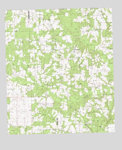
Mount Hermon, LA USGS Topographic Map
Click on map above to begin viewing in our Map Viewer.

This topographic map contains these locations and features:
Feature Name Type Latitude Longitude GNIS ID View Map
BaileyPopulated PlaceN30.8791°W90.3384°549638View Map
Banister CemeteryCemeteryN30.9541°W90.3106°532302View Map
Bladefield Church of God in ChristChurchN30.9788°W90.3629°554731View Map
Brock CemeteryCemeteryN30.9821°W90.2765°542053View Map
Butler CemeteryCemeteryN30.9674°W90.3565°542030View Map
Carter CemeteryCemeteryN30.9277°W90.2543°533793View Map
Connerley CemeteryCemeteryN30.9771°W90.2695°534084View Map
Deer Lick CreekStreamN30.9063°W90.2979°534470View Map
Dyson CemeteryCemeteryN30.9296°W90.3129°542065View Map
Jackson Store (historical)LocaleN30.9980°W90.3348°543996View Map
James ChapelChurchN30.8807°W90.2665°536000View Map
Maples CemeteryCemeteryN30.9443°W90.2615°536887View Map
McDaniel CemeteryCemeteryN30.8791°W90.3193°536978View Map
McElveen CemeteryCemeteryN30.9563°W90.3593°536989View Map
Midway ChurchChurchN30.9207°W90.2704°537070View Map
Miller CemeteryCemeteryN30.9516°W90.2848°537134View Map
Miller CemeteryCemeteryN30.9849°W90.2504°537135View Map
Mount HermonPopulated PlaceN30.9602°W90.2959°555392View Map
Mount Hermon CemeteryCemeteryN30.9741°W90.3170°537324View Map
Mount Hermon Post OfficePost OfficeN30.9613°W90.2953°1632393View Map
Mount Hermon SchoolSchoolN30.9570°W90.2953°543997View Map
Mount Hermon United Methodist ChurchChurchN30.9571°W90.2962°543998View Map
Mount Olive CemeteryCemeteryN30.9299°W90.3137°542081View Map
Mount Olive ChurchChurchN30.9285°W90.3120°537358View Map
New Zion Church (historical)ChurchN30.9555°W90.3176°543999View Map
Ott CemeteryCemeteryN30.9730°W90.3059°537904View Map
Parish Governing Authority District 11 (historical)CivilN30.9130°W90.2587°1929814View Map
Plainview ChurchChurchN30.8835°W90.2826°542084View Map
Pleasant Hill ChurchChurchN30.9124°W90.2840°538253View Map
Porters CurvePopulated PlaceN30.9591°W90.3170°555712View Map
Roberts CemeteryCemeteryN30.9438°W90.3479°538637View Map
Schilling CemeteryCemeteryN30.9246°W90.2748°539212View Map
Silver Creek CemeteryCemeteryN30.8988°W90.3459°539372View Map
Silver Creek ChurchChurchN30.8913°W90.3459°539373View Map
Simmons CemeteryCemeteryN30.9785°W90.2629°539384View Map
Simmons CemeteryCemeteryN30.9932°W90.2618°542088View Map
Simmons Pond DamDamN30.9902°W90.2684°556819View Map
Smith CemeteryCemeteryN30.9363°W90.3143°542092View Map
Snell BranchStreamN30.9771°W90.2920°539462View Map
Statham CemeteryCemeteryN30.9243°W90.2890°539642View Map
Stringfield CemeteryCemeteryN30.8891°W90.2509°539693View Map
Sunlight ChurchChurchN30.9893°W90.3229°539730View Map
Sunny HillPopulated PlaceN30.9243°W90.3273°556171View Map
Sunny Hill Baptist ChurchChurchN30.9241°W90.3262°559442View Map
Sunny Hill Lookout TowerTowerN30.8993°W90.2662°558830View Map
Tate CemeteryCemeteryN30.9155°W90.3295°539791View Map
Tate CemeteryCemeteryN30.9232°W90.3251°539792View Map
Union Chapel African Methodist Episcopal ChurchChurchN30.8913°W90.3459°556665View Map
Union ChurchChurchN30.9930°W90.2795°540090View Map
Varnado CemeteryCemeteryN30.9580°W90.3220°540141View Map
Vernon CemeteryCemeteryN30.8874°W90.2706°540150View Map
Vernon SchoolSchoolN30.8846°W90.2834°540151View Map
Ward TwoCivilN30.9577°W90.2762°545256View Map
Washington Parish Fire Protection District 9 Mount Herman StationBuildingN30.9513°W90.2924°2332349View Map
Wilson BranchStreamN30.9243°W90.3379°556449View Map

Note: Coordinates in the location and feature list above are referenced to NAD83 datum.


Copyright (C) 2008-2024 Ryan Niemi / Sunset Dynamics ... All Rights Reserved