TopoQuest Logo
Do you find TopoQuest useful?
Help keep TopoQuest running and adding new maps/features by donating!
Bitcoin:  19c7KJd3qBynnjoSw5npx9KScwjBe4ifkT
Litecoin:  LXs6TkuXGGXo1vDsWCkWVdjQX94eUKd6ui
Home View Maps Find Maps Find Places Resources & Links


Spring Creek, Louisiana Topographic Map

USGS Map Title: Spring Creek, LA
USGS Map MRC: 30090H4
DRG (GeoTIFF) Download: o30090h4.tif


Neighboring USGS Topographic Map Quads:


  Terrys Creek, MS  
31090A5
 

  Osyka, MS  
31090A4
 

  Progress, MS  
31090A3
 

  Kentwood, LA  
30090H5
 

  Spring Creek, LA  
30090H4
 

  Mount Hermon, LA  
30090H3
 

  Roseland, LA  
30090G5
 

  Chesbrough, LA  
30090G4
 

  Wilmer, LA  
30090G3


Map MRC Location:

N31°
W91°
N31°
W90°
H8 H7 H6 H5 H4 H3 H2 H1
G8 G7 G6 G5 G4 G3 G2 G1
F8 F7 F6 F5 F4 F3 F2 F1
E8 E7 E6 E5 E4 E3 E2 E1
D8 D7 D6 D5 D4 D3 D2 D1
C8 C7 C6 C5 C4 C3 C2 C1
B8 B7 B6 B5 B4 B3 B2 B1
A8 A7 A6 A5 A4 A3 A2 A1
N30°
W91°
N30°
W90°

Spring Creek, LA USGS 1:24K Topographic Map Preview:
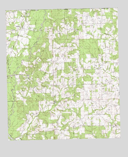
Spring Creek, LA USGS Topographic Map
Click on map above to begin viewing in our Map Viewer.

This topographic map contains these locations and features:
Feature Name Type Latitude Longitude GNIS ID View Map
Ashleys BranchStreamN30.9199°W90.4934°532235View Map
Bala Chitto CreekStreamN30.9982°W90.4545°666479View Map
Beaver CreekStreamN30.8780°W90.4962°560123View Map
Beulah ChurchChurchN30.8860°W90.3834°533000View Map
Booty CemeteryCemeteryN30.9232°W90.3937°533332View Map
Chubby BottomValleyN30.9802°W90.4690°533948View Map
Chubby CreekStreamN30.9635°W90.4723°533949View Map
Conerly CemeteryCemeteryN30.9430°W90.3965°542033View Map
Conerly CemeteryCemeteryN30.9452°W90.3973°542034View Map
Cool CreekStreamN30.9441°W90.4979°554073View Map
Cutrer CemeteryCemeteryN30.9505°W90.4623°542035View Map
Dean CemeteryCemeteryN30.9477°W90.3887°534438View Map
East Fork Baptist ChurchChurchN30.9777°W90.4398°554318View Map
First ChurchChurchN30.9346°W90.4762°542036View Map
German CemeteryCemeteryN30.9980°W90.4737°535205View Map
Gill CemeteryCemeteryN30.8816°W90.4398°535218View Map
Gill CemeteryCemeteryN30.9005°W90.4706°535219View Map
GreenlawPopulated PlaceN30.9843°W90.4848°554619View Map
Greenlaw Baptist ChurchChurchN30.9821°W90.4854°554620View Map
Greenlaw Oil FieldOilfieldN30.9807°W90.4723°549668View Map
Hagen SchoolSchoolN30.9371°W90.4757°542037View Map
Hope BranchStreamN30.9905°W90.4565°535780View Map
Irving BranchStreamN30.9518°W90.4765°554841View Map
Jeff McDaniel BranchStreamN30.9127°W90.4423°536011View Map
Kirkville (historical)Populated PlaceN30.9955°W90.4784°549695View Map
LewistonPopulated PlaceN30.9413°W90.4223°556664View Map
Lewiston Baptist ChurchChurchN30.9416°W90.4212°555032View Map
Louisiana Noname 117 DamDamN30.9268°W90.4201°556821View Map
Louisiana Noname 17 DamDamN30.9618°W90.4934°556820View Map
Masonic CemeteryCemeteryN30.9099°W90.4465°542041View Map
McDaniel CemeteryCemeteryN30.9113°W90.4331°542042View Map
Midway ChurchChurchN30.9443°W90.3998°537071View Map
Mixon CemeteryCemeteryN30.8813°W90.4801°537170View Map
Parish Governing Authority District 1CivilN30.8815°W90.4301°1929762View Map
Pierce CemeteryCemeteryN30.9027°W90.3879°538119View Map
Spring BranchStreamN30.9724°W90.4648°539571View Map
Spring CreekPopulated PlaceN30.9121°W90.4470°556115View Map
Spring CreekStreamN30.8766°W90.4920°539583View Map
Spring Creek Baptist ChurchChurchN30.9107°W90.4468°549754View Map
Spring Creek Elementary SchoolSchoolN30.9111°W90.4472°549755View Map
Terrys CreekStreamN30.9263°W90.4920°539829View Map
Ward TwoCivilN30.9374°W90.4120°545205View Map

Note: Coordinates in the location and feature list above are referenced to NAD83 datum.


Copyright (C) 2008-2024 Ryan Niemi / Sunset Dynamics ... All Rights Reserved