TopoQuest Logo
Do you find TopoQuest useful?
Help keep TopoQuest running and adding new maps/features by donating!
Bitcoin:  19c7KJd3qBynnjoSw5npx9KScwjBe4ifkT
Litecoin:  LXs6TkuXGGXo1vDsWCkWVdjQX94eUKd6ui
Home View Maps Find Maps Find Places Resources & Links


Benson, Illinois Topographic Map

USGS Map Title: Benson, IL
USGS Map MRC: 40089G1
DRG (GeoTIFF) Download: o40089g1.tif


Neighboring USGS Topographic Map Quads:


  La Rose, IL  
40089H2
 

  Minonk, IL  
40089H1
 

  Dana, IL  
40088H8
 

  Roanoke, IL  
40089G2
 

  Benson, IL  
40089G1
 

  Flanagan SW, IL  
40088G8
 

  Secor, IL  
40089F2
 

  El Paso, IL  
40089F1
 

  Gridley, IL  
40088F8


Map MRC Location:

N41°
W90°
N41°
W89°
H8 H7 H6 H5 H4 H3 H2 H1
G8 G7 G6 G5 G4 G3 G2 G1
F8 F7 F6 F5 F4 F3 F2 F1
E8 E7 E6 E5 E4 E3 E2 E1
D8 D7 D6 D5 D4 D3 D2 D1
C8 C7 C6 C5 C4 C3 C2 C1
B8 B7 B6 B5 B4 B3 B2 B1
A8 A7 A6 A5 A4 A3 A2 A1
N40°
W90°
N40°
W89°

Benson, IL USGS 1:24K Topographic Map Preview:
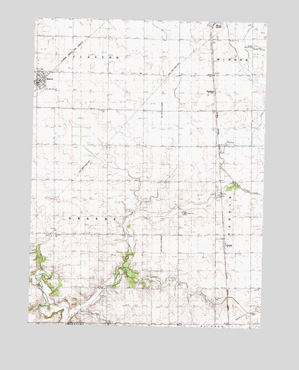
Benson, IL USGS Topographic Map
Click on map above to begin viewing in our Map Viewer.

This topographic map contains these locations and features:
Feature Name Type Latitude Longitude GNIS ID View Map
Barnstorm FieldAirportN40.7754°W89.0053°2679046View Map
BensonPopulated PlaceN40.8506°W89.1223°404183View Map
Benson Ambulance ServiceBuildingN40.8503°W89.1205°2674001View Map
Benson Baptist ChurchChurchN40.8517°W89.1209°2043889View Map
Benson Community Fire Protection DistrictBuildingN40.8505°W89.1205°2640738View Map
Benson Post OfficePost OfficeN40.8500°W89.1210°2788662View Map
Benson Water TowerReservoirN40.8503°W89.1198°1824254View Map
Carroll CemeteryCemeteryN40.7728°W89.1201°405638View Map
Clayton CemeteryCemeteryN40.8380°W89.0862°406194View Map
Corn Alley 2 AirportAirportN40.7550°W89.0148°2770517View Map
East Branch Panther CreekStreamN40.7731°W89.0759°407613View Map
Greene Township HallBuildingN40.7873°W89.1123°1801993View Map
Harper CemeteryCemeteryN40.7692°W89.0613°409823View Map
Janssen Airport (historical)AirportN40.8656°W89.0034°427545View Map
Little Panther CreekStreamN40.8061°W89.0162°2013508View Map
PanolaPopulated PlaceN40.7836°W89.0212°415345View Map
Roanoke-Benson Junior High SchoolSchoolN40.8492°W89.1242°1824288View Map
Saint John CemeteryCemeteryN40.8462°W89.1189°1802029View Map
Saint Johns Catholic ChurchChurchN40.8478°W89.1201°2043890View Map
Saint Marys CemeteryCemeteryN40.7611°W89.0256°417564View Map
Saint Paul Lutheran ChurchChurchN40.8523°W89.1198°2043891View Map
Spring Hill School (historical)SchoolN40.7875°W89.0759°418965View Map
Township of GreeneCivilN40.7945°W89.1022°429077View Map
Unzicker AirportAirportN40.8238°W89.1198°2679029View Map
Village of BensonCivilN40.8507°W89.1211°2398096View Map
Village of PanolaCivilN40.7828°W89.0203°2399620View Map
West Branch Panther CreekStreamN40.7511°W89.1056°420793View Map
WoodfordPopulated PlaceN40.8467°W89.0281°423331View Map

Note: Coordinates in the location and feature list above are referenced to NAD83 datum.


Copyright (C) 2008-2024 Ryan Niemi / Sunset Dynamics ... All Rights Reserved