TopoQuest Logo
Do you find TopoQuest useful?
Help keep TopoQuest running and adding new maps/features by donating!
Bitcoin:  19c7KJd3qBynnjoSw5npx9KScwjBe4ifkT
Litecoin:  LXs6TkuXGGXo1vDsWCkWVdjQX94eUKd6ui
Home View Maps Find Maps Find Places Resources & Links


Roanoke, Illinois Topographic Map

USGS Map Title: Roanoke, IL
USGS Map MRC: 40089G2
DRG (GeoTIFF) Download: o40089g2.tif


Neighboring USGS Topographic Map Quads:


  Washburn, IL  
40089H3
 

  La Rose, IL  
40089H2
 

  Minonk, IL  
40089H1
 

  Metamora, IL  
40089G3
 

  Roanoke, IL  
40089G2
 

  Benson, IL  
40089G1
 

  Eureka, IL  
40089F3
 

  Secor, IL  
40089F2
 

  El Paso, IL  
40089F1


Map MRC Location:

N41°
W90°
N41°
W89°
H8 H7 H6 H5 H4 H3 H2 H1
G8 G7 G6 G5 G4 G3 G2 G1
F8 F7 F6 F5 F4 F3 F2 F1
E8 E7 E6 E5 E4 E3 E2 E1
D8 D7 D6 D5 D4 D3 D2 D1
C8 C7 C6 C5 C4 C3 C2 C1
B8 B7 B6 B5 B4 B3 B2 B1
A8 A7 A6 A5 A4 A3 A2 A1
N40°
W90°
N40°
W89°

Roanoke, IL USGS 1:24K Topographic Map Preview:
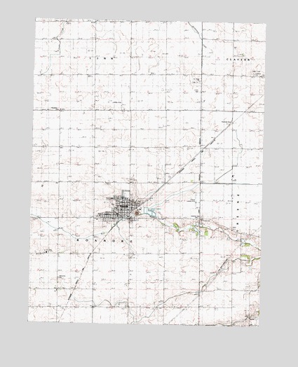
Roanoke, IL USGS Topographic Map
Click on map above to begin viewing in our Map Viewer.

This topographic map contains these locations and features:
Feature Name Type Latitude Longitude GNIS ID View Map
Apostolic Christian CemeteryCemeteryN40.7796°W89.2406°1953787View Map
Apostolic ChurchChurchN40.7786°W89.2412°403570View Map
Brethren ChurchChurchN40.7945°W89.1595°404818View Map
Church of the Brethern CemeteryCemeteryN40.7942°W89.1592°1953789View Map
Clayton Township CemeteryCemeteryN40.8539°W89.1311°1802038View Map
Linn Mennonite ChurchChurchN40.8375°W89.2370°413405View Map
Mennonite CemeteryCemeteryN40.7686°W89.2340°413403View Map
Mennonite ChurchChurchN40.7631°W89.2354°413404View Map
Pineline FarmsLocaleN40.7592°W89.1817°2585290View Map
Roanke CemeteryCemeteryN40.8004°W89.1905°1953804View Map
RoanokePopulated PlaceN40.7961°W89.1973°416741View Map
Roanoke Fire Protection DistrictBuildingN40.7971°W89.1974°2640224View Map
Roanoke Municipal Ambulance DepartmentBuildingN40.7938°W89.1975°2673883View Map
Roanoke United Methodist ChurchChurchN40.7970°W89.2009°2043892View Map
Roanoke-Benson High SchoolSchoolN40.8014°W89.1992°1802027View Map
Saint Joseph's Catholic ChurchChurchN40.7950°W89.2037°2043893View Map
Saint Peter Lutheran CemeteryCemeteryN40.8502°W89.1620°1953815View Map
Saint Peter Lutheran ChurchChurchN40.8506°W89.1606°417754View Map
Saint Peters CemeteryCemeteryN40.7931°W89.1587°417749View Map
Scherer Landing Strip (historical)AirportN40.8014°W89.1609°1802032View Map
Sowers Elementary SchoolSchoolN40.8017°W89.1981°1802035View Map
Township of RoanokeCivilN40.7934°W89.2161°429649View Map
Trinity CemeteryCemeteryN40.8462°W89.1608°1802039View Map
Trinity Lutheran ChurchChurchN40.8003°W89.1981°2043894View Map
Village of RoanokeCivilN40.7969°W89.2023°2399095View Map
Woodford CountyCivilN40.7882°W89.2111°1785231View Map

Note: Coordinates in the location and feature list above are referenced to NAD83 datum.


Copyright (C) 2008-2024 Ryan Niemi / Sunset Dynamics ... All Rights Reserved