TopoQuest Logo
Do you find TopoQuest useful?
Help keep TopoQuest running and adding new maps/features by donating!
Bitcoin:  19c7KJd3qBynnjoSw5npx9KScwjBe4ifkT
Litecoin:  LXs6TkuXGGXo1vDsWCkWVdjQX94eUKd6ui
Home View Maps Find Maps Find Places Resources & Links


Lynville, Mississippi Topographic Map

USGS Map Title: Lynville, MS
USGS Map MRC: 32088G7
DRG (GeoTIFF) Download: o32088g7.tif


Neighboring USGS Topographic Map Quads:


  Vernon, MS  
32088H8
 

  Preston, MS  
32088H7
 

  Gholson, MS  
32088H6
 

  Owl Creek, MS  
32088G8
 

  Lynville, MS  
32088G7
 

  De Kalb, MS  
32088G6
 

  House, MS  
32088F8
 

  Moscow, MS  
32088F7
 

  Lauderdale NW, MS  
32088F6


Map MRC Location:

N33°
W89°
N33°
W88°
H8 H7 H6 H5 H4 H3 H2 H1
G8 G7 G6 G5 G4 G3 G2 G1
F8 F7 F6 F5 F4 F3 F2 F1
E8 E7 E6 E5 E4 E3 E2 E1
D8 D7 D6 D5 D4 D3 D2 D1
C8 C7 C6 C5 C4 C3 C2 C1
B8 B7 B6 B5 B4 B3 B2 B1
A8 A7 A6 A5 A4 A3 A2 A1
N32°
W89°
N32°
W88°

Lynville, MS USGS 1:24K Topographic Map Preview:
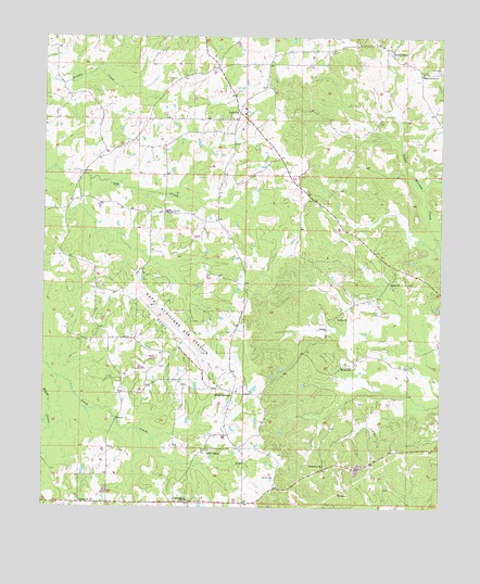
Lynville, MS USGS Topographic Map
Click on map above to begin viewing in our Map Viewer.

This topographic map contains these locations and features:
Feature Name Type Latitude Longitude GNIS ID View Map
Bethlehem ChurchChurchN32.7615°W88.7862°667001View Map
Bluff SpringsPopulated PlaceN32.7810°W88.8153°691715View Map
Bluff Springs CemeteryCemeteryN32.7815°W88.8139°707939View Map
Bluff Springs ChurchChurchN32.8654°W88.7564°667342View Map
Chamberlin CemeteryCemeteryN32.8660°W88.7506°668301View Map
Clarks ChapelChurchN32.7651°W88.8231°668520View Map
ClevelandPopulated PlaceN32.7512°W88.8301°668600View Map
Cow Creek (historical)Populated PlaceN32.8299°W88.8373°686697View Map
Joe Williams Naval Outlying FieldAirportN32.7934°W88.8313°680355View Map
Kellis StoreLocaleN32.8718°W88.7664°672082View Map
LynvillePopulated PlaceN32.8551°W88.8156°672970View Map
Lynville Attendance Center (historical)SchoolN32.8560°W88.8123°707974View Map
Mellen ChurchChurchN32.7874°W88.7781°673465View Map
Peden (historical)Populated PlaceN32.8182°W88.7709°691639View Map
Pleasant Springs CemeteryCemeteryN32.8568°W88.8134°707987View Map
Salem CemeteryCemeteryN32.8718°W88.7664°707993View Map
Shephard ChurchChurchN32.8457°W88.8534°677647View Map
Shepherd CemeteryCemeteryN32.7648°W88.8506°707995View Map
Sinai ChurchChurchN32.8099°W88.7659°677843View Map
Smith CemeteryCemeteryN32.7579°W88.8023°677908View Map
Smyrna CemeteryCemeteryN32.8012°W88.7820°707998View Map
Smyrna ChurchChurchN32.8010°W88.7831°677950View Map
Supervisor District 4CivilN32.8446°W88.7981°711926View Map
Tucker ChurchChurchN32.7515°W88.8631°678917View Map

Note: Coordinates in the location and feature list above are referenced to NAD83 datum.


Copyright (C) 2008-2025 Ryan Niemi / Sunset Dynamics ... All Rights Reserved