TopoQuest Logo
Do you find TopoQuest useful?
Help keep TopoQuest running and adding new maps/features by donating!
Bitcoin:  19c7KJd3qBynnjoSw5npx9KScwjBe4ifkT
Litecoin:  LXs6TkuXGGXo1vDsWCkWVdjQX94eUKd6ui
Home View Maps Find Maps Find Places Resources & Links


Panama, Oklahoma Topographic Map

USGS Map Title: Panama, OK
USGS Map MRC: 35094B6
DRG (GeoTIFF) Download: o35094b6.tif


Neighboring USGS Topographic Map Quads:


  Robert S Kerr Dam, OK  
35094C7
 

  Muldrow SW, OK  
35094C6
 

  Fort Coffee, OK  
35094C5
 

  Bokoshe, OK  
35094B7
 

  Panama, OK  
35094B6
 

  Spiro, OK  
35094B5
 

  Potato Peaks, OK  
35094A7
 

  Poteau West, OK  
35094A6
 

  Poteau East, OK  
35094A5


Map MRC Location:

N36°
W95°
N36°
W94°
H8 H7 H6 H5 H4 H3 H2 H1
G8 G7 G6 G5 G4 G3 G2 G1
F8 F7 F6 F5 F4 F3 F2 F1
E8 E7 E6 E5 E4 E3 E2 E1
D8 D7 D6 D5 D4 D3 D2 D1
C8 C7 C6 C5 C4 C3 C2 C1
B8 B7 B6 B5 B4 B3 B2 B1
A8 A7 A6 A5 A4 A3 A2 A1
N35°
W95°
N35°
W94°

Panama, OK USGS 1:24K Topographic Map Preview:
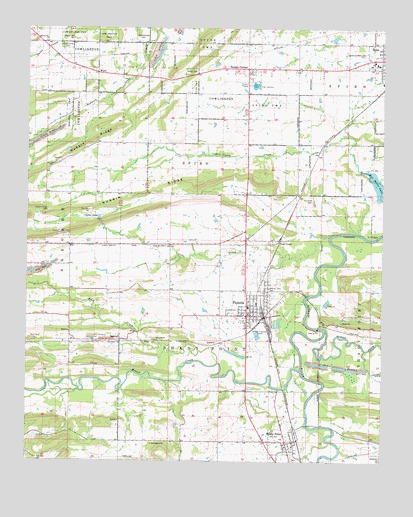
Panama, OK USGS Topographic Map
Click on map above to begin viewing in our Map Viewer.

This topographic map contains these locations and features:
Feature Name Type Latitude Longitude GNIS ID View Map
BedwellPopulated PlaceN35.1598°W94.7169°1100200View Map
Bennington ChurchChurchN35.1301°W94.7058°1090010View Map
Brazil CreekStreamN35.1512°W94.6538°1101307View Map
Buck CreekStreamN35.1534°W94.6824°1090607View Map
Carter LakeLakeN35.1954°W94.7248°1091007View Map
Coal CreekPopulated PlaceN35.1890°W94.6608°1100305View Map
Coal CreekStreamN35.1901°W94.6438°1091496View Map
Fair View CemeteryCemeteryN35.2004°W94.6491°1092688View Map
First Assembly of GodChurchN35.2387°W94.6349°1810032View Map
Flower Hill ChurchChurchN35.2459°W94.7441°1092907View Map
Flower Hill SchoolSchoolN35.2470°W94.7344°1092908View Map
Garden of Memories CemeteryCemeteryN35.2426°W94.6308°1093110View Map
James ForkStreamN35.1633°W94.6453°72167View Map
Kiamichi Technology Center SpiroSchoolN35.2381°W94.6291°1819351View Map
Nubbin Ridge CemeteryCemeteryN35.1976°W94.7427°1096071View Map
PanamaPopulated PlaceN35.1673°W94.6724°1096393View Map
Panama Elementary SchoolSchoolN35.1779°W94.6753°1819270View Map
Panama Fire DepartmentBuildingN35.1674°W94.6701°2656928View Map
Panama High SchoolSchoolN35.1748°W94.6700°1790426View Map
Panama Middle SchoolSchoolN35.1778°W94.6762°1790427View Map
Panama Police DepartmentBuildingN35.1674°W94.6724°2757677View Map
Shady PointPopulated PlaceN35.1301°W94.6586°1097947View Map
Shady Point Elementary SchoolSchoolN35.1318°W94.6602°1790749View Map
Shady Point Fire DepartmentBuildingN35.1278°W94.6614°2657035View Map
Shady Point Police DepartmentBuildingN35.1278°W94.6613°2757571View Map
Spiro Elementary SchoolSchoolN35.2395°W94.6304°1819355View Map
Spiro High SchoolSchoolN35.2406°W94.6289°1819352View Map
Spiro Middle SchoolSchoolN35.2400°W94.6298°1819353View Map
Sunset CornerPopulated PlaceN35.2384°W94.6722°1098658View Map
Swink LakeReservoirN35.2468°W94.6419°1755786View Map
Swink Lake DamDamN35.2468°W94.6419°1755785View Map
Town of PanamaCivilN35.1715°W94.6707°2413104View Map
Town of Shady PointCivilN35.1277°W94.6687°2413274View Map
Township of Shady PointCivilN35.1584°W94.6711°1824672View Map
WardPopulated PlaceN35.2373°W94.7255°1100918View Map

Note: Coordinates in the location and feature list above are referenced to NAD83 datum.


Copyright (C) 2008-2025 Ryan Niemi / Sunset Dynamics ... All Rights Reserved