TopoQuest Logo
Do you find TopoQuest useful?
Help keep TopoQuest running and adding new maps/features by donating!
Bitcoin:  19c7KJd3qBynnjoSw5npx9KScwjBe4ifkT
Litecoin:  LXs6TkuXGGXo1vDsWCkWVdjQX94eUKd6ui
Home View Maps Find Maps Find Places Resources & Links


Bighill, Kentucky Topographic Map

USGS Map Title: Bighill, KY
USGS Map MRC: 37084E2
DRG (GeoTIFF) Download: o37084e2.tif


Neighboring USGS Topographic Map Quads:


  Richmond South, KY  
37084F3
 

  Moberly, KY  
37084F2
 

  Panola, KY  
37084F1
 

  Berea, KY  
37084E3
 

  Bighill, KY  
37084E2
 

  Alcorn, KY  
37084E1
 

  Wildie, KY  
37084D3
 

  Johnetta, KY  
37084D2
 

  Sandgap, KY  
37084D1


Map MRC Location:

N38°
W85°
N38°
W84°
H8 H7 H6 H5 H4 H3 H2 H1
G8 G7 G6 G5 G4 G3 G2 G1
F8 F7 F6 F5 F4 F3 F2 F1
E8 E7 E6 E5 E4 E3 E2 E1
D8 D7 D6 D5 D4 D3 D2 D1
C8 C7 C6 C5 C4 C3 C2 C1
B8 B7 B6 B5 B4 B3 B2 B1
A8 A7 A6 A5 A4 A3 A2 A1
N37°
W85°
N37°
W84°

Bighill, KY USGS 1:24K Topographic Map Preview:
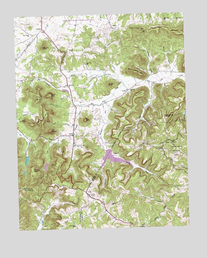
Bighill, KY USGS Topographic Map
Click on map above to begin viewing in our Map Viewer.

This topographic map contains these locations and features:
Feature Name Type Latitude Longitude GNIS ID View Map
Baker (historical)Populated PlaceN37.5496°W84.1363°2505034View Map
Baker HollowValleyN37.5606°W84.2081°510362View Map
Baker SchoolSchoolN37.5495°W84.1358°510363View Map
Bark Road ChurchChurchN37.6206°W84.1291°510395View Map
Bark Road SchoolSchoolN37.6209°W84.1391°510396View Map
Basin MountainSummitN37.5790°W84.2241°510427View Map
Berea City LakesReservoirN37.5407°W84.2430°2557479View Map
Berea College ForestForestN37.5394°W84.2259°2558301View Map
Berea DivisionCivilN37.5958°W84.2462°1936873View Map
Big Hill (historical)Populated PlaceN37.5151°W84.1813°2505037View Map
Big Hill School (historical)SchoolN37.5581°W84.2087°2557483View Map
Big MountainSummitN37.5559°W84.1766°510680View Map
BighillPopulated PlaceN37.5545°W84.2083°510711View Map
Bighill MountainSummitN37.5295°W84.1972°510712View Map
Bighill SchoolSchoolN37.5148°W84.1813°510713View Map
Blue Lick CreekStreamN37.5773°W84.2094°510805View Map
BobtownPopulated PlaceN37.6176°W84.2291°510829View Map
Bobtown School (historical)SchoolN37.6161°W84.2279°2557505View Map
Brushy KnobSummitN37.5842°W84.1802°510980View Map
Buckeye HollowValleyN37.5654°W84.1267°511023View Map
Burnt BridgeArchN37.5249°W84.2185°2726324View Map
Cowbell CreekStreamN37.5723°W84.2019°511601View Map
Cox CemeteryCemeteryN37.5217°W84.1980°511609View Map
Coyle Post Office (historical)Post OfficeN37.5839°W84.1941°2557496View Map
Croley MountainSummitN37.5510°W84.1465°2505012View Map
Cruse Ridge SchoolSchoolN37.5015°W84.2088°511667View Map
DreyfusPopulated PlaceN37.6173°W84.1766°511886View Map
Dreyfus Post Office (historical)Post OfficeN37.6180°W84.1779°2558304View Map
DuluthPopulated PlaceN37.5795°W84.1683°511950View Map
Duluth Post Office (historical)Post OfficeN37.5805°W84.1673°2557495View Map
East PinnaclePillarN37.5573°W84.2241°511996View Map
Floyd BranchStreamN37.5851°W84.1505°512209View Map
Gravel Lick BranchStreamN37.5876°W84.1735°512399View Map
Hacker Smith MountainSummitN37.5912°W84.1602°512495View Map
Hardin CemeteryCemeteryN37.5106°W84.2305°512559View Map
Hart HollowValleyN37.5015°W84.2333°512577View Map
Hickory Flat MountainSummitN37.6156°W84.1577°512679View Map
Horse Cove BranchStreamN37.5773°W84.2094°512791View Map
Horseshoe GapGapN37.5739°W84.2319°2557490View Map
Hugh (historical)Populated PlaceN37.5431°W84.1792°2505019View Map
Hugh ChurchChurchN37.5445°W84.1794°2504902View Map
Hugh Post Office (historical)Post OfficeN37.5435°W84.1792°2504903View Map
Hugh SchoolSchoolN37.5437°W84.1783°512840View Map
Indian Fort MountainSummitN37.5637°W84.2324°512911View Map
Indian Fort TheatreLocaleN37.5537°W84.2412°2557482View Map
Joe Lick ForkStreamN37.5856°W84.1694°513022View Map
Joe Lick KnobSummitN37.6067°W84.2285°513023View Map
Log Cabin SchoolSchoolN37.5956°W84.1958°513568View Map
Long BranchStreamN37.5126°W84.1405°513595View Map
Malory Mineral Spring (historical)LocaleN37.5689°W84.1795°2557487View Map
Maplewood Farm (historical)LocaleN37.6195°W84.1866°2557506View Map
McCarter BranchStreamN37.5865°W84.1347°513845View Map
Millstone RidgeRidgeN37.5390°W84.2185°514021View Map
MorrillPopulated PlaceN37.5193°W84.1974°514063View Map
Morrill Post Office (historical)Post OfficeN37.5183°W84.1956°2504930View Map
New Liberty Baptist ChurchChurchN37.6148°W84.2391°514245View Map
Owsley ForkStreamN37.5737°W84.1835°514402View Map
Owsley Fork ReservoirReservoirN37.5410°W84.1800°2504941View Map
Pig HollowValleyN37.5097°W84.2288°514539View Map
Pilot KnobSummitN37.5637°W84.1980°514564View Map
Pilot Knob Baptist ChurchChurchN37.5831°W84.2094°514565View Map
Pinnacle KnobSummitN37.5345°W84.2385°514615View Map
Radford HollowValleyN37.5419°W84.1844°514824View Map
Red Lick Baptist ChurchChurchN37.5806°W84.1649°514870View Map
Red Lick BranchStreamN37.5545°W84.2066°514868View Map
Red Lick CemeteryCemeteryN37.5842°W84.1488°514869View Map
Red Lick Sulphur SpringSpringN37.6113°W84.1709°2557503View Map
Red Lick Volunteer Fire DepartmentBuildingN37.5799°W84.1692°2636819View Map
Robe MountainSummitN37.5773°W84.2335°514997View Map
Shirley Post Office (historical)Post OfficeN37.5660°W84.1433°2504961View Map
Stillhouse BranchStreamN37.5876°W84.1460°515708View Map
Sulphur SpringSpringN37.5700°W84.2103°2557488View Map
Tilday MountainSummitN37.5720°W84.1616°515948View Map
Walnut Valley Post Office (historical)Post OfficeN37.5723°W84.2070°2557489View Map
West PinnaclePillarN37.5645°W84.2433°516281View Map
WKXO-FM (Berea)TowerN37.5043°W84.2160°517922View Map
Wolf GapGapN37.6145°W84.1524°516442View Map
Wolf Gap MountainSummitN37.6137°W84.1285°516443View Map

Note: Coordinates in the location and feature list above are referenced to NAD83 datum.


Copyright (C) 2008-2024 Ryan Niemi / Sunset Dynamics ... All Rights Reserved