TopoQuest Logo
Do you find TopoQuest useful?
Help keep TopoQuest running and adding new maps/features by donating!
Bitcoin:  19c7KJd3qBynnjoSw5npx9KScwjBe4ifkT
Litecoin:  LXs6TkuXGGXo1vDsWCkWVdjQX94eUKd6ui
Home View Maps Find Maps Find Places Resources & Links


Johnetta, Kentucky Topographic Map

USGS Map Title: Johnetta, KY
USGS Map MRC: 37084D2
DRG (GeoTIFF) Download: o37084d2.tif


Neighboring USGS Topographic Map Quads:


  Berea, KY  
37084E3
 

  Bighill, KY  
37084E2
 

  Alcorn, KY  
37084E1
 

  Wildie, KY  
37084D3
 

  Johnetta, KY  
37084D2
 

  Sandgap, KY  
37084D1
 

  Mount Vernon, KY  
37084C3
 

  Livingston, KY  
37084C2
 

  Parrot, KY  
37084C1


Map MRC Location:

N38°
W85°
N38°
W84°
H8 H7 H6 H5 H4 H3 H2 H1
G8 G7 G6 G5 G4 G3 G2 G1
F8 F7 F6 F5 F4 F3 F2 F1
E8 E7 E6 E5 E4 E3 E2 E1
D8 D7 D6 D5 D4 D3 D2 D1
C8 C7 C6 C5 C4 C3 C2 C1
B8 B7 B6 B5 B4 B3 B2 B1
A8 A7 A6 A5 A4 A3 A2 A1
N37°
W85°
N37°
W84°

Johnetta, KY USGS 1:24K Topographic Map Preview:
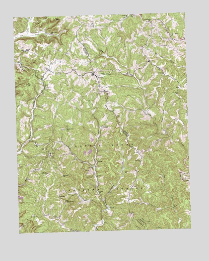
Johnetta, KY USGS Topographic Map
Click on map above to begin viewing in our Map Viewer.

This topographic map contains these locations and features:
Feature Name Type Latitude Longitude GNIS ID View Map
Anglin FallsFallsN37.4998°W84.2172°510277View Map
Anglin Falls SchoolSchoolN37.4923°W84.2227°510278View Map
Anglin ForkStreamN37.4897°W84.2406°510279View Map
Barnett ValleyValleyN37.3933°W84.1877°510416View Map
Brushy Ridge SchoolSchoolN37.4348°W84.2127°510985View Map
Cave Spring ChurchChurchN37.4981°W84.1672°511281View Map
Cave Spring School (historical)SchoolN37.4976°W84.1688°2505051View Map
Chastine CemeteryCemeteryN37.4815°W84.2419°511318View Map
ClimaxPopulated PlaceN37.4698°W84.2249°511411View Map
Climax ChurchChurchN37.4598°W84.2283°511412View Map
Clover BottomPopulated PlaceN37.4990°W84.1513°511418View Map
Clover Bottom ChurchChurchN37.4909°W84.1352°511419View Map
Clover Bottom Post Office (historical)Post OfficeN37.4957°W84.1502°2505055View Map
Clover Bottom School (historical)SchoolN37.4962°W84.1424°2505056View Map
CooksburgPopulated PlaceN37.3890°W84.1852°511506View Map
Corinth ChurchChurchN37.3976°W84.1910°511541View Map
Corinth ChurchChurchN37.4070°W84.1924°511542View Map
Cruse RidgeRidgeN37.4995°W84.2280°511666View Map
Deer LickStreamN37.4351°W84.1482°2505013View Map
Dicycope ChapelChurchN37.4806°W84.2413°511809View Map
Dry ForkStreamN37.4118°W84.1933°511925View Map
Dry Fork (historical)Populated PlaceN37.3880°W84.1379°2505073View Map
Dry Fork SchoolSchoolN37.3879°W84.1374°511932View Map
EglonPopulated PlaceN37.4615°W84.1299°512016View Map
Eglon Post Office (historical)Post OfficeN37.4570°W84.1304°2505075View Map
Evergreen Post Office (historical)Post OfficeN37.4475°W84.1481°2505016View Map
GoochlandPopulated PlaceN37.4359°W84.1869°512339View Map
Horse Lick School (historical)SchoolN37.4437°W84.1550°2504900View Map
JohnettaPopulated PlaceN37.4156°W84.1919°513035View Map
Johnetta CemeteryCemeteryN37.4259°W84.2344°513036View Map
Johnson SchoolSchoolN37.4698°W84.1833°513056View Map
King and Clark CemeteryCemeteryN37.4692°W84.2244°2726501View Map
Limestone BranchStreamN37.4650°W84.1665°2504918View Map
Little Clover CreekStreamN37.4311°W84.1417°513469View Map
LoamPopulated PlaceN37.4076°W84.1297°513553View Map
Loam HillSummitN37.4171°W84.1384°2504920View Map
Loam Post Office (historical)Post OfficeN37.4079°W84.1294°2504921View Map
New Hope ChurchChurchN37.4206°W84.2266°514239View Map
New Hope Lookout TowerTowerN37.4095°W84.2283°517249View Map
New Hope SchoolSchoolN37.4081°W84.2172°514243View Map
Owen Allen SchoolSchoolN37.4126°W84.1941°514389View Map
Pine Grove (historical)Populated PlaceN37.4534°W84.1310°2504945View Map
Pine Grove SchoolSchoolN37.4576°W84.1313°514582View Map
Pony Lot ChurchChurchN37.4695°W84.1413°514706View Map
Poplar GapGapN37.3926°W84.2147°514711View Map
Poplar Gap ChurchChurchN37.3956°W84.2205°514712View Map
Poplar Gap SchoolSchoolN37.3834°W84.2222°514713View Map
Rice Hill (historical)Populated PlaceN37.4946°W84.1912°2504951View Map
Rice Hill SchoolSchoolN37.4973°W84.1899°514903View Map
Robinet Post Office (historical)Post OfficeN37.4092°W84.1634°2504952View Map
Rose's MillLocaleN37.4287°W84.1415°2504953View Map
Sand Bluff Post Office (historical)Post OfficeN37.4737°W84.1939°2504956View Map
Sugar Cane BranchStreamN37.4306°W84.1476°2504995View Map
Thad Drew SchoolSchoolN37.4184°W84.1602°515903View Map
Three Links Post Office (historical)Post OfficeN37.4637°W84.1900°2504974View Map
ThreelinksPopulated PlaceN37.4679°W84.1894°515940View Map

Note: Coordinates in the location and feature list above are referenced to NAD83 datum.


Copyright (C) 2008-2024 Ryan Niemi / Sunset Dynamics ... All Rights Reserved