TopoQuest Logo
Do you find TopoQuest useful?
Help keep TopoQuest running and adding new maps/features by donating!
Bitcoin:  19c7KJd3qBynnjoSw5npx9KScwjBe4ifkT
Litecoin:  LXs6TkuXGGXo1vDsWCkWVdjQX94eUKd6ui
Home View Maps Find Maps Find Places Resources & Links


Poynette, Wisconsin Topographic Map

USGS Map Title: Poynette, WI
USGS Map MRC: 43089D4
DRG (GeoTIFF) Download: o43089d4.tif


Neighboring USGS Topographic Map Quads:


  Pine Island, WI  
43089E5
 

  Portage, WI  
43089E4
 

  Pardeeville, WI  
43089E3
 

  Durwards Glen, WI  
43089D5
 

  Poynette, WI  
43089D4
 

  Wyocena, WI  
43089D3
 

  Lodi, WI  
43089C5
 

  Arlington, WI  
43089C4
 

  Morrisonville, WI  
43089C3


Map MRC Location:

N44°
W90°
N44°
W89°
H8 H7 H6 H5 H4 H3 H2 H1
G8 G7 G6 G5 G4 G3 G2 G1
F8 F7 F6 F5 F4 F3 F2 F1
E8 E7 E6 E5 E4 E3 E2 E1
D8 D7 D6 D5 D4 D3 D2 D1
C8 C7 C6 C5 C4 C3 C2 C1
B8 B7 B6 B5 B4 B3 B2 B1
A8 A7 A6 A5 A4 A3 A2 A1
N43°
W90°
N43°
W89°

Poynette, WI USGS 1:24K Topographic Map Preview:
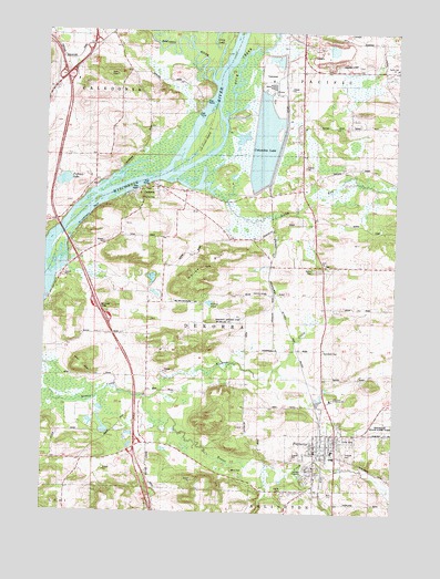
Poynette, WI USGS Topographic Map
Click on map above to begin viewing in our Map Viewer.

This topographic map contains these locations and features:
Feature Name Type Latitude Longitude GNIS ID View Map
Allen BluffCliffN43.4125°W89.4848°1560768View Map
Bancroft Landing Strip (historical)AirportN43.4255°W89.4343°1842931View Map
Baraboo RiverStreamN43.4875°W89.4418°1561153View Map
Columbia Energy CenterBuildingN43.4861°W89.4200°2392030View Map
DekorraPopulated PlaceN43.4575°W89.4676°1563868View Map
Dekorra CemeteryCemeteryN43.4569°W89.4596°1955170View Map
Dekorra Elementary SchoolSchoolN43.4321°W89.4212°1563871View Map
Duck CreekStreamN43.4780°W89.4362°1564146View Map
Fulton PondLakeN43.4294°W89.4414°1565367View Map
Ginter CemeteryCemeteryN43.4608°W89.4823°1565548View Map
Hillside CemeteryCemeteryN43.3907°W89.3930°1566457View Map
Hinkson CreekStreamN43.4053°W89.4632°1566483View Map
Inch CemeteryCemeteryN43.4394°W89.4004°1955171View Map
Inch ChurchChurchN43.4397°W89.4001°1566892View Map
Klaila CemeteryCemeteryN43.3814°W89.4140°1567453View Map
Lake ColumbiaReservoirN43.4710°W89.4224°1577257View Map
Lib Cross IslandIslandN43.4722°W89.4446°1568005View Map
Muir ParkParkN43.3847°W89.4307°1570014View Map
Pacific SchoolSchoolN43.4908°W89.3757°1570984View Map
Pickerel LakeLakeN43.4610°W89.4939°1843000View Map
PoynettePopulated PlaceN43.3903°W89.4029°1571865View Map
Poynette - Dekorra Fire Department and Emergency Medical ServicesBuildingN43.3885°W89.4023°2697652View Map
Poynette Christian SchoolSchoolN43.4047°W89.3973°1571866View Map
Poynette Elementary SchoolSchoolN43.3913°W89.3964°2716922View Map
Poynette High SchoolSchoolN43.3895°W89.3960°2716723View Map
Poynette Middle SchoolSchoolN43.3909°W89.3966°2716612View Map
Poynette Police DepartmentBuildingN43.3901°W89.4029°2759538View Map
Rocky RunStreamN43.4611°W89.4548°1572513View Map
Rubin-Guenther CemeteryCemeteryN43.4594°W89.4823°1955181View Map
Saint Lawrence BluffCliffN43.4530°W89.4818°1573208View Map
Schofield CemeteryCemeteryN43.4169°W89.4003°1573797View Map
Town of DekorraCivilN43.4201°W89.4484°1583065View Map
Village of PoynetteCivilN43.3922°W89.4059°1583969View Map
Whites BluffCliffN43.4397°W89.4440°1576686View Map

Note: Coordinates in the location and feature list above are referenced to NAD83 datum.


Copyright (C) 2008-2025 Ryan Niemi / Sunset Dynamics ... All Rights Reserved