TopoQuest Logo
Do you find TopoQuest useful?
Help keep TopoQuest running and adding new maps/features by donating!
Bitcoin:  19c7KJd3qBynnjoSw5npx9KScwjBe4ifkT
Litecoin:  LXs6TkuXGGXo1vDsWCkWVdjQX94eUKd6ui
Home View Maps Find Maps Find Places Resources & Links


Park Hill, Oklahoma Topographic Map

USGS Map Title: Park Hill, OK
USGS Map MRC: 35094G8
DRG (GeoTIFF) Download: o35094g8.tif


Neighboring USGS Topographic Map Quads:


  Thompson Corner, OK  
35095H1
 

  Tahlequah, OK  
35094H8
 

  Proctor, OK  
35094H7
 

  Zeb, OK  
35095G1
 

  Park Hill, OK  
35094G8
 

  Tailholt, OK  
35094G7
 

  Qualls, OK  
35095F1
 

  Cookson, OK  
35094F8
 

  Bunch, OK  
35094F7


Map MRC Location:

N36°
W95°
N36°
W94°
H8 H7 H6 H5 H4 H3 H2 H1
G8 G7 G6 G5 G4 G3 G2 G1
F8 F7 F6 F5 F4 F3 F2 F1
E8 E7 E6 E5 E4 E3 E2 E1
D8 D7 D6 D5 D4 D3 D2 D1
C8 C7 C6 C5 C4 C3 C2 C1
B8 B7 B6 B5 B4 B3 B2 B1
A8 A7 A6 A5 A4 A3 A2 A1
N35°
W95°
N35°
W94°

Park Hill, OK USGS 1:24K Topographic Map Preview:
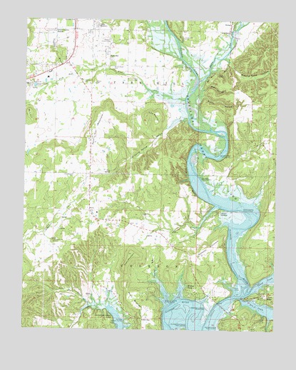
Park Hill, OK USGS Topographic Map
Click on map above to begin viewing in our Map Viewer.

This topographic map contains these locations and features:
Feature Name Type Latitude Longitude GNIS ID View Map
Alum BluffCliffN35.8098°W94.9183°1089603View Map
Bald HillSummitN35.8370°W94.9980°1089800View Map
Baron ForkStreamN35.8508°W94.9140°70518View Map
Big HollowValleyN35.7681°W94.9313°1090114View Map
Blue SpringSpringN35.8137°W94.9575°1090294View Map
Boy Scout BluffCliffN35.8543°W94.9055°1090440View Map
Camp DarbyLocaleN35.8531°W94.9050°1090856View Map
Caney CreekStreamN35.7654°W94.8875°1090919View Map
Caney RidgePopulated PlaceN35.7643°W94.8808°1090927View Map
Carter ChurchChurchN35.7895°W94.9261°1091003View Map
Carters LandingPopulated PlaceN35.7973°W94.9038°1100266View Map
Carters Landing Public Use AreaParkN35.7984°W94.8933°1091011View Map
Cherokee Home MissionChurchN35.7856°W94.9858°1091241View Map
Cherokee Landing State ParkParkN35.7590°W94.9088°1091243View Map
Cherokee Nation Emergency Medical ServicesBuildingN35.8548°W94.9845°2695921View Map
Dripping Spring HollowValleyN35.8356°W94.9202°1092192View Map
Dry CreekStreamN35.7634°W94.8919°1092226View Map
Elk Creek Landing Public Use AreaParkN35.7515°W94.9027°1092535View Map
Etta Bend Public Use AreaParkN35.8120°W94.9111°1092641View Map
Etta ChurchChurchN35.8268°W94.8866°1092642View Map
Goodman BranchStreamN35.8529°W94.9758°1093254View Map
Green Country EstatesPopulated PlaceN35.8704°W94.9883°1093369View Map
Horseshoe Bend Public Use AreaParkN35.8212°W94.9036°1093955View Map
Indian MeadowsPopulated PlaceN35.8731°W94.9658°1094094View Map
KeysCivilN35.8056°W94.9425°2631120View Map
KeysPopulated PlaceN35.7981°W94.9677°1094355View Map
Keys Census Designated PlaceCensusN35.8056°W94.9425°2408478View Map
Keys Elementary SchoolSchoolN35.7972°W94.9637°1803474View Map
Keys Fire Department Station 1BuildingN35.7945°W94.9611°2656985View Map
Keys High SchoolSchoolN35.7901°W94.9657°2712965View Map
Keys Mission ChurchChurchN35.8123°W94.9766°1094357View Map
Keys SpringSpringN35.8701°W94.8991°1094358View Map
King MountainSummitN35.8373°W94.9350°1094386View Map
Mahaney MountainSummitN35.7831°W94.9100°1095094View Map
Manes HollowValleyN35.8445°W94.9136°1095107View Map
Minning Camp HollowValleyN35.8584°W94.8991°1095439View Map
Murrell Home ParkParkN35.8556°W94.9577°1095711View Map
Oklahoma Department of Agriculture Forestry Northeast AreaBuildingN35.8533°W94.9602°2657405View Map
Park HillCivilN35.8546°W94.9559°2631149View Map
Park HillPopulated PlaceN35.8612°W94.9588°1096432View Map
Park Hill BranchStreamN35.8429°W94.9208°1096433View Map
Park Hill CemeteryCemeteryN35.8495°W94.9681°1096434View Map
Park Hill Census Designated PlaceCensusN35.8546°W94.9559°2409027View Map
Park Hill MountainSummitN35.8293°W94.9663°1096435View Map
PettitCivilN35.7656°W94.9691°2631152View Map
PettitPopulated PlaceN35.7648°W94.9655°1100734View Map
Pettit BayPopulated PlaceN35.7526°W94.9433°1096583View Map
Pettit Bay Public Use AreaParkN35.7537°W94.9480°1096584View Map
Pettit CemeteryCemeteryN35.7678°W94.9583°2711317View Map
Pettit Census Designated PlaceCensusN35.7656°W94.9691°2409058View Map
Pettit CreekStreamN35.7593°W94.9588°1096586View Map
Pettit MountainSummitN35.7648°W94.9452°1096587View Map
Ross CemeteryCemeteryN35.8511°W94.9479°1097462View Map
Ross HollowValleyN35.8470°W94.9124°1097463View Map
Short MountainSummitN35.7806°W94.9461°1098024View Map
Strayhorn Landing Public Use AreaParkN35.7631°W94.9302°1098582View Map
Township of Park HillCivilN35.8501°W94.9419°1824589View Map
Tsa La Gi Indian VillagePopulated PlaceN35.8665°W94.9586°1100897View Map
Turner Ford CampLocaleN35.8673°W94.9219°1099070View Map
Wildcat PointPopulated PlaceN35.7648°W94.9175°1099781View Map
Worcester Mission CemeteryCemeteryN35.8491°W94.9649°1100018View Map

Note: Coordinates in the location and feature list above are referenced to NAD83 datum.


Copyright (C) 2008-2025 Ryan Niemi / Sunset Dynamics ... All Rights Reserved