TopoQuest Logo
Do you find TopoQuest useful?
Help keep TopoQuest running and adding new maps/features by donating!
Bitcoin:  19c7KJd3qBynnjoSw5npx9KScwjBe4ifkT
Litecoin:  LXs6TkuXGGXo1vDsWCkWVdjQX94eUKd6ui
Home View Maps Find Maps Find Places Resources & Links


Everton, Arkansas Topographic Map

USGS Map Title: Everton, AR
USGS Map MRC: 36092B8
DRG (GeoTIFF) Download: o36092b8.tif


Neighboring USGS Topographic Map Quads:


  Bergman, AR  
36093C1
 

  Zinc, AR  
36092C8
 

  Pyatt, AR  
36092C7
 

  Harrison, AR  
36093B1
 

  Everton, AR  
36092B8
 

  Bruno, AR  
36092B7
 

  Hasty, AR  
36093A1
 

  Western Grove, AR  
36092A8
 

  Saint Joe, AR  
36092A7


Map MRC Location:

N37°
W93°
N37°
W92°
H8 H7 H6 H5 H4 H3 H2 H1
G8 G7 G6 G5 G4 G3 G2 G1
F8 F7 F6 F5 F4 F3 F2 F1
E8 E7 E6 E5 E4 E3 E2 E1
D8 D7 D6 D5 D4 D3 D2 D1
C8 C7 C6 C5 C4 C3 C2 C1
B8 B7 B6 B5 B4 B3 B2 B1
A8 A7 A6 A5 A4 A3 A2 A1
N36°
W93°
N36°
W92°

Everton, AR USGS 1:24K Topographic Map Preview:
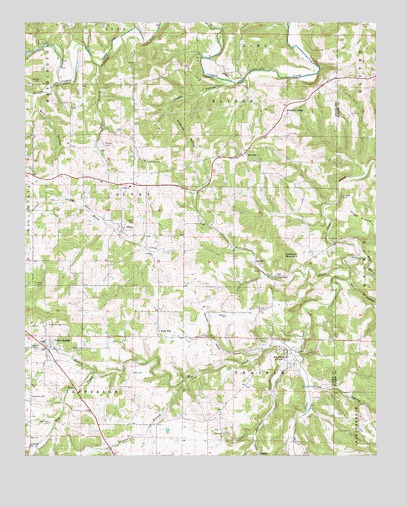
Everton, AR USGS Topographic Map
Click on map above to begin viewing in our Map Viewer.

This topographic map contains these locations and features:
Feature Name Type Latitude Longitude GNIS ID View Map
Britton CemeteryCemeteryN36.2151°W92.9724°46966View Map
Buie HollowValleyN36.2295°W92.9952°47163View Map
Cowvat HollowValleyN36.2334°W92.9277°48124View Map
CrawfordPopulated PlaceN36.1767°W92.9104°57602View Map
Crawford MountainSummitN36.1831°W92.9085°57603View Map
Crossroad ChurchChurchN36.1273°W92.9988°48213View Map
Davidson CemeteryCemeteryN36.2353°W92.9274°48369View Map
Davis ChurchChurchN36.1315°W92.9293°48390View Map
DuggerPopulated PlaceN36.1259°W92.9177°57682View Map
Elm BranchStreamN36.1487°W92.9743°48868View Map
EvertonPopulated PlaceN36.1554°W92.9068°48952View Map
Everton Baptist ChurchChurchN36.1534°W92.9071°69282View Map
Hampton CemeteryCemeteryN36.1421°W92.9981°49811View Map
HarmonPopulated PlaceN36.2131°W92.9213°57885View Map
Harmon Fire Department Station 1BuildingN36.2133°W92.9216°2116529View Map
Harmon Fire Department Station 2BuildingN36.1906°W92.9661°2116530View Map
Hog CreekStreamN36.1562°W92.9027°72029View Map
Hog Creek CemeteryCemeteryN36.1345°W92.9913°50166View Map
Huzzah CreekStreamN36.2328°W92.9880°77262View Map
Jones CemeteryCemeteryN36.1489°W92.9621°50728View Map
Jones HollowValleyN36.1459°W92.9004°77387View Map
Keele HollowValleyN36.2423°W92.9949°50779View Map
Kings BranchStreamN36.1828°W92.8796°50864View Map
Liberty ChurchChurchN36.2112°W92.9241°51110View Map
Marshall BranchStreamN36.1540°W92.9021°51693View Map
McBridge HollowValleyN36.2253°W92.9493°51780View Map
Meeks CreekStreamN36.1795°W92.8852°51897View Map
Newton CemeteryCemeteryN36.1652°W92.9282°52761View Map
OlveyPopulated PlaceN36.1909°W92.9660°58308View Map
Olvey CemeteryCemeteryN36.1923°W92.9618°53045View Map
Olvey ChurchChurchN36.2028°W92.9630°53046View Map
Pedlo (historical)Populated PlaceN36.2056°W92.9882°69319View Map
Pedlo BranchStreamN36.2376°W92.9738°53259View Map
Pine HollowValleyN36.1759°W92.8854°53446View Map
Pine Hollow CreekStreamN36.1759°W92.8854°61088View Map
Pleasant RidgePopulated PlaceN36.2253°W92.9079°78054View Map
Polk HollowValleyN36.2481°W92.9627°53663View Map
Rally HillPopulated PlaceN36.1609°W92.9527°58456View Map
Roland CemeteryCemeteryN36.1562°W92.9954°54169View Map
Smith CemeteryCemeteryN36.1752°W92.9961°54939View Map
Snowball BranchStreamN36.1459°W92.9449°54990View Map
Starkey CemeteryCemeteryN36.2326°W92.9952°55169View Map
Town of EvertonCivilN36.1542°W92.9095°2406475View Map
Town of Valley SpringsCivilN36.1540°W92.9899°2406786View Map
Township of BlytheCivilN36.2251°W92.9260°69606View Map
Township of JeffersonCivilN36.1442°W92.9808°69613View Map
Township of OlveyCivilN36.2000°W92.9637°69617View Map
Township of PrairieCivilN36.1550°W92.9148°69619View Map
Valley SpringsPopulated PlaceN36.1576°W92.9930°78643View Map
Valley Springs CemeteryCemeteryN36.1630°W92.9924°55879View Map
Valley Springs Elementary SchoolSchoolN36.1587°W92.9939°69327View Map
Valley Springs Fire Department Station 1BuildingN36.1363°W92.9750°2117244View Map
Valley Springs Fire Department Station 2BuildingN36.1558°W92.9933°2117245View Map
Valley Springs Fire Department Station 4BuildingN36.1540°W92.9064°2117247View Map
Valley Springs High SchoolSchoolN36.1580°W92.9936°69328View Map
Valley Springs Middle SchoolSchoolN36.1579°W92.9930°2093012View Map
Valley Springs Post OfficePost OfficeN36.1537°W92.9895°84483View Map
Warner CemeteryCemeteryN36.2101°W92.9568°56062View Map

Note: Coordinates in the location and feature list above are referenced to NAD83 datum.


Copyright (C) 2008-2024 Ryan Niemi / Sunset Dynamics ... All Rights Reserved