TopoQuest Logo
Do you find TopoQuest useful?
Help keep TopoQuest running and adding new maps/features by donating!
Bitcoin:  19c7KJd3qBynnjoSw5npx9KScwjBe4ifkT
Litecoin:  LXs6TkuXGGXo1vDsWCkWVdjQX94eUKd6ui
Home View Maps Find Maps Find Places Resources & Links


Patoka, Indiana Topographic Map

USGS Map Title: Patoka, IN
USGS Map MRC: 38087D5
DRG (GeoTIFF) Download: o38087d5.tif


Neighboring USGS Topographic Map Quads:


  Saint Francisville, IL  
38087E6
 

  Decker, IN  
38087E5
 

  Iona, IN  
38087E4
 

  East Mount Carmel, IN  
38087D6
 

  Patoka, IN  
38087D5
 

  Union, IN  
38087D4
 

  Owensville, IN  
38087C6
 

  Princeton, IN  
38087C5
 

  Francisco, IN  
38087C4


Map MRC Location:

N39°
W88°
N39°
W87°
H8 H7 H6 H5 H4 H3 H2 H1
G8 G7 G6 G5 G4 G3 G2 G1
F8 F7 F6 F5 F4 F3 F2 F1
E8 E7 E6 E5 E4 E3 E2 E1
D8 D7 D6 D5 D4 D3 D2 D1
C8 C7 C6 C5 C4 C3 C2 C1
B8 B7 B6 B5 B4 B3 B2 B1
A8 A7 A6 A5 A4 A3 A2 A1
N38°
W88°
N38°
W87°

Patoka, IN USGS 1:24K Topographic Map Preview:
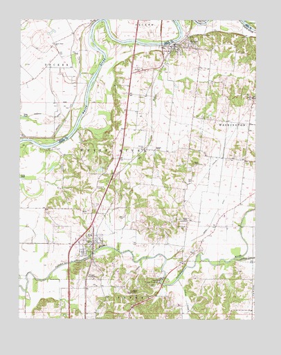
Patoka, IN USGS Topographic Map
Click on map above to begin viewing in our Map Viewer.

This topographic map contains these locations and features:
Feature Name Type Latitude Longitude GNIS ID View Map
Bald HillSummitN38.3864°W87.5642°430444View Map
Barnett CemeteryCemeteryN38.4787°W87.5616°430510View Map
Decker ChapelPopulated PlaceN38.4895°W87.5370°446746View Map
Decker ChapelChurchN38.4167°W87.5356°433404View Map
Decker Chapel CemeteryCemeteryN38.4128°W87.5367°433405View Map
Decker Elementary SchoolSchoolN38.4895°W87.6072°433406View Map
Field CemeteryCemeteryN38.4425°W87.5609°434472View Map
Fields StationLocaleN38.4467°W87.5578°452174View Map
HazletonPopulated PlaceN38.4889°W87.5417°435943View Map
Hitch CemeteryCemeteryN38.3842°W87.5792°436248View Map
Hull AirportAirportN38.4059°W87.5996°449299View Map
Humphrey CemeteryCemeteryN38.4298°W87.5836°436605View Map
Indian CreekStreamN38.3912°W87.5400°436748View Map
Johnson - Decker Township Volunteer Fire DepartmentBuildingN38.4895°W87.6072°2625804View Map
Luke Decker ClaimReserveN38.4459°W87.6000°446745View Map
Milburn CemeteryCemeteryN38.4178°W87.5717°439134View Map
Millers StationLocaleN38.4350°W87.5736°452175View Map
Morrison CemeteryCemeteryN38.4467°W87.5592°439457View Map
PatokaPopulated PlaceN38.4070°W87.5856°440922View Map
Patoka Fire DepartmentBuildingN38.4099°W87.5874°2625629View Map
Patoka Police DepartmentBuildingN38.4058°W87.5855°2758410View Map
Princeton Country ClubLocaleN38.3920°W87.5870°452385View Map
Princeton WaterworksLocaleN38.3903°W87.5506°452386View Map
Robb CemeteryCemeteryN38.4328°W87.5356°442132View Map
Robb CreekStreamN38.4895°W87.5475°442134View Map
Shiloh ChurchChurchN38.4678°W87.5017°443393View Map
Snider FieldAirportN38.4974°W87.5947°2676878View Map
Steelman ChapelChurchN38.4459°W87.5531°444109View Map
Thompson DitchCanalN38.4598°W87.6100°444712View Map
Town of HazletonCivilN38.4892°W87.5407°2396992View Map
Town of PatokaCivilN38.4012°W87.5876°2396850View Map
Township of White RiverCivilN38.4322°W87.6095°454053View Map
Trippet CemeteryCemeteryN38.4398°W87.5314°444913View Map
Trippet DitchCanalN38.4187°W87.5211°444914View Map
White River - Hazleton Volunteer Fire DepartmentBuildingN38.4884°W87.5447°2625867View Map

Note: Coordinates in the location and feature list above are referenced to NAD83 datum.


Copyright (C) 2008-2024 Ryan Niemi / Sunset Dynamics ... All Rights Reserved