TopoQuest Logo
Do you find TopoQuest useful?
Help keep TopoQuest running and adding new maps/features by donating!
Bitcoin:  19c7KJd3qBynnjoSw5npx9KScwjBe4ifkT
Litecoin:  LXs6TkuXGGXo1vDsWCkWVdjQX94eUKd6ui
Home View Maps Find Maps Find Places Resources & Links


Shingle Hollow, North Carolina Topographic Map

USGS Map Title: Shingle Hollow, NC
USGS Map MRC: 35082D1
DRG (GeoTIFF) Download: o35082d1.tif


Neighboring USGS Topographic Map Quads:


  Moffitt Hill, NC  
35082E2
 

  Sugar Hill, NC  
35082E1
 

  Glenwood, NC  
35081E8
 

  Lake Lure, NC  
35082D2
 

  Shingle Hollow, NC  
35082D1
 

  Rutherfordton North, NC  
35081D8
 

  Mill Spring, NC  
35082C2
 

  Pea Ridge, NC  
35082C1
 

  Rutherfordton South, NC  
35081C8


Map MRC Location:

N36°
W83°
N36°
W82°
H8 H7 H6 H5 H4 H3 H2 H1
G8 G7 G6 G5 G4 G3 G2 G1
F8 F7 F6 F5 F4 F3 F2 F1
E8 E7 E6 E5 E4 E3 E2 E1
D8 D7 D6 D5 D4 D3 D2 D1
C8 C7 C6 C5 C4 C3 C2 C1
B8 B7 B6 B5 B4 B3 B2 B1
A8 A7 A6 A5 A4 A3 A2 A1
N35°
W83°
N35°
W82°

Shingle Hollow, NC USGS 1:24K Topographic Map Preview:
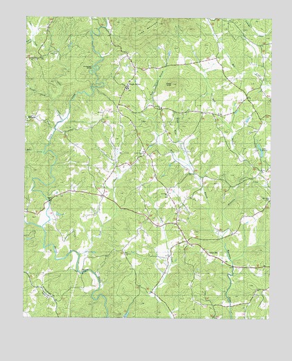
Shingle Hollow, NC USGS Topographic Map
Click on map above to begin viewing in our Map Viewer.

This topographic map contains these locations and features:
Feature Name Type Latitude Longitude GNIS ID View Map
Anderson ShoalBarN35.4790°W82.0909°980183View Map
Antioch ChurchChurchN35.4826°W82.1212°1007541View Map
Antioch Church CemeteryCemeteryN35.4827°W82.1201°2779012View Map
Bills CreekStreamN35.4435°W82.1151°981488View Map
Brooks Lake DamDamN35.4418°W82.0032°998972View Map
Cedar CreekStreamN35.4568°W82.1054°1023894View Map
Cedar Creek ChurchChurchN35.4854°W82.1109°1007542View Map
Chapel Hill ChurchChurchN35.3882°W82.0073°983015View Map
Cove CreekStreamN35.4118°W82.1154°1023926View Map
Cuba (historical)Populated PlaceN35.4748°W82.0040°1008424View Map
East Branch Mountain CreekStreamN35.4251°W82.0176°1023959View Map
Gage (historical)Populated PlaceN35.4829°W82.1207°1008431View Map
Green HillPopulated PlaceN35.4071°W82.0418°1020537View Map
Green Hill Baptist ChurchChurchN35.3985°W82.0240°1008437View Map
Green Hill CemeteryCemeteryN35.3990°W82.0228°1008438View Map
Green Hill Elementary SchoolSchoolN35.4054°W82.0396°1008439View Map
Green Hill Volunteer Fire DepartmentBuildingN35.4099°W82.0443°2639158View Map
Knob CreekStreamN35.4010°W82.0962°988045View Map
Lake BrooksReservoirN35.4421°W82.0043°981986View Map
Mathews ChurchChurchN35.4015°W82.0726°989456View Map
Matthews Church CemeteryCemeteryN35.4021°W82.0736°2779005View Map
Miller - Twitty CemeteryCemeteryN35.3871°W82.0065°1008449View Map
Mountain Creek CemeteryCemeteryN35.4252°W82.0003°1024175View Map
Mullin Bible CampSchoolN35.4593°W82.1240°1021584View Map
Nanito (historical)Populated PlaceN35.4626°W82.0782°1008454View Map
Nanney (historical)Populated PlaceN35.4260°W82.0846°1008455View Map
Oak Ridge ChurchChurchN35.4262°W82.0521°991441View Map
Piney CreekStreamN35.4654°W82.1104°992323View Map
Piney KnobSummitN35.4721°W82.0501°992378View Map
Piney Knob ChurchChurchN35.4629°W82.0551°1021954View Map
Piney Knob CreekStreamN35.4379°W82.0412°1024222View Map
Pleasant Grove CemeteryCemeteryN35.4437°W82.0645°1008457View Map
Pleasant Grove ChurchChurchN35.4435°W82.0646°1022006View Map
Rutherford Power Plant (historical)BuildingN35.4710°W82.1073°1008464View Map
Shingle HollowPopulated PlaceN35.4710°W82.0737°994726View Map
Shingle Hollow Fire DepartmentBuildingN35.4739°W82.0718°2638713View Map
Toms MountainSummitN35.4918°W82.0682°1022967View Map
Township of Green HillCivilN35.3943°W82.0568°1027162View Map
Township of MorganCivilN35.4982°W82.0625°1027164View Map
West Branch Mountain CreekStreamN35.4093°W82.0246°996991View Map
Whiteside BridgeBridgeN35.3935°W82.0948°997256View Map
Youngs CreekStreamN35.4898°W82.1212°1024416View Map

Note: Coordinates in the location and feature list above are referenced to NAD83 datum.


Copyright (C) 2008-2025 Ryan Niemi / Sunset Dynamics ... All Rights Reserved