TopoQuest Logo
Do you find TopoQuest useful?
Help keep TopoQuest running and adding new maps/features by donating!
Bitcoin:  19c7KJd3qBynnjoSw5npx9KScwjBe4ifkT
Litecoin:  LXs6TkuXGGXo1vDsWCkWVdjQX94eUKd6ui
Home View Maps Find Maps Find Places Resources & Links


Rutherfordton North, North Carolina Topographic Map

USGS Map Title: Rutherfordton North, NC
USGS Map MRC: 35081D8
DRG (GeoTIFF) Download: o35081d8.tif


Neighboring USGS Topographic Map Quads:


  Sugar Hill, NC  
35082E1
 

  Glenwood, NC  
35081E8
 

  Dysartsville, NC  
35081E7
 

  Shingle Hollow, NC  
35082D1
 

  Rutherfordton North, NC  
35081D8
 

  Sunshine, NC  
35081D7
 

  Pea Ridge, NC  
35082C1
 

  Rutherfordton South, NC  
35081C8
 

  Forest City, NC  
35081C7


Map MRC Location:

N36°
W82°
N36°
W81°
H8 H7 H6 H5 H4 H3 H2 H1
G8 G7 G6 G5 G4 G3 G2 G1
F8 F7 F6 F5 F4 F3 F2 F1
E8 E7 E6 E5 E4 E3 E2 E1
D8 D7 D6 D5 D4 D3 D2 D1
C8 C7 C6 C5 C4 C3 C2 C1
B8 B7 B6 B5 B4 B3 B2 B1
A8 A7 A6 A5 A4 A3 A2 A1
N35°
W82°
N35°
W81°

Rutherfordton North, NC USGS 1:24K Topographic Map Preview:
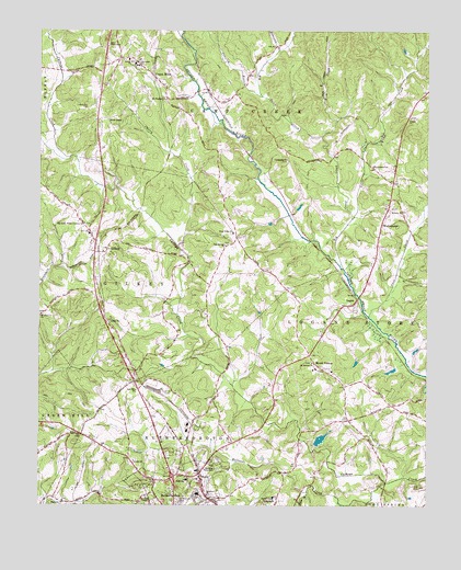
Rutherfordton North, NC USGS Topographic Map
Click on map above to begin viewing in our Map Viewer.

This topographic map contains these locations and features:
Feature Name Type Latitude Longitude GNIS ID View Map
Alexander SchoolSchoolN35.4915°W81.9695°1018789View Map
Big Camp CreekStreamN35.4376°W81.9018°981370View Map
Brittain Church CemeteryCemeteryN35.4533°W81.8857°1008413View Map
Brittain Presbyterian ChurchChurchN35.4535°W81.8859°1019305View Map
Brittain School (historical)SchoolN35.4646°W81.8859°1008414View Map
Buncomb BranchStreamN35.4946°W81.9234°982255View Map
Calvary ChurchChurchN35.3868°W81.9690°982444View Map
Calvary Church CemeteryCemeteryN35.3871°W81.9685°2779020View Map
Cane CreekStreamN35.4248°W81.8934°982590View Map
Case BranchStreamN35.3785°W81.9129°982724View Map
Centennial ChurchChurchN35.4662°W81.9204°1019591View Map
Centennial United Methodist Church CemeteryCemeteryN35.4657°W81.9204°1008420View Map
Cherry CreekStreamN35.4435°W81.9551°983074View Map
Crawley BranchStreamN35.4826°W81.9290°983727View Map
FernwoodPopulated PlaceN35.3801°W81.9654°1005488View Map
Frog CreekStreamN35.4723°W81.9090°985465View Map
Gilboa CemeteryCemeteryN35.4235°W81.9782°1008433View Map
Gilboa Methodist ChurchChurchN35.4235°W81.9768°1020432View Map
GilkeyPopulated PlaceN35.4426°W81.9779°985690View Map
Gilkey Elementary SchoolSchoolN35.4465°W81.9837°1007086View Map
Gold Hill CemeteryCemeteryN35.4057°W81.9582°985768View Map
Gold Hill ChurchChurchN35.4054°W81.9682°985770View Map
Grace Bible ChurchChurchN35.3943°W81.9882°2709343View Map
Grace TabernacleChurchN35.4962°W81.9776°985902View Map
Harmon (historical)Populated PlaceN35.4032°W81.8795°1008441View Map
Harris CreekStreamN35.4985°W81.9976°1018634View Map
Hollands CreekStreamN35.3810°W81.8876°1020802View Map
Hudlow Fire and Rescue DepartmentBuildingN35.4143°W81.9121°2638329View Map
Hudlow Volunteer Fire Department Station 2BuildingN35.4563°W81.8860°2639082View Map
Liberty Hill CemeteryCemeteryN35.4794°W81.9845°988431View Map
Little Camp CreekStreamN35.4507°W81.8993°988565View Map
Little White Country Church CemeteryCemeteryN35.4489°W81.9853°2779013View Map
LoganPopulated PlaceN35.4273°W81.8993°1021267View Map
Mill CreekStreamN35.4665°W81.9904°1024747View Map
Mitchell ChapelChurchN35.3773°W81.9648°990093View Map
Mount Hebron CemeteryCemeteryN35.4128°W81.9121°2779045View Map
Mount Hebron ChurchChurchN35.4129°W81.9115°1021547View Map
Mount Pisgah (historical)Populated PlaceN35.4685°W81.8859°1008451View Map
Mount Pleasant ChurchChurchN35.4818°W81.9595°990534View Map
Mount Pleasant Church CemeteryCemeteryN35.4816°W81.9600°2779017View Map
Mount VernonPopulated PlaceN35.4107°W81.9084°990594View Map
Mount Vernon Baptist ChurchChurchN35.4104°W81.9054°1008452View Map
Mount Vernon Elementary SchoolSchoolN35.4110°W81.9104°1007085View Map
Mountain Creek CemeteryCemeteryN35.4254°W81.9984°1008453View Map
Mountain Creek ChurchChurchN35.4254°W81.9990°1021568View Map
Oak Springs ChurchChurchN35.4435°W81.9401°1021704View Map
Oak Springs Church CemeteryCemeteryN35.4438°W81.9397°2779019View Map
Owens ChapelChurchN35.4765°W81.9779°991752View Map
Piedmont ChurchChurchN35.3762°W81.9918°1021886View Map
Piedmont Church CemeteryCemeteryN35.3765°W81.9915°2779021View Map
Piney Ridge ChurchChurchN35.4471°W81.9376°992394View Map
Piney Ridge Church CemeteryCemeteryN35.4467°W81.9381°2779018View Map
Pisgah ChurchChurchN35.4771°W81.8804°1021988View Map
Round Hill ChurchChurchN35.4923°W81.9718°1022409View Map
Round Hill Church CemeteryCemeteryN35.4934°W81.9711°2779015View Map
Round Hill Church CemeteryCemeteryN35.4927°W81.9705°2779016View Map
RuthPopulated PlaceN35.3821°W81.9470°1022449View Map
Ruth Elementary SchoolSchoolN35.3818°W81.9518°1024855View Map
Rutherford CountyCivilN35.4026°W81.9198°1008584View Map
Rutherford County Airport - Marchman FieldAirportN35.4319°W81.9364°997923View Map
Rutherfordton City CemeteryCemeteryN35.3754°W81.9549°2779023View Map
Southern ChurchChurchN35.3779°W81.9454°1022720View Map
Southern Church CemeteryCemeteryN35.3780°W81.9440°2779024View Map
Tate (historical)Populated PlaceN35.4846°W81.9459°1008468View Map
The Bible TabernacleChurchN35.3848°W81.9429°995956View Map
The Little White Country ChurchChurchN35.4493°W81.9854°995987View Map
Thermal ValleyPopulated PlaceN35.3893°W81.9565°1005487View Map
Town of RuthCivilN35.3824°W81.9448°2407259View Map
Township of Camp CreekCivilN35.4949°W81.9405°1027155View Map
Township of GilkeyCivilN35.4355°W81.9852°1027160View Map
Tryon County (historical)CivilN35.4168°W81.9165°1952428View Map
Union MillsPopulated PlaceN35.4879°W81.9634°1023042View Map
Union Mills Post OfficePost OfficeN35.4876°W81.9628°2774024View Map
Union Mills Presbyterian ChurchChurchN35.4854°W81.9593°1008472View Map
Union Mills Volunteer Fire DepartmentBuildingN35.4904°W81.9777°2639640View Map
Watkins School (historical)SchoolN35.4021°W81.9523°1008474View Map
WCAB-AM (Rutherfordton)TowerN35.3968°W81.9259°1018443View Map
Westminister ChurchChurchN35.4643°W81.8923°997067View Map
WestminsterPopulated PlaceN35.4504°W81.8890°1023184View Map
Westminster School (historical)SchoolN35.4535°W81.8865°1008475View Map

Note: Coordinates in the location and feature list above are referenced to NAD83 datum.


Copyright (C) 2008-2025 Ryan Niemi / Sunset Dynamics ... All Rights Reserved