TopoQuest Logo
Do you find TopoQuest useful?
Help keep TopoQuest running and adding new maps/features by donating!
Bitcoin:  19c7KJd3qBynnjoSw5npx9KScwjBe4ifkT
Litecoin:  LXs6TkuXGGXo1vDsWCkWVdjQX94eUKd6ui
Home View Maps Find Maps Find Places Resources & Links


Peace Valley, Missouri Topographic Map

USGS Map Title: Peace Valley, MO
USGS Map MRC: 36091G6
DRG (GeoTIFF) Download: o36091g6.tif


Neighboring USGS Topographic Map Quads:


  Trask, MO  
36091H7
 

  Mountain View, MO  
36091H6
 

  Montier, MO  
36091H5
 

  White Church, MO  
36091G7
 

  Peace Valley, MO  
36091G6
 

  Thomasville, MO  
36091G5
 

  West Plains, MO  
36091F7
 

  Brandsville, MO  
36091F6
 

  Rover, MO  
36091F5


Map MRC Location:

N37°
W92°
N37°
W91°
H8 H7 H6 H5 H4 H3 H2 H1
G8 G7 G6 G5 G4 G3 G2 G1
F8 F7 F6 F5 F4 F3 F2 F1
E8 E7 E6 E5 E4 E3 E2 E1
D8 D7 D6 D5 D4 D3 D2 D1
C8 C7 C6 C5 C4 C3 C2 C1
B8 B7 B6 B5 B4 B3 B2 B1
A8 A7 A6 A5 A4 A3 A2 A1
N36°
W92°
N36°
W91°

Peace Valley, MO USGS 1:24K Topographic Map Preview:
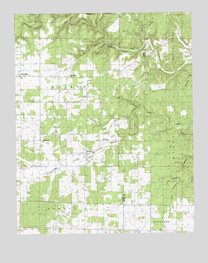
Peace Valley, MO USGS Topographic Map
Click on map above to begin viewing in our Map Viewer.

This topographic map contains these locations and features:
Feature Name Type Latitude Longitude GNIS ID View Map
Bennett ChapelChurchN36.8026°W91.7313°713948View Map
Blowing SpringsSpringN36.8576°W91.6829°714392View Map
Cane HollowValleyN36.8587°W91.6582°715352View Map
Chalk Hole ValleyValleyN36.7984°W91.7024°735111View Map
County HollowValleyN36.8612°W91.6857°735567View Map
Courtois HillsAreaN36.8748°W91.6254°754098View Map
Dalton School (historical)SchoolN36.8731°W91.6410°735573View Map
FanchonPopulated PlaceN36.7951°W91.7004°740845View Map
Ferguson School (historical)SchoolN36.8381°W91.6946°735107View Map
Forest View School (historical)SchoolN36.7717°W91.6940°718100View Map
Gunters ValleyValleyN36.7973°W91.6890°750179View Map
Hilltop Holiness ChurchChurchN36.8395°W91.7465°730000View Map
Hughlett School (historical)SchoolN36.7995°W91.6765°719979View Map
Little CreekStreamN36.8659°W91.6909°750762View Map
Lost Pond HollowValleyN36.7781°W91.6343°721599View Map
Lost Pond SchoolSchoolN36.7548°W91.6560°721600View Map
Peace ValleyPopulated PlaceN36.8745°W91.7313°724138View Map
Peace Valley - White Church Volunteer Station 2BuildingN36.8398°W91.7434°2620319View Map
Peace Valley High SchoolSchoolN36.8387°W91.7454°735110View Map
Peace Valley Post OfficePost OfficeN36.8395°W91.7465°2783160View Map
Pilgrims Rest ChurchChurchN36.8031°W91.6851°743131View Map
Riggs School (historical)SchoolN36.7992°W91.7140°735108View Map
Snow HollowValleyN36.8576°W91.6829°726673View Map
Walnut Sink CreekStreamN36.8214°W91.6604°735109View Map
Walnut Sink HollowValleyN36.8392°W91.7110°728331View Map

Note: Coordinates in the location and feature list above are referenced to NAD83 datum.


Copyright (C) 2008-2025 Ryan Niemi / Sunset Dynamics ... All Rights Reserved