TopoQuest Logo
Do you find TopoQuest useful?
Help keep TopoQuest running and adding new maps/features by donating!
Bitcoin:  19c7KJd3qBynnjoSw5npx9KScwjBe4ifkT
Litecoin:  LXs6TkuXGGXo1vDsWCkWVdjQX94eUKd6ui
Home View Maps Find Maps Find Places Resources & Links


West Plains, Missouri Topographic Map

USGS Map Title: West Plains, MO
USGS Map MRC: 36091F7
DRG (GeoTIFF) Download: o36091f7.tif


Neighboring USGS Topographic Map Quads:


  Pomona, MO  
36091G8
 

  White Church, MO  
36091G7
 

  Peace Valley, MO  
36091G6
 

  South Fork, MO  
36091F8
 

  West Plains, MO  
36091F7
 

  Brandsville, MO  
36091F6
 

  Moody, MO  
36091E8
 

  Lanton, MO  
36091E7
 

  Koshkonong, MO  
36091E6


Map MRC Location:

N37°
W92°
N37°
W91°
H8 H7 H6 H5 H4 H3 H2 H1
G8 G7 G6 G5 G4 G3 G2 G1
F8 F7 F6 F5 F4 F3 F2 F1
E8 E7 E6 E5 E4 E3 E2 E1
D8 D7 D6 D5 D4 D3 D2 D1
C8 C7 C6 C5 C4 C3 C2 C1
B8 B7 B6 B5 B4 B3 B2 B1
A8 A7 A6 A5 A4 A3 A2 A1
N36°
W92°
N36°
W91°

West Plains, MO USGS 1:24K Topographic Map Preview:
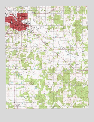
West Plains, MO USGS Topographic Map
Click on map above to begin viewing in our Map Viewer.

This topographic map contains these locations and features:
Feature Name Type Latitude Longitude GNIS ID View Map
American Legion FieldParkN36.7326°W91.8463°713259View Map
Big Greasy CreekStreamN36.7276°W91.7501°735512View Map
Bratton DamDamN36.6584°W91.8501°765300View Map
Burton CreekStreamN36.7398°W91.8676°738504View Map
Butler ParkParkN36.7320°W91.8657°743128View Map
Carmichal SchoolSchoolN36.7328°W91.8588°743124View Map
Carson (historical)Populated PlaceN36.7098°W91.8032°735128View Map
ChapinPopulated PlaceN36.6906°W91.7715°740737View Map
Chapin BranchStreamN36.6870°W91.7724°715731View Map
Chapin CemeteryCemeteryN36.6781°W91.7685°754138View Map
City of West PlainsCivilN36.7378°W91.8680°2397273View Map
CottbusPopulated PlaceN36.6498°W91.8482°740589View Map
Cottbus Post OfficePost OfficeN36.6498°W91.8482°760030View Map
Evergreen ChurchChurchN36.6517°W91.8307°717691View Map
Evergreen School (historical)SchoolN36.6387°W91.8171°717694View Map
Foster SchoolSchoolN36.7364°W91.8515°743125View Map
FrankvillePopulated PlaceN36.6973°W91.8057°735127View Map
Glenwood SchoolSchoolN36.6745°W91.8604°743112View Map
Greenwood SchoolSchoolN36.6898°W91.8282°718845View Map
Hill Top ChapelChurchN36.6290°W91.8582°743111View Map
Hines HillSummitN36.7228°W91.8532°735126View Map
Howell County CemeteryCemeteryN36.6831°W91.8099°743115View Map
Howell County Sheriff's OfficeBuildingN36.7429°W91.8691°2752469View Map
Howell County Welfare Home (historical)BuildingN36.6831°W91.8013°735123View Map
Howell Valley AirportAirportN36.7078°W91.8042°758994View Map
Howell Valley CemeteryCemeteryN36.7145°W91.7954°735125View Map
Howell Valley ChurchChurchN36.7153°W91.7957°735658View Map
Howell Valley SchoolSchoolN36.7131°W91.8176°743117View Map
James P. Harlin MuseumBuildingN36.7267°W91.8551°743123View Map
Kennedy DamDamN36.6251°W91.8301°765301View Map
KWPM-AM (West Plains)TowerN36.7412°W91.8338°759257View Map
Langston School (historical)SchoolN36.7123°W91.7963°720811View Map
LeaderLocaleN36.6290°W91.7738°740590View Map
Leader Post OfficePost OfficeN36.6290°W91.7738°760041View Map
Lincoln ParkParkN36.7417°W91.8515°743126View Map
Little Greasy CreekStreamN36.6834°W91.7568°721243View Map
Martin Lake DamDamN36.6501°W91.8301°765302View Map
Missouri Department of Conservation Forestry Ozark Regional Field Fire Office West PlainsBuildingN36.7421°W91.8465°2620629View Map
Missouri State University-West PlainsSchoolN36.7289°W91.8607°743127View Map
Mononame 772 DamDamN36.6567°W91.8635°764765View Map
Mount Pleasant SchoolSchoolN36.6315°W91.7504°722870View Map
Mustion CreekStreamN36.6942°W91.7838°723089View Map
Mustion HollowValleyN36.7048°W91.8049°735124View Map
North Fork Howell CreekStreamN36.7337°W91.8538°754359View Map
Oak Lawn CemeteryCemeteryN36.7237°W91.8421°723679View Map
Orchard Grove SchoolSchoolN36.6326°W91.8618°723841View Map
Park-way Shopping CenterLocaleN36.7389°W91.8699°736097View Map
Parker CemeteryCemeteryN36.6731°W91.8471°743113View Map
Peoples ParkParkN36.7303°W91.8646°724218View Map
Reese SchoolSchoolN36.7264°W91.8471°743122View Map
Round PondLakeN36.7254°W91.7620°725609View Map
Saint Marys SchoolSchoolN36.7189°W91.8340°743121View Map
South Fork Howell CreekStreamN36.7337°W91.8538°754356View Map
Southern Hills ChurchChurchN36.6956°W91.8126°743114View Map
Southern Hills Shopping CenterLocaleN36.7312°W91.8526°736098View Map
Spradlin CreekStreamN36.7181°W91.8160°726878View Map
Summers AdditionPopulated PlaceN36.7231°W91.8504°735129View Map
Sylvan SchoolSchoolN36.6776°W91.8707°727422View Map
Township of HowellCivilN36.7064°W91.8160°766785View Map
Twin PondsLakeN36.6679°W91.8559°727927View Map
Valley View ChurchChurchN36.6753°W91.7765°743116View Map
Valley View SchoolSchoolN36.6789°W91.7815°728106View Map
West PlainsPopulated PlaceN36.7281°W91.8524°740027View Map
West Plains Fire and Rescue Station 1 HeadquartersBuildingN36.7295°W91.8499°2621042View Map
West Plains High SchoolSchoolN36.7339°W91.8449°743120View Map
West Plains Junior High SchoolSchoolN36.7339°W91.8418°743118View Map
West Plains Municipal Airport (historical)AirportN36.7451°W91.8638°758996View Map
West Plains Post OfficePost OfficeN36.7295°W91.8523°2782735View Map
West Plains Voc-Tech SchoolSchoolN36.7342°W91.8440°743119View Map

Note: Coordinates in the location and feature list above are referenced to NAD83 datum.


Copyright (C) 2008-2024 Ryan Niemi / Sunset Dynamics ... All Rights Reserved