TopoQuest Logo
Do you find TopoQuest useful?
Help keep TopoQuest running and adding new maps/features by donating!
Bitcoin:  19c7KJd3qBynnjoSw5npx9KScwjBe4ifkT
Litecoin:  LXs6TkuXGGXo1vDsWCkWVdjQX94eUKd6ui
Home View Maps Find Maps Find Places Resources & Links


White Church, Missouri Topographic Map

USGS Map Title: White Church, MO
USGS Map MRC: 36091G7
DRG (GeoTIFF) Download: o36091g7.tif


Neighboring USGS Topographic Map Quads:


  Willow Springs South, MO  
36091H8
 

  Trask, MO  
36091H7
 

  Mountain View, MO  
36091H6
 

  Pomona, MO  
36091G8
 

  White Church, MO  
36091G7
 

  Peace Valley, MO  
36091G6
 

  South Fork, MO  
36091F8
 

  West Plains, MO  
36091F7
 

  Brandsville, MO  
36091F6


Map MRC Location:

N37°
W92°
N37°
W91°
H8 H7 H6 H5 H4 H3 H2 H1
G8 G7 G6 G5 G4 G3 G2 G1
F8 F7 F6 F5 F4 F3 F2 F1
E8 E7 E6 E5 E4 E3 E2 E1
D8 D7 D6 D5 D4 D3 D2 D1
C8 C7 C6 C5 C4 C3 C2 C1
B8 B7 B6 B5 B4 B3 B2 B1
A8 A7 A6 A5 A4 A3 A2 A1
N36°
W92°
N36°
W91°

White Church, MO USGS 1:24K Topographic Map Preview:
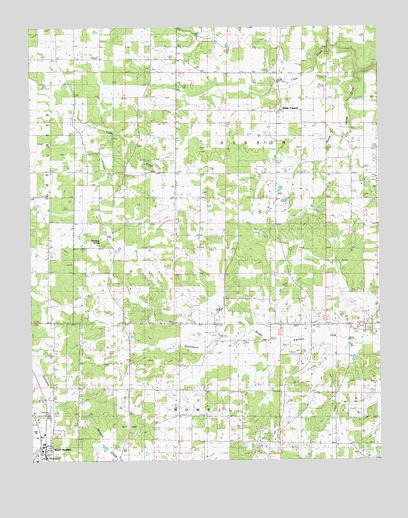
White Church, MO USGS Topographic Map
Click on map above to begin viewing in our Map Viewer.

This topographic map contains these locations and features:
Feature Name Type Latitude Longitude GNIS ID View Map
Antioch ChurchChurchN36.8728°W91.8307°713323View Map
Barnett School (historical)SchoolN36.7876°W91.7593°713684View Map
Brower School (historical)SchoolN36.8292°W91.8590°714754View Map
Buck ParkParkN36.7601°W91.8404°743070View Map
Dripping SpringSpringN36.8134°W91.8501°738500View Map
Dripping Springs CemeteryCemeteryN36.8174°W91.8498°2702330View Map
Dripping Springs ChurchChurchN36.8176°W91.8488°717054View Map
Galloway CreekStreamN36.7523°W91.8715°754361View Map
Galloway School (historical)SchoolN36.7531°W91.8690°718321View Map
Highland SchoolSchoolN36.7998°W91.8468°719575View Map
Macke Church (historical)ChurchN36.8659°W91.8657°721726View Map
New Hope CemeteryCemeteryN36.8306°W91.7543°735105View Map
New Hope ChurchChurchN36.8303°W91.7540°723241View Map
Oak Grove SchoolSchoolN36.7539°W91.7615°723591View Map
Peace Valley - White Church Volunteer Station 1 HeadquartersBuildingN36.8504°W91.7869°2620553View Map
Peace Valley DraftValleyN36.8620°W91.7571°724140View Map
Pleasant View CemeteryCemeteryN36.7901°W91.8260°724637View Map
Pleasant View Church (historical)ChurchN36.7898°W91.8249°735106View Map
Pleasant View School (historical)SchoolN36.7556°W91.8179°724648View Map
Potts School (historical)SchoolN36.8517°W91.8221°724799View Map
Schneider SchoolSchoolN36.7953°W91.8054°726109View Map
Smith ChapelChurchN36.7551°W91.7754°726607View Map
Township of SissonCivilN36.8387°W91.7632°766789View Map
West Plains Police DepartmentBuildingN36.7549°W91.8716°2752436View Map
White ChurchPopulated PlaceN36.8503°W91.7863°728727View Map
White Church ChurchChurchN36.8506°W91.7871°735103View Map
White Church School (historical)SchoolN36.8503°W91.7857°735104View Map

Note: Coordinates in the location and feature list above are referenced to NAD83 datum.


Copyright (C) 2008-2025 Ryan Niemi / Sunset Dynamics ... All Rights Reserved