TopoQuest Logo
Do you find TopoQuest useful?
Help keep TopoQuest running and adding new maps/features by donating!
Bitcoin:  19c7KJd3qBynnjoSw5npx9KScwjBe4ifkT
Litecoin:  LXs6TkuXGGXo1vDsWCkWVdjQX94eUKd6ui
Home View Maps Find Maps Find Places Resources & Links


Faithorn, Michigan Topographic Map

USGS Map Title: Faithorn, MI
USGS Map MRC: 45087F7
DRG (GeoTIFF) Download: o45087f7.tif


Neighboring USGS Topographic Map Quads:


  Norway, MI  
45087G8
 

  Vulcan, MI  
45087G7
 

  Waucedah, MI  
45087G6
 

  Pembine, WI  
45087F8
 

  Faithorn, MI  
45087F7
 

  Cunard, MI  
45087F6
 

  Amberg, WI  
45087E8
 

  Miscauno Island, WI  
45087E7
 

  Banat, MI  
45087E6


Map MRC Location:

N46°
W88°
N46°
W87°
H8 H7 H6 H5 H4 H3 H2 H1
G8 G7 G6 G5 G4 G3 G2 G1
F8 F7 F6 F5 F4 F3 F2 F1
E8 E7 E6 E5 E4 E3 E2 E1
D8 D7 D6 D5 D4 D3 D2 D1
C8 C7 C6 C5 C4 C3 C2 C1
B8 B7 B6 B5 B4 B3 B2 B1
A8 A7 A6 A5 A4 A3 A2 A1
N45°
W88°
N45°
W87°

Faithorn, MI USGS 1:24K Topographic Map Preview:
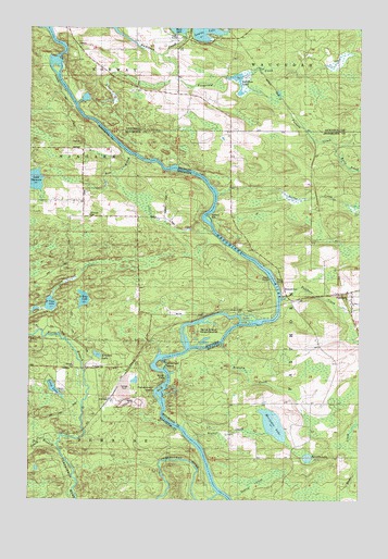
Faithorn, MI USGS Topographic Map
Click on map above to begin viewing in our Map Viewer.

This topographic map contains these locations and features:
Feature Name Type Latitude Longitude GNIS ID View Map
Bear CreekStreamN45.7163°W87.8379°1561350View Map
Brandts CreekStreamN45.6666°W87.8012°621890View Map
Brandts LakeLakeN45.6362°W87.7694°621891View Map
Chapman School (historical)SchoolN45.7022°W87.8551°1876838View Map
Earle BrookStreamN45.7194°W87.7590°625107View Map
Echo LakeLakeN45.6781°W87.8545°1564425View Map
Emebonwon DamDamN45.6552°W87.8226°625555View Map
FaithornPopulated PlaceN45.6797°W87.7521°625807View Map
Faithorn CreekStreamN45.6780°W87.7796°625808View Map
Faithorn Emergency SquadBuildingN45.6794°W87.7533°2662011View Map
Faithorn Post Office (historical)Post OfficeN45.6797°W87.7519°2353173View Map
Faithorn StationLocaleN45.6800°W87.7528°2353174View Map
Faithorn Township Volunteer Fire DepartmentBuildingN45.6794°W87.7533°2626971View Map
Faithorn Township Volunteer Fire Department StorageBuildingN45.6801°W87.7586°2626915View Map
Fitzgerald CreekStreamN45.7430°W87.8257°626100View Map
Grangers PointCapeN45.7005°W87.8076°627138View Map
Green IslandIslandN45.6733°W87.7910°1565812View Map
Harter CreekStreamN45.7064°W87.8037°627880View Map
Hillcrest CemeteryCemeteryN45.7005°W87.8529°1566432View Map
Ile Le GrandIslandN45.6697°W87.8076°1566854View Map
Kading CreekStreamN45.6261°W87.7990°629431View Map
Kimlark LakeLakeN45.6633°W87.8491°1567489View Map
KremlinPopulated PlaceN45.6508°W87.8448°1577684View Map
Lake Mary ParkParkN45.7478°W87.8194°2128578View Map
Lake ShannonLakeN45.7095°W87.8735°1573965View Map
Long IslandIslandN45.6725°W87.7929°1568532View Map
Long LakeLakeN45.6545°W87.8657°1568561View Map
Louise LakeLakeN45.7490°W87.8093°631132View Map
Merryman LakeLakeN45.6450°W87.7824°632144View Map
Mission ChapelChurchN45.6991°W87.8554°1569606View Map
North Branch Pemebonwon RiverStreamN45.6389°W87.8654°1570386View Map
Nose Peak IslandIslandN45.6608°W87.8260°1570566View Map
Pemebonwon Dam (historical)DamN45.6550°W87.8235°1571164View Map
Pemebonwon IslandsIslandN45.6541°W87.8265°1571165View Map
Pemebonwon RiverStreamN45.6269°W87.8032°1571166View Map
Quiver FallsFallsN45.6548°W87.8239°635575View Map
Red Dam LakeLakeN45.7370°W87.7971°635709View Map
Riverside CemeteryCemeteryN45.6811°W87.7789°2099847View Map
Saint Marys ChurchCemeteryN45.6773°W87.7533°2099846View Map
Seynor CreekStreamN45.6411°W87.8129°637620View Map
South Branch Pemebonwon RiverStreamN45.6394°W87.8648°1574410View Map
Sturgeon Falls (historical)FallsN45.7422°W87.8648°1876874View Map
Sturgeon Falls FlowageReservoirN45.7415°W87.8633°2784449View Map
Turners CreekStreamN45.7330°W87.7935°1615192View Map
Twin LakeLakeN45.6767°W87.8670°1575785View Map

Note: Coordinates in the location and feature list above are referenced to NAD83 datum.


Copyright (C) 2008-2025 Ryan Niemi / Sunset Dynamics ... All Rights Reserved