TopoQuest Logo
Do you find TopoQuest useful?
Help keep TopoQuest running and adding new maps/features by donating!
Bitcoin:  19c7KJd3qBynnjoSw5npx9KScwjBe4ifkT
Litecoin:  LXs6TkuXGGXo1vDsWCkWVdjQX94eUKd6ui
Home View Maps Find Maps Find Places Resources & Links


Miscauno Island, Wisconsin Topographic Map

USGS Map Title: Miscauno Island, WI
USGS Map MRC: 45087E7
DRG (GeoTIFF) Download: o45087e7.tif


Neighboring USGS Topographic Map Quads:


  Pembine, WI  
45087F8
 

  Faithorn, MI  
45087F7
 

  Cunard, MI  
45087F6
 

  Amberg, WI  
45087E8
 

  Miscauno Island, WI  
45087E7
 

  Banat, MI  
45087E6
 

  Wausaukee North, WI  
45087D8
 

  Resort Lake, MI  
45087D7
 

  Swanson, MI  
45087D6


Map MRC Location:

N46°
W88°
N46°
W87°
H8 H7 H6 H5 H4 H3 H2 H1
G8 G7 G6 G5 G4 G3 G2 G1
F8 F7 F6 F5 F4 F3 F2 F1
E8 E7 E6 E5 E4 E3 E2 E1
D8 D7 D6 D5 D4 D3 D2 D1
C8 C7 C6 C5 C4 C3 C2 C1
B8 B7 B6 B5 B4 B3 B2 B1
A8 A7 A6 A5 A4 A3 A2 A1
N45°
W88°
N45°
W87°

Miscauno Island, WI USGS 1:24K Topographic Map Preview:
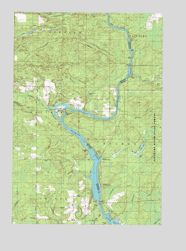
Miscauno Island, WI USGS Topographic Map
Click on map above to begin viewing in our Map Viewer.

This topographic map contains these locations and features:
Feature Name Type Latitude Longitude GNIS ID View Map
Chalk HillSummitN45.5427°W87.8023°623041View Map
Chalk Hill BridgeBridgeN45.5122°W87.8015°1876837View Map
Chalk Hill DamDamN45.5136°W87.8029°1562933View Map
Chalk Hill DamDamN45.5136°W87.8021°623042View Map
Chalk Hill FlowageReservoirN45.5139°W87.8025°2784306View Map
Chalk Hill Recreational Area FourParkN45.5394°W87.8019°2099844View Map
Chalk Hill Recreational Area ThreeParkN45.5236°W87.8006°2099842View Map
Dawn LakeLakeN45.5463°W87.7662°624365View Map
Goodman BrookStreamN45.5394°W87.8026°626947View Map
McAllister CreekStreamN45.5675°W87.8187°1569159View Map
McAllister PondReservoirN45.5770°W87.8120°1569161View Map
Miscauna CreekStreamN45.5883°W87.7757°632486View Map
Miscauno CreekStreamN45.5689°W87.8404°1569597View Map
Miscauno IslandIslandN45.5661°W87.8362°1569598View Map
Mullaney CreekStreamN45.5894°W87.7787°1577240View Map
Pemene CreekStreamN45.5880°W87.7751°634579View Map
Pemene FallsFallsN45.5938°W87.7771°634580View Map
Sawbridge CreekStreamN45.5052°W87.7923°637288View Map
Shangrila AirportAirportN45.5825°W87.8438°1581880View Map
Silver CreekStreamN45.6236°W87.8329°1577436View Map
Sunset LakeLakeN45.5418°W87.7701°639095View Map
White Pine HavenPopulated PlaceN45.5636°W87.7946°1876876View Map
White Rapids ChurchChurchN45.5030°W87.8559°1576652View Map
White Rapids School (historical)SchoolN45.5064°W87.8243°1876877View Map

Note: Coordinates in the location and feature list above are referenced to NAD83 datum.


Copyright (C) 2008-2024 Ryan Niemi / Sunset Dynamics ... All Rights Reserved