TopoQuest Logo
Do you find TopoQuest useful?
Help keep TopoQuest running and adding new maps/features by donating!
Bitcoin:  19c7KJd3qBynnjoSw5npx9KScwjBe4ifkT
Litecoin:  LXs6TkuXGGXo1vDsWCkWVdjQX94eUKd6ui
Home View Maps Find Maps Find Places Resources & Links


Palmer, Missouri Topographic Map

USGS Map Title: Palmer, MO
USGS Map MRC: 37090G8
DRG (GeoTIFF) Download: o37090g8.tif


Neighboring USGS Topographic Map Quads:


  Berryman, MO  
37091H1
 

  Shirley, MO  
37090H8
 

  Potosi, MO  
37090H7
 

  Courtois, MO  
37091G1
 

  Palmer, MO  
37090G8
 

  Belgrade, MO  
37090G7
 

  Viburnum East, MO  
37091F1
 

  Johnson Mountain, MO  
37090F8
 

  Banner, MO  
37090F7


Map MRC Location:

N38°
W91°
N38°
W90°
H8 H7 H6 H5 H4 H3 H2 H1
G8 G7 G6 G5 G4 G3 G2 G1
F8 F7 F6 F5 F4 F3 F2 F1
E8 E7 E6 E5 E4 E3 E2 E1
D8 D7 D6 D5 D4 D3 D2 D1
C8 C7 C6 C5 C4 C3 C2 C1
B8 B7 B6 B5 B4 B3 B2 B1
A8 A7 A6 A5 A4 A3 A2 A1
N37°
W91°
N37°
W90°

Palmer, MO USGS 1:24K Topographic Map Preview:
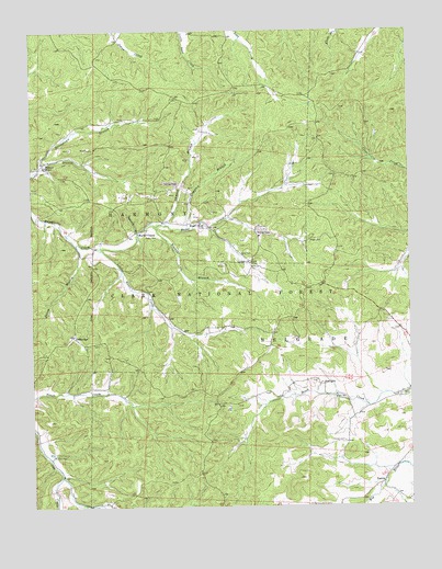
Palmer, MO USGS Topographic Map
Click on map above to begin viewing in our Map Viewer.

This topographic map contains these locations and features:
Feature Name Type Latitude Longitude GNIS ID View Map
Bit Lead DiggingsMineN37.8462°W90.9907°736824View Map
Blackwell Lead DiggingsMineN37.8439°W90.9874°736823View Map
Booth Lead DiggingsMineN37.8439°W90.9818°736822View Map
Clemins Lead DiggingsMineN37.8428°W90.9585°736821View Map
Cochran Lead DiggingsMineN37.8581°W90.9832°736820View Map
Compton BranchStreamN37.8228°W90.9493°749440View Map
Daylight Lead DiggingsMineN37.8412°W90.9479°736819View Map
DelbridgePopulated PlaceN37.7948°W90.9868°749618View Map
English Lead DiggingsMineN37.8714°W90.9979°736818View Map
Flint Hill Lead DiggingsMineN37.8487°W90.9949°736817View Map
Gopher Lead DiggingsMineN37.8225°W90.9229°736816View Map
Grave-Yard Lead DiggingsMineN37.8575°W90.9449°736815View Map
Gudaitis LakeReservoirN37.8094°W90.8941°764541View Map
Gudaitis Lake DamDamN37.8100°W90.8918°764540View Map
Hazel Creek CemeteryCemeteryN37.8245°W90.9440°1759794View Map
Hazel Creek ChurchChurchN37.8245°W90.9440°750271View Map
Horton CemeteryCemeteryN37.7670°W90.8973°750402View Map
Horton School (historical)SchoolN37.7628°W90.8982°736829View Map
Horton TownPopulated PlaceN37.7764°W90.9251°736825View Map
Howell LakeReservoirN37.8384°W90.9479°754964View Map
Howell Mine DamDamN37.8334°W90.9501°764538View Map
Hypocrite Lead DiggingsMineN37.8237°W90.9249°736813View Map
Ishmael BranchStreamN37.8239°W90.9557°750471View Map
Ismael Lead DiggingsMineN37.8464°W90.9443°736814View Map
Jenkins Family CemeteryCemeteryN37.8137°W90.9271°750504View Map
Little Hazel CreekStreamN37.8178°W90.9785°750771View Map
Lizzie ChurchChurchN37.8142°W90.9276°750810View Map
Madden Hill Lead DiggingsMineN37.8592°W90.9979°736812View Map
Marler ChapelChurchN37.8220°W90.9649°750938View Map
McClain CemeteryCemeteryN37.7637°W90.9940°750985View Map
Montgomery Lead DiggingsMineN37.8606°W90.9949°736811View Map
Mount Zion Church (historical)ChurchN37.7670°W90.8962°1986047View Map
PalmerPopulated PlaceN37.8395°W90.9960°751477View Map
Palmer CemeteryCemeteryN37.8395°W90.9990°1759795View Map
Palmer LakeReservoirN37.8216°W90.9175°758409View Map
Palmer Mine DamDamN37.8234°W90.9268°764296View Map
Palmer School (historical)SchoolN37.8398°W90.9962°736810View Map
Parole LakeReservoirN37.8509°W90.9725°758408View Map
Parole Lead DiggingsMineN37.8623°W90.9621°736809View Map
Parole Mine DamDamN37.8500°W90.9785°764297View Map
PeoriaPopulated PlaceN37.7562°W90.8843°751545View Map
Peru Lead DiggingsMineN37.8314°W90.9671°736808View Map
Pigeon-Roost Lead MineMineN37.8620°W90.9857°736807View Map
Pine City School (historical)SchoolN37.8423°W90.9126°736826View Map
Piney BranchStreamN37.8192°W90.9854°751631View Map
Schnelle Lake DamDamN37.7634°W90.9051°765127View Map
Scott CemeteryCemeteryN37.8162°W90.9301°752067View Map
Seymour Branch Hazel CreekStreamN37.8250°W90.9599°752084View Map
Sitton CemeteryCemeteryN37.8212°W90.9626°752185View Map
Sitton School (historical)SchoolN37.8220°W90.9654°736827View Map
Strawberry Lead DiggingsMineN37.8656°W90.9799°736806View Map
Stringtown BranchStreamN37.8398°W90.9974°752401View Map
SunlightPopulated PlaceN37.7817°W90.9051°752431View Map
Sunlight CemeteryCemeteryN37.7781°W90.9001°1759793View Map
Sunlight ChurchChurchN37.7784°W90.8999°1985934View Map
Sweassey Lead DiggingsMineN37.8320°W90.9618°736805View Map
Sweezy BranchStreamN37.8203°W90.9649°752467View Map
Tarkey Lead DiggingsMineN37.8303°W90.9115°736804View Map
Thomas School (historical)SchoolN37.7970°W90.8907°736828View Map
Tiff Lookout TowerTowerN37.8584°W90.9329°754051View Map
Township of BelgradeCivilN37.7995°W90.8770°767505View Map
Trace Creek TrailTrailN37.7773°W90.9693°754379View Map
Trash Lead DiggingsMineN37.8625°W90.9726°736803View Map
Turkey Hill Lead DiggingsMineN37.8573°W90.9643°736802View Map
Wright CemeteryCemeteryN37.8200°W90.9085°752983View Map

Note: Coordinates in the location and feature list above are referenced to NAD83 datum.


Copyright (C) 2008-2024 Ryan Niemi / Sunset Dynamics ... All Rights Reserved