TopoQuest Logo
Do you find TopoQuest useful?
Help keep TopoQuest running and adding new maps/features by donating!
Bitcoin:  19c7KJd3qBynnjoSw5npx9KScwjBe4ifkT
Litecoin:  LXs6TkuXGGXo1vDsWCkWVdjQX94eUKd6ui
Home View Maps Find Maps Find Places Resources & Links


Petroleum, Indiana Topographic Map

USGS Map Title: Petroleum, IN
USGS Map MRC: 40085E2
DRG (GeoTIFF) Download: o40085e2.tif


Neighboring USGS Topographic Map Quads:


  Liberty Center, IN  
40085F3
 

  Bluffton, IN  
40085F2
 

  Linn Grove, IN  
40085F1
 

  Montpelier, IN  
40085E3
 

  Petroleum, IN  
40085E2
 

  Domestic, IN  
40085E1
 

  Hartford City East, IN  
40085D3
 

  Pennville, IN  
40085D2
 

  Blaine, IN  
40085D1


Map MRC Location:

N41°
W86°
N41°
W85°
H8 H7 H6 H5 H4 H3 H2 H1
G8 G7 G6 G5 G4 G3 G2 G1
F8 F7 F6 F5 F4 F3 F2 F1
E8 E7 E6 E5 E4 E3 E2 E1
D8 D7 D6 D5 D4 D3 D2 D1
C8 C7 C6 C5 C4 C3 C2 C1
B8 B7 B6 B5 B4 B3 B2 B1
A8 A7 A6 A5 A4 A3 A2 A1
N40°
W86°
N40°
W85°

Petroleum, IN USGS 1:24K Topographic Map Preview:
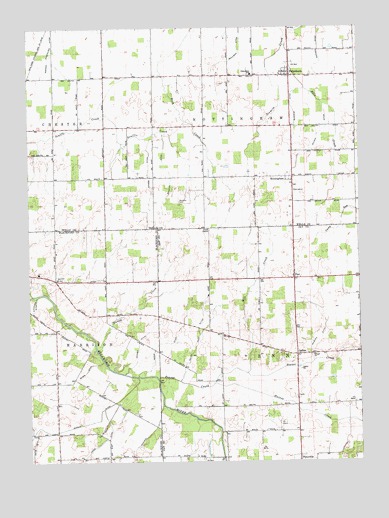
Petroleum, IN USGS Topographic Map
Click on map above to begin viewing in our Map Viewer.

This topographic map contains these locations and features:
Feature Name Type Latitude Longitude GNIS ID View Map
BalbecPopulated PlaceN40.5309°W85.1489°430443View Map
Beaver CreekStreamN40.5242°W85.2016°430674View Map
Beckler DitchCanalN40.5839°W85.1972°430693View Map
Bills CreekStreamN40.6200°W85.1522°431084View Map
Bloxsom CemeteryCemeteryN40.5750°W85.1933°431211View Map
Bloxsom DitchCanalN40.6009°W85.1491°431212View Map
Chaney DitchCanalN40.5345°W85.2089°432398View Map
FiatPopulated PlaceN40.5534°W85.1500°434469View Map
Gieger DitchCanalN40.5259°W85.2289°435057View Map
Gilead ChurchChurchN40.5309°W85.1427°435070View Map
Haines CreekStreamN40.5225°W85.1802°435594View Map
Hickman DitchCanalN40.5000°W85.2105°436093View Map
McClain DitchCanalN40.5398°W85.1383°438790View Map
Mill CreekStreamN40.5256°W85.1680°439150View Map
Miller Pugh DitchCanalN40.5381°W85.1864°439224View Map
Mulligan DitchCanalN40.6156°W85.1733°439872View Map
NottinghamPopulated PlaceN40.5812°W85.1502°440360View Map
Nottingham Township Volunteer Fire DepartmentBuildingN40.6109°W85.1544°2626449View Map
Oswalt Hog FarmLocaleN40.5019°W85.2344°2710717View Map
PetroleumPopulated PlaceN40.6114°W85.1508°441064View Map
Petroleum SchoolSchoolN40.6114°W85.1655°441065View Map
Sharpe DitchCanalN40.5848°W85.2047°443310View Map
Shinn DitchCanalN40.5525°W85.2294°443409View Map
Shook DitchCanalN40.5367°W85.1939°443441View Map
Slocum DitchCanalN40.5098°W85.2375°443624View Map
Stoney CreekStreamN40.5325°W85.2250°444219View Map
Township of NottinghamCivilN40.6112°W85.1453°453680View Map
Township of PennCivilN40.5236°W85.1536°453712View Map
Union ChapelChurchN40.5673°W85.1822°445090View Map
Warner DitchCanalN40.6195°W85.1397°445473View Map
Wilson DitchCanalN40.5931°W85.1405°446141View Map

Note: Coordinates in the location and feature list above are referenced to NAD83 datum.


Copyright (C) 2008-2025 Ryan Niemi / Sunset Dynamics ... All Rights Reserved