TopoQuest Logo
Do you find TopoQuest useful?
Help keep TopoQuest running and adding new maps/features by donating!
Bitcoin:  19c7KJd3qBynnjoSw5npx9KScwjBe4ifkT
Litecoin:  LXs6TkuXGGXo1vDsWCkWVdjQX94eUKd6ui
Home View Maps Find Maps Find Places Resources & Links


Montpelier, Indiana Topographic Map

USGS Map Title: Montpelier, IN
USGS Map MRC: 40085E3
DRG (GeoTIFF) Download: o40085e3.tif


Neighboring USGS Topographic Map Quads:


  Warren, IN  
40085F4
 

  Liberty Center, IN  
40085F3
 

  Bluffton, IN  
40085F2
 

  Roll, IN  
40085E4
 

  Montpelier, IN  
40085E3
 

  Petroleum, IN  
40085E2
 

  Hartford City West, IN  
40085D4
 

  Hartford City East, IN  
40085D3
 

  Pennville, IN  
40085D2


Map MRC Location:

N41°
W86°
N41°
W85°
H8 H7 H6 H5 H4 H3 H2 H1
G8 G7 G6 G5 G4 G3 G2 G1
F8 F7 F6 F5 F4 F3 F2 F1
E8 E7 E6 E5 E4 E3 E2 E1
D8 D7 D6 D5 D4 D3 D2 D1
C8 C7 C6 C5 C4 C3 C2 C1
B8 B7 B6 B5 B4 B3 B2 B1
A8 A7 A6 A5 A4 A3 A2 A1
N40°
W86°
N40°
W85°

Montpelier, IN USGS 1:24K Topographic Map Preview:
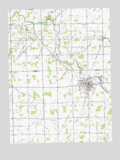
Montpelier, IN USGS Topographic Map
Click on map above to begin viewing in our Map Viewer.

This topographic map contains these locations and features:
Feature Name Type Latitude Longitude GNIS ID View Map
Asbury ChapelChurchN40.5817°W85.3722°430294View Map
Bugh DitchCanalN40.5328°W85.3519°431783View Map
Burchard Foreman DitchCanalN40.5420°W85.3730°431826View Map
Chester Center SchoolSchoolN40.6098°W85.2791°432452View Map
Chester Township Volunteer Fire DepartmentBuildingN40.6053°W85.2788°2626458View Map
City of MontpelierCivilN40.5494°W85.2874°2395388View Map
Custard DrainStreamN40.6225°W85.3605°433264View Map
Dick DrainStreamN40.5795°W85.3139°433535View Map
Dutro DitchCanalN40.5153°W85.3491°433818View Map
East CreekStreamN40.5581°W85.2758°433878View Map
Erie Stone QuarryMineN40.5625°W85.2742°2649423View Map
Fairview ChurchChurchN40.5081°W85.3700°434332View Map
Five PointsPopulated PlaceN40.5817°W85.3200°434541View Map
Friends ChurchChurchN40.5984°W85.2589°434849View Map
Gary Stotts DrainStreamN40.5989°W85.3555°434982View Map
Groff DitchCanalN40.5284°W85.3678°435516View Map
Haag DitchCanalN40.5034°W85.3572°435573View Map
Hawkins DitchCanalN40.5459°W85.3047°435904View Map
JeffPopulated PlaceN40.6053°W85.3530°436954View Map
KeystonePopulated PlaceN40.5956°W85.2594°437280View Map
Lake Blue WaterLakeN40.5584°W85.2625°431254View Map
Lost LakeLakeN40.6107°W85.3704°438327View Map
MatamorasPopulated PlaceN40.5542°W85.2630°438709View Map
McGeath DitchCanalN40.5170°W85.3186°438871View Map
McMammon DitchCanalN40.5123°W85.3277°438918View Map
Miller CemeteryCemeteryN40.6109°W85.3069°439183View Map
MontpelierPopulated PlaceN40.5539°W85.2775°439371View Map
Montpelier - Harrison Township Volunteer Fire Department Station 1BuildingN40.5550°W85.2813°2626063View Map
Montpelier - Harrison Township Volunteer Fire Department Station 2BuildingN40.5472°W85.2804°2626162View Map
Montpelier Elementary SchoolSchoolN40.5523°W85.2750°446551View Map
Montpelier Police DepartmentBuildingN40.5546°W85.2831°2758402View Map
Odd Fellows CemeteryCemeteryN40.5648°W85.2872°440502View Map
Prairie CreekStreamN40.6137°W85.3544°441548View Map
Rhoton DitchCanalN40.5556°W85.2983°441932View Map
Rinard ProngCanalN40.5217°W85.3269°442044View Map
Schwartzkopf DitchCanalN40.5250°W85.2877°443124View Map
Scuffle CreekStreamN40.5914°W85.3116°443179View Map
Shadle DrainStreamN40.6117°W85.3433°443241View Map
Simonton DitchCanalN40.5375°W85.2561°443525View Map
Snow CemeteryCemeteryN40.6209°W85.3105°443734View Map
Snow DrainStreamN40.6237°W85.2611°443738View Map
South Salem ChurchChurchN40.5962°W85.3530°443846View Map
Township of ChesterCivilN40.6109°W85.2775°453199View Map
Township of HarrisonCivilN40.5232°W85.2670°453378View Map
Twibell CemeteryCemeteryN40.5153°W85.2589°445005View Map
Wells County Emergency Medical Services - South StationBuildingN40.6053°W85.2788°2719386View Map
White Hoover DitchCanalN40.5231°W85.2786°445942View Map
Woodlawn CemeteryCemeteryN40.5534°W85.2697°446290View Map
Wright CemeteryCemeteryN40.6031°W85.3469°446336View Map

Note: Coordinates in the location and feature list above are referenced to NAD83 datum.


Copyright (C) 2008-2025 Ryan Niemi / Sunset Dynamics ... All Rights Reserved